Box Camp
 Photo: Calaina, CC BY-SA 3.0 (via Wikimedia Commons)
- 7.4 mi
- round trip
- 1,589 ft
- climb
- 6,930 ft
- high point
- Out and back
- route
Is Box Camp open right now?
Alert in the area
The Forest Service lists 2 alerts for Klamath National Forest.
Temporarily closure of approximately 3.5 miles of National Forest System Roads 47N01
Agency alert covering Klamath National Forest · Order 05-05-00-26-08 · USFS · Klamath National Forest
Grayback Road Repairs
Agency alert covering Klamath National Forest · USFS · Klamath National Forest
As of · Source: USFS · Klamath National Forest. Agencies don't list every closure — check before you go.
Box Camp is a hard hike of about 7.4 miles in the Scott River Ranger District of Klamath National Forest in northern California, managed by the Forest Service. The trail is natural-surfaced and follows an out-and-back route, rising from about 5,400 feet to about 6,930 feet. The climb is steep, with a total gain of about 1,589 feet. The route starts at the lower end of the district and works its way up to the high point before returning. Several other destinations sit close by. Lovers Camp is about a mile away, and Canyon Creek and Red Rock are each within about a mile and a half. For an overnight stay, Indian Scotty Group Site is about 4 miles off.
Local outfitters
- Applegate Trail Rides43 mi away
- Ashland Family YMCA47 mi away
Not on Roamze yet. Their page has how to reach them.
Keep exploring — more trails worth the drive
 Photo: Calaina, CC BY-SA 3.0 (via Wikimedia Commons)
Lovers Camp
~2 min drive
0.50-mile out-and-back trail at Lovers Camp in California with 28 ft of elevation gain.
Photo: Calaina, CC BY-SA 3.0 (via Wikimedia Commons)Canyon Creek
~2 min drive
8.40-mile out-and-back trail in California with 2,479 ft gain.
 Photo: Calaina, CC BY-SA 3.0 (via Wikimedia Commons)
Marble Gap Trail
~7 min drive
5.80-mile out-and-back hike in California with 484 ft gain.
HIKE
Pacific Crest National Scenic Trail
~5 min drive
59.23-mile point-to-point trail in California with 5,825 ft gain and 10,406 ft loss.
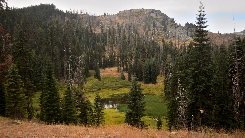 Photo: Tom Hilton, CC BY 2.0 (via Flickr)
Cold Spring
~8 min drive
0.83-mile out-and-back trail in California with 42 ft of elevation gain.
Photo: Calaina, CC BY-SA 3.0 (via Wikimedia Commons)Red Rock
~2 min drive
Red Rock is a 9.35-mile out-and-back trail in California with 2,526 feet of elevation gain.
Photo: Calaina, CC BY-SA 3.0 (via Wikimedia Commons)Marble Rim
~8 min drive
4.44-mile out-and-back trail in California with 991 ft gain.
HIKE
Kings Castle Crest Trail
~7 min drive
7.02-mile out-and-back trail in California with 3,154 ft elevation gain and loss.
Photo: Tom Hilton, CC BY 2.0 (via Flickr)Shadow Lake
~8 min drive
0.42-mile out-and-back trail to Shadow Lake in California with 270 ft of elevation gain.
Photo: Calaina, CC BY-SA 3.0 (via Wikimedia Commons)Haypress
~8 min drive
12.42-mile out-and-back trail in California with 2,107 ft elevation gain.
