Loading…

Free — you'll pick up right here.
Watch this water
Sign up to watch it — saving subscribes you to gate, closure and report changes.
California
We won't guess. Here is exactly what we do and don't know.
What we do know
Inside Tahoe National Forest
2 managing-area boundaries mapped — agency alerts for them feed this page automatically.
Boundary data
What's missing
No access route mapped
We don't yet know which road reaches this trailhead, so we can't tell you if it's gated.
Nobody's filed a report here yet — be the first.
Why you'll love it
Foresthill Divide Road
AI-suggested draft · review before you go
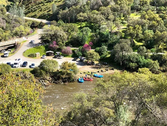
The recreation information for the Tahoe National Forest is primarily provided by travel corridor. The main travel corridors are: Interstate 80, Highway 49, Highway 20, Highway 89 (North and South), Foresthill Divide Road, Mosquito Ridge Road, Bowman Road, Marysville Road, and Gold Lakes Road.The Gate at China Wall is OPENForesthill Divide RoadThe Foresthill Divide Road extends from the town of Foresthill east to Robinson Flat Campground and then veers to the north and intersects old Highway 40 near Soda Springs. Much of the north eastern part of this corridor is not paved. Campgrounds, picnic sites, reservoirs, OHV trails, and access trails into the North Fork American Wild and Scenic River are available along the Foresthill Divide Road. Activities such as camping and hiking are listed below for this corridor.
Euchre Bar Trailhead
~10 min drive
A worthwhile stop near California.
Forbes Creek
~10 min drive
A worthwhile stop near California.
Sunset-Union Valley
~42 min drive
A worthwhile stop near California.
Tunnel Mills Ii
~12 min drive
A worthwhile stop near California.
Shirttail Creek
~10 min drive
A worthwhile stop near California.
Little Lasier Meadows Campground
~43 min drive
A worthwhile stop near California.
Black Oak
~30 min drive
A worthwhile stop near California.
Giant Gap
~11 min drive
A worthwhile stop near California.
North Fork
~14 min drive
A worthwhile stop near California.
Middle Meadows
~23 min drive
A worthwhile stop near California.