Fowlers Camp Cg-F
- from $15
- fee
- May–Jun, Sep–Oct
- best months
Caution at last check
Agency alerts are in effect for this area; weather is marginal · USFS, OpenWeather · checked 22 h ago
Is Fowlers Camp Cg-F open right now?
Closure in the area
There's a closure order in Shasta-Trinity National Forest. It doesn't name Fowlers Camp Cg-F, so check the source for the area it covers (2 listed).
Mud and Ash Creek Area and Road Closure
Agency closure covering Shasta-Trinity National Forest · Order 14-26-13 · USFS · Shasta-Trinity National Forest
Road Closure on Wild Mad Road
Agency closure covering Shasta-Trinity National Forest · Order 14-25-09 · USFS · Shasta-Trinity National Forest
Trout Creek Bridge Closure Order
Agency alert covering Shasta-Trinity National Forest · Order 14-26-02 · USFS · Shasta-Trinity National Forest
South Fork Suspension Bridge Closure
Agency alert covering Shasta-Trinity National Forest · Order 14-25-30 · USFS · Shasta-Trinity National Forest
Ah-Di-Na Area Closure
Agency alert covering Shasta-Trinity National Forest · Order 14-25-10 · USFS · Shasta-Trinity National Forest
As of · Source: USFS · Shasta-Trinity National Forest. Agencies don't list every closure — check before you go.
- At 3,287 ft
- McCloud Ranger DistrictShasta-Trinity National Forest
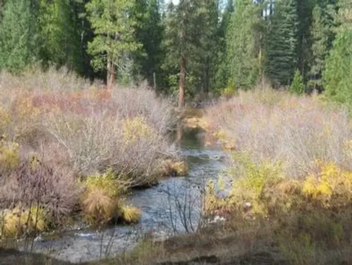
This is the most popular campground on the unit. It's located on the Upper McCloud River at an elevation of 3400 feet, and has 39 sites with tables, fire-rings, vault toilets, and piped drinking water. Suitable for tents and mid-sized RV's or trailers. 14 day limit. $15 per night. The CG has been converted mostly to a reservation system (see below) There are only eight sites that are first come first served. This campground is situated near three waterfalls on the river, which adds to its popularity. The McCloud Falls vary in height from 15 to 50 feet. A river-side trail from the campground provides access to the falls. It is approximately three miles round trip to see all three. Swimming and fishing are other popular activities. This section of river has no special restrictions for fishing. The McCloud River Loop, a paved road approx. 12 miles in length provides access to the Middle Falls and Upper Falls parking lots and overlooks if you do not wish to hike the trail.
- Camp 4 (cg-G)Camping2.1 mi
 Camp 4 Group CampgroundCampingPhoto: Recreation.gov (RIDB) / public domain2.2 mi
- Great Shasta Rail TrailMountain biking2.3 mi
- Angel CreekCanoeing3.5 mi
- Cattle Camp Cg-FCamping4.5 mi
- Mud CreekCanoeing4.9 mi
 McCloud RiverCanoeingPhoto: Public domain (via Wikimedia Commons)6.1 mi
- Upper Mccloud RiverHiking7.3 mi
Source: Roamze catalog (indexable pages within 10 miles, PostGIS distance)
- Camp 4 Group CampgroundCamping · ~4 min drive
- Fowlers CampgroundCamping · Next door
- Cattle Camp CampgroundCamping · ~8 min drive
- Cattle Camp Cg-FCamping · ~8 min drive
- Skunk Hollow CampCamping · ~10 min drive
- Fourmile CampCamping · ~11 min drive
- Algoma CampgroundCamping · ~13 min drive
- Algoma Cg-FCamping · ~13 min drive
- Ash CampCamping · ~15 min drive
- Ah-Di-Na Cg-FCamping · ~17 min drive
Also worth it near here
 Lower Falls NatureHiking · Next doorPhoto: JingKe888, CC BY 2.0 (via Flickr)
 Lower Falls ViewMountain biking · Next doorPhoto: Sergey Yarmolyuk, CC BY-SA 4.0 (via Wikimedia Commons)
- Modoc Volcanic Scenic BywayScenic drive · ~10 min drive
- McCloud RiverCanoeing · ~10 min drivePhoto: Public domain (via Wikimedia Commons)
Best time to visit Fowlers Camp Cg-F
Best months: May–June and September–October. Best months have typical highs of 55–85 °F, lows of 30 °F or warmer (32 °F where the station doesn't record snow), at most one snowy day and no more than 12 wet days.
Jan
47° / 24°
Feb
51° / 25°
Mar
55° / 28°
Apr
61° / 31°
May
71° / 39°
Jun
81° / 44°
Jul
90° / 50°
Aug
89° / 47°
Sep
84° / 41°
Oct
71° / 33°
Nov
55° / 28°
Dec
47° / 24°
Typical high / low (°F) and days with rain or snow, 1991–2020. Measured at Mccloud, CA, 6 mi away at 3,233 ft. This station doesn't record snowfall. Source: NOAA NCEI U.S. Climate Normals 1991–2020.
