Cattle Camp Cg-F
- from $15
- fee
- May–Jun, Sep–Oct
- best months
Caution today
Agency alerts are in effect for this area; weather is good · USFS, OpenWeather · checked 10 h ago
Is Cattle Camp Cg-F open right now?
Closure in the area
There's a closure order in Shasta-Trinity National Forest. It doesn't name Cattle Camp Cg-F, so check the source for the area it covers (2 listed).
Mud and Ash Creek Area and Road Closure
Agency closure covering Shasta-Trinity National Forest · Order 14-26-13 · USFS · Shasta-Trinity National Forest
Road Closure on Wild Mad Road
Agency closure covering Shasta-Trinity National Forest · Order 14-25-09 · USFS · Shasta-Trinity National Forest
Bailey Cove Road Closure Order
Agency alert covering Shasta-Trinity National Forest · Order 14-25-11 · USFS · Shasta-Trinity National Forest
Trout Creek Bridge Closure Order
Agency alert covering Shasta-Trinity National Forest · Order 14-26-02 · USFS · Shasta-Trinity National Forest
South Fork Suspension Bridge Closure
Agency alert covering Shasta-Trinity National Forest · Order 14-25-30 · USFS · Shasta-Trinity National Forest
As of · Source: USFS · Shasta-Trinity National Forest. Agencies don't list every closure — check before you go.
- At 3,700 ft
- McCloud Ranger DistrictShasta-Trinity National Forest
At an elevation of 3700 feet, this is one of two developed campgrounds on the Upper McCloud River. There are 27 sites with tables and fire rings, vault toilets, and piped drinking water. Suitable for tents and larger RV's or trailers. Double sites for large families or small groups. 14 day limit. $15 per night. No reservations. The Upper McCloud River is one of the primary attractions in the area. In addition to swimming and fishing, there is 15 miles of river-side trail to explore. Please do not dam up the river with rocks, this prevents the natural flow of the McCloud River and encourages algae growth in the swimming hole when the water is low.
 McCloud RiverCanoeingPhoto: Public domain (via Wikimedia Commons)2.1 mi
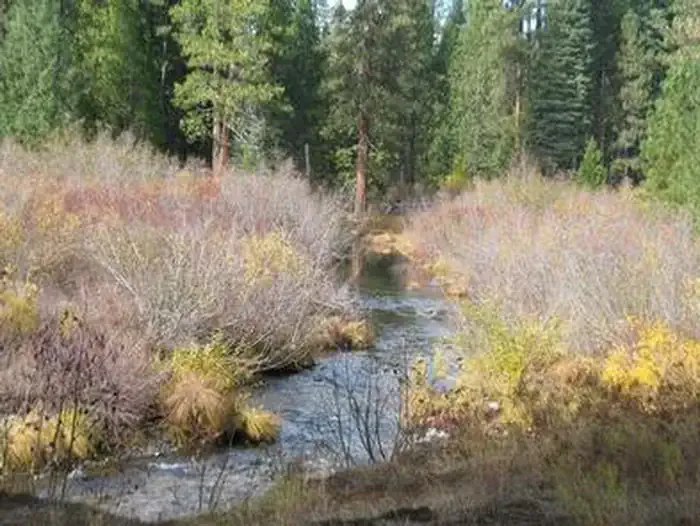 Camp 4 Group CampgroundCampingPhoto: Recreation.gov (RIDB) / public domain2.9 mi
- Upper Mccloud RiverHiking3 mi
- Algoma Cg-FCamping3 mi
- Camp 4 (cg-G)Camping3 mi
- Angel CreekCanoeing4.7 mi
- Great Shasta Rail TrailMountain biking5.9 mi
- McCloud Area RecreationRiver fishing5.9 mi
Source: Roamze catalog (indexable pages within 10 miles, PostGIS distance)
- Camp 4 Group CampgroundCamping · ~5 min drive
- Cattle Camp CampgroundCamping · Next door
- Nitwit CampCamping · ~2 min drive
- Skunk Hollow CampCamping · ~2 min drive
- Algoma CampgroundCamping · ~5 min drive
- Camp 4 (cg-G)Camping · ~5 min drive
- Fowlers Camp Cg-FCamping · ~8 min drive
- Fowlers CampgroundCamping · ~8 min drive
- McCloud RV ParkCamping · ~17 min drive
- Ash CampCamping · ~20 min drive
Best time to visit Cattle Camp Cg-F
Best months: May–June and September–October. Best months have typical highs of 55–85 °F, lows of 30 °F or warmer (32 °F where the station doesn't record snow), at most one snowy day and no more than 12 wet days.
Jan
47° / 24°
Feb
51° / 25°
Mar
55° / 28°
Apr
61° / 31°
May
71° / 39°
Jun
81° / 44°
Jul
90° / 50°
Aug
89° / 47°
Sep
84° / 41°
Oct
71° / 33°
Nov
55° / 28°
Dec
47° / 24°
Typical high / low (°F) and days with rain or snow, 1991–2020. Measured at Mccloud, CA, 10.4 mi away at 3,233 ft. This station doesn't record snowfall. Source: NOAA NCEI U.S. Climate Normals 1991–2020.

