Great Shasta Rail Trail
- 1.2 mi
- round trip
- 10 ft
- climb
- Mixed
- surface
- Out and back
- route
- May–Jun, Sep–Oct
- best months
Is Great Shasta Rail Trail open right now?
Closure in the area
There's a closure order in Shasta-Trinity National Forest. It doesn't name Great Shasta Rail Trail, so check the source for the area it covers (2 listed).
Mud and Ash Creek Area and Road Closure
Agency closure covering Shasta-Trinity National Forest · Order 14-26-13 · USFS · Shasta-Trinity National Forest
Road Closure on Wild Mad Road
Agency closure covering Shasta-Trinity National Forest · Order 14-25-09 · USFS · Shasta-Trinity National Forest
Trout Creek Bridge Closure Order
Agency alert covering Shasta-Trinity National Forest · Order 14-26-02 · USFS · Shasta-Trinity National Forest
South Fork Suspension Bridge Closure
Agency alert covering Shasta-Trinity National Forest · Order 14-25-30 · USFS · Shasta-Trinity National Forest
Ah-Di-Na Area Closure
Agency alert covering Shasta-Trinity National Forest · Order 14-25-10 · USFS · Shasta-Trinity National Forest
As of · Source: USFS · Shasta-Trinity National Forest. Agencies don't list every closure — check before you go.
The Great Shasta Rail Trail is a short, easy mountain biking route in California's Shasta-Trinity National Forest, within the McCloud Ranger District. The trail is an out-and-back that covers about 2.3 miles, with a low point of 3,430 feet and a high of 3,448 feet, so the climb is minimal, about 10 feet of elevation gain one way. The most comfortable months for a ride are typically late spring and early fall. Typical averages from a nearby weather station in Mccloud show May highs around 71°F and October highs around 71°F, while July and August average near 90°F. Fowlers Camp Cg-F is about 2.3 miles away, and Mud Creek, a canoeing spot, is about 2.6 miles off. Camp 4 (cg-G) and Camp 4 Group Campground are both about 4.4 miles away.
- Fowlers Camp Cg-FCamping2.3 mi
- Mud CreekCanoeing2.6 mi
- Camp 4 (cg-G)Camping4.3 mi
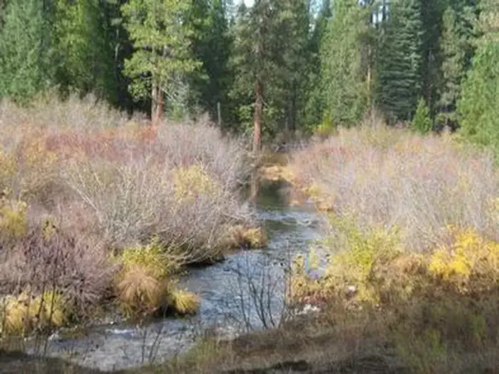 Camp 4 Group CampgroundCampingPhoto: Recreation.gov (RIDB) / public domain4.4 mi
- Angel CreekCanoeing5.8 mi
- Ash CreekCanoeing6.1 mi
- Clear CreekHiking7.7 mi
 RED FIR RIDGEHikingPhoto: davidwilson1949, CC BY 2.0 (via Flickr)7.7 mi
Source: Roamze catalog (indexable pages within 10 miles, PostGIS distance)
 Lower Falls NatureMountain biking · ~4 min drivePhoto: Sergey Yarmolyuk, CC BY-SA 4.0 (via Wikimedia Commons)
- ChipmunkMountain biking · ~15 min drive
- Lower Falls ViewMountain biking · ~4 min drivePhoto: Sergey Yarmolyuk, CC BY-SA 4.0 (via Wikimedia Commons)
- Huckleberry Loop (South)Mountain biking · ~15 min drive
- Middle Falls MainMountain biking · ~5 min drivePhoto: Sergey Yarmolyuk, CC BY-SA 4.0 (via Wikimedia Commons)
- Huckleberry Loop (South)Mountain biking · ~15 min drive
- Fowlers CrossMountain biking · ~4 min drive
- ChipmunkMountain biking · ~15 min drive
- Upper Falls MainMountain biking · ~5 min drive
- Huckleberry Loop (South)Mountain biking · ~15 min drive
Best time to visit Great Shasta Rail Trail
Best months: May–June and September–October. Best months have typical highs of 55–85 °F, lows of 30 °F or warmer (32 °F where the station doesn't record snow), at most one snowy day and no more than 12 wet days.
Jan
47° / 24°
Feb
51° / 25°
Mar
55° / 28°
Apr
61° / 31°
May
71° / 39°
Jun
81° / 44°
Jul
90° / 50°
Aug
89° / 47°
Sep
84° / 41°
Oct
71° / 33°
Nov
55° / 28°
Dec
47° / 24°
Typical high / low (°F) and days with rain or snow, 1991–2020. Measured at Mccloud, CA, 4.6 mi away at 3,233 ft. This station doesn't record snowfall. Source: NOAA NCEI U.S. Climate Normals 1991–2020.

Map and trail data © OpenStreetMap contributors
