Signal Hill
 Photo: hakkun, CC BY-SA 3.0 (via Wikimedia Commons)
- 2,485 ft
- summit
- 2
- ways up
- National Park Service
- managed by
- Nov–Apr
- best months
Is Signal Hill open right now?
Closure in the area
There's a closure order in Saguaro National Park. It doesn't name Signal Hill, so check the source for the area it covers.
Bajada Loop Drive Closure in West District
Park closure covering Saguaro National Park · NPS · Saguaro National Park
Vehicle Break-Ins
Park alert covering Saguaro National Park · NPS · Saguaro National Park
As of · Source: NPS · Saguaro National Park. Agencies don't list every closure — check before you go.
Signal Hill is a summit of 2,485 feet in Arizona's Saguaro Wilderness, within Saguaro National Park, which the National Park Service manages. The nearest town is Picture Rocks, about 4 miles away. Winter and early spring are the most comfortable times to go. Typical averages from a nearby weather station show March highs around 76°F with lows near 46°F, while summer highs climb to about 102°F. Several trails start close by. Manville Trail is about 0.1 mile away, Signal Hill (West District) is about 0.2 mile away, and Wild Dog Trail is about half a mile off. Climbers can head to Panther Peak, roughly 4.6 miles away.
Conditions and forecast
Daily highs and lows, wind and the chance of precipitation at the summit and cactus wren access for the next 7 days, from the Open-Meteo model.
- Summit elevation
- 2,485 ft
- Land manager
- National Park Service
Elevation from USGS 3D Elevation Program terrain data (about 10 m resolution).
- Cactus Wren TrailEasyFrom Cactus Wren Access · about 228 ft of climbing3.7 mi round trip
- Manville TrailEasyabout 182 ft of climbing4.8 mi round trip
Compare the routes Cactus Wren Trail Manville Trail Starts at Cactus Wren Access — Climbing About 228 ft About 182 ft Round trip 3.7 mi 4.8 mi Difficulty Easy Easy Terrain Hike Hike Map © Mapbox © OpenStreetMap contributors Questions about Signal Hill
How tall is Signal Hill?
2,485 ft (757 m).
How many routes go to the summit of Signal Hill?
2: Cactus Wren Trail and Manville Trail.
What is the shortest route up Signal Hill?
Cactus Wren Trail, about 3.7 mi round trip.
Where do the routes up Signal Hill start?
Cactus Wren Trail starts at Cactus Wren Access.
- Wasson Peak4,685 ft · Arizona2 routes3.8 mi away
- Safford Peak3,566 ft · Arizona1 route5.0 mi away
- Brown Mountain3,109 ft · Arizona1 route5.0 mi away
 Pusch Peak5,358 ft · Arizona1 route17 mi awayPhoto: Djmaschek, CC BY-SA 3.0 (via Wikimedia Commons)
- Mount Kimball7,259 ft · Arizona1 route20 mi away
- Mule Ears7,017 ft · Arizona1 route27 mi away
 Manville TrailHikingPhoto: w_lemay, CC BY-SA 2.0 (via Flickr)0.1 mi
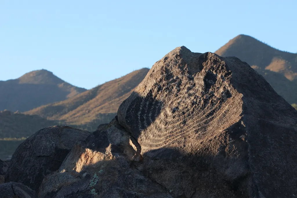 Signal Hill (West District)HikingPhoto: NPS / public domain0.2 mi
 Wild Dog TrailHikingPhoto: InSapphoWeTrust from Los Angeles, California, USA, CC BY-SA 2.0 (via Wikimedia Commons)0.5 mi
 Encinas TrailHikingPhoto: w_lemay, CC BY-SA 2.0 (via Flickr)1.1 mi
- Beast BoulderRock climbing4.6 mi
- Split BoulderRock climbing4.6 mi
- Stella StoneRock climbing4.6 mi
- Panther PeakRock climbing4.6 mi
Source: Roamze catalog (indexable pages within 10 miles, PostGIS distance)
 Black MountainSummit · ~29 min drivePhoto: $1LENCE D00600D, CC BY-SA 3.0 (via Wikimedia Commons)
 Thimble PeakSummit · ~44 min drivePhoto: Susan Lynn Peterson, CC BY-SA 3.0 (via Wikimedia Commons)
 Mount LemmonSummit · ~46 min drivePhoto: Debby Kriegel, Public domain (via Wikimedia Commons)
 Mica MountainSummit · ~1h 7m drivePhoto: All Fronts Quiet, CC BY-SA 3.0 (via Wikimedia Commons)
 Baboquivari PeakSummit · ~1h 13m drivePhoto: Phillip Capper from Wellington, New Zealand, CC BY 2.0 (via Wikimedia Commons)
 Mount HopkinsSummit · ~1h 18m drivePhoto: Wars, CC BY-SA 3.0 (via Wikimedia Commons)
- Pusch PeakSummit · ~29 min drivePhoto: Djmaschek, CC BY-SA 3.0 (via Wikimedia Commons)
 Mount WrightsonSummit · ~1h 19m drivePhoto: Wars, CC BY-SA 3.0 (via Wikimedia Commons)
- Amole PeakSummit · ~6 min drive
- Wasson PeakSummit · ~7 min drive
Also worth it near here
Best time to visit Signal Hill
Best months: November–April. Best months have typical highs of 55–85 °F, lows of 30 °F or warmer (32 °F where the station doesn't record snow), at most one snowy day and no more than 12 wet days.
Jan
67° / 39°
4 wet
Feb
70° / 41°
4 wet
Mar
76° / 46°
3 wet
Apr
84° / 51°
1 wet
May
93° / 59°
1 wet
Jun
102° / 69°
2 wet
Jul
102° / 74°
7 wet
Aug
100° / 72°
8 wet
Sep
97° / 68°
5 wet
Oct
87° / 57°
3 wet
Nov
76° / 47°
3 wet
Dec
66° / 39°
4 wet
Typical high / low (°F) and days with rain or snow, 1991–2020. Measured at Tucson 17 Nw, AZ, 2.7 mi away at 2,561 ft. Source: NOAA NCEI U.S. Climate Normals 1991–2020.


