West Clear Creek
- 37.5 mi
- distance
- 6,005 ft
- high point
- Feb–May, Sep–Nov
- best months
Is West Clear Creek open right now?
Closure in the area
There's a closure order in Red Rock Ranger District. It doesn't name West Clear Creek, so check the source for the area it covers (3 listed).
Beaver Creek Picnic Site temporarily closed
Agency closure covering Red Rock Ranger District · Order 03-04-06-26-05 · USFS · Red Rock Ranger District
Red Rock Ranger District affected by severe flooding; many closures in effect
Agency closure covering Red Rock Ranger District · USFS · Red Rock Ranger District
Banjo Bill Picnic Area Closure
Agency closure covering Red Rock Ranger District · Order 03-04-06-25-01 · USFS · Red Rock Ranger District
West Fork Temporary Area Closure - Extension to 2/27/27
Agency alert covering Coconino National Forest · Order 03-04-00-26-09 · USFS · Coconino National Forest
West Sedona Camping and Campfire Restrictions
Agency alert covering Red Rock Ranger District · Order 03-04-06-26-04 · USFS · Red Rock Ranger District
As of · Source: USFS · Red Rock Ranger District. Agencies don't list every closure — check before you go.
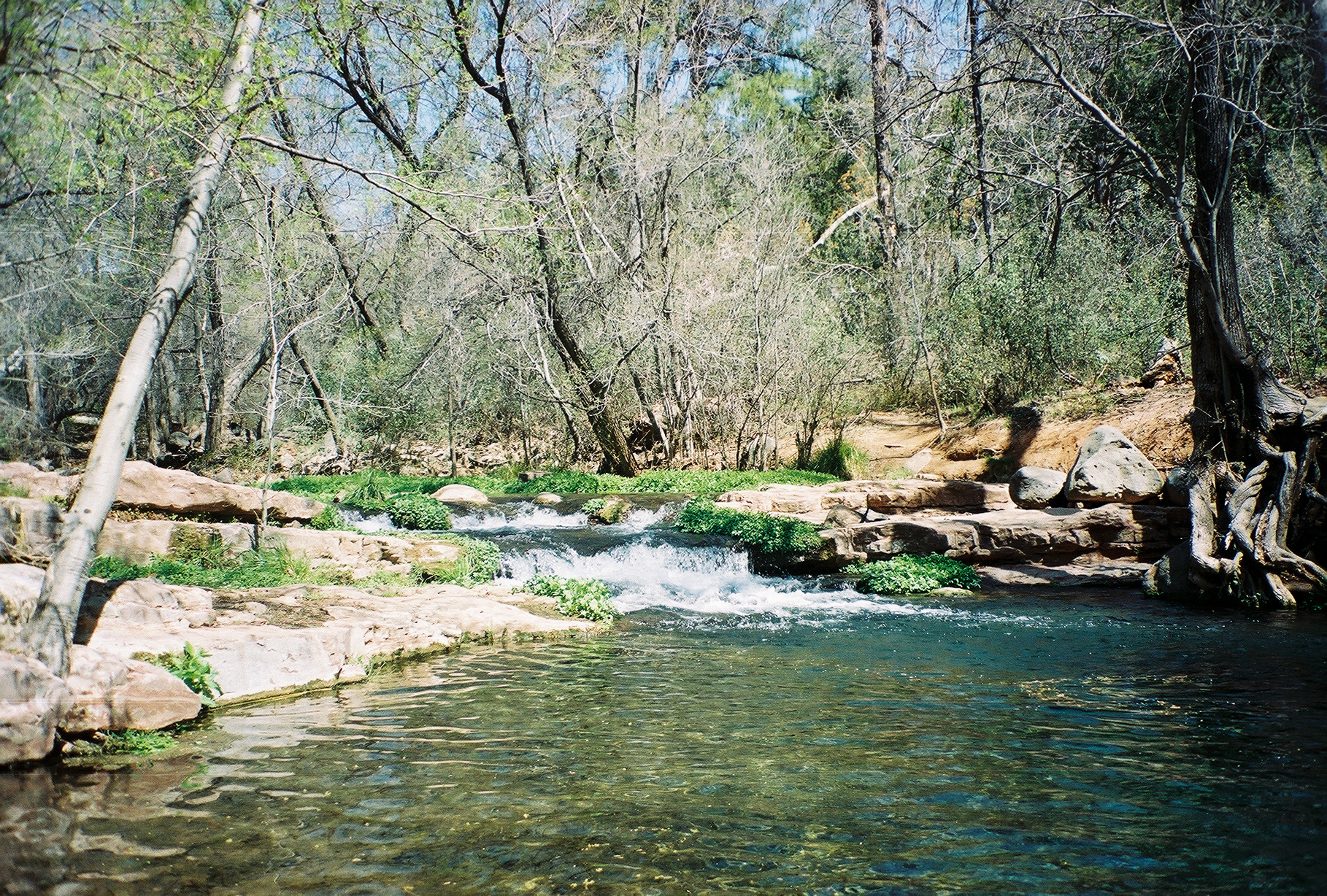
West Clear Creek is a paddling spot in the Red Rock Ranger District of Coconino National Forest in Arizona, managed by the Forest Service. The nearest town is about 37 miles away, so plan on a trip that includes time to get to the creek and to explore the surrounding area. Spring and fall are the most comfortable times to paddle. Typical averages from a nearby weather station run to highs around 70°F in April and 74°F in October, while July highs average about 91°F. That station sits roughly 1,400 feet lower than the creek, so temperatures here run cooler. Several other outdoor spots lie within a short drive. The Mail and Blodgett Basin hikes are both within about 4 miles. Thirteen Mile Rock, a climbing area, is about 5 miles away. For more paddling, Wet Beaver Creek is about 9 miles off.
Local outfitters
- Verde Ranch RV Resort16 mi away
- Fort Tuthill Luke AFB Recreation Area41 mi away
Not on Roamze yet. Their page has how to reach them.
- MailHiking3.5 mi
- Blodgett BasinHiking4.1 mi
- Thirteen Mile RockRock climbing5.2 mi
- CashHiking5.5 mi
- BuckskinHiking6.8 mi
- Wet Beaver CreekCanoeing9 mi
 Wet Beaver CrackRock climbingPhoto: Coconino National Forest, CC0 (via Wikimedia Commons)9.5 mi
 Quickie WallRock climbingPhoto: Coconino National Forest, CC BY-SA 2.0 (via Wikimedia Commons)9.7 mi
Source: Roamze catalog (indexable pages within 10 miles, PostGIS distance)
 Fossil CreekCanoeing · ~19 min drivePhoto: Gonzo fan2007, CC BY-SA 3.0 (via Wikimedia Commons)
- Kinnikinick Lake Boating SiteBoat launch · ~50 min drive
 East Verde RiverCanoeing · ~35 min drivePhoto: Richard N Horne, CC BY-SA 4.0 (via Wikimedia Commons)
- Knoll Lake Boating SiteBoat launch · ~52 min drive
 Verde RiverCanoeing · ~38 min drivePhoto: Jennifer Horn, Public domain (via Wikimedia Commons)
- Ashurst Lake Boat LaunchBoat launch · ~59 min drive
 Tonto CreekCanoeing · ~1h 7m drivePhoto: Richard N Horne, CC BY-SA 4.0 (via Wikimedia Commons)
- Narrows Boat RampBoat launch · ~1h 2m drive
 Walnut CreekCanoeing · ~1h 13m drivePhoto: Llrice1240, CC BY-SA 3.0 (via Wikimedia Commons)
- Lake Mary Narrows Boat Launch and Picnic AreaBoat launch · ~1h 2m drive
Also worth it near here
Best time to visit West Clear Creek
Best months: February–May and September–November. Best months have typical highs of 55–85 °F, lows of 30 °F or warmer (32 °F where the station doesn't record snow), at most one snowy day and no more than 12 wet days.
Jan
54° / 30°
Feb
57° / 32°
Mar
64° / 36°
Apr
70° / 41°
May
79° / 48°
Jun
88° / 58°
Jul
91° / 65°
Aug
89° / 62°
Sep
84° / 57°
Oct
74° / 46°
Nov
63° / 36°
Dec
53° / 30°
Typical high / low (°F) and days with rain or snow, 1991–2020. Measured at Natural Brg, AZ, 17.6 mi away at 4,608 ft. The station sits about 1,400 ft lower than this place, so expect it a little cooler here. This station doesn't record snowfall. Source: NOAA NCEI U.S. Climate Normals 1991–2020.


