Cockscomb
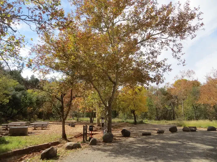
Campground
Campground · 2.5 mi from the trail
 Photo: davidpinter, CC BY 3.0 (via Wikimedia Commons)
Closure in the area
There's a closure order in Red Rock Ranger District. It doesn't name Ground Control, so check the source for the area it covers (2 listed).
Red Rock Ranger District affected by severe flooding; many closures in effect
Agency closure covering Red Rock Ranger District · USFS · Red Rock Ranger District
Banjo Bill Picnic Area Closure
Agency closure covering Red Rock Ranger District · Order 03-04-06-25-01 · USFS · Red Rock Ranger District
West Fork Temporary Area Closure - Extension to 2/27/27
Agency alert covering Coconino National Forest · Order 03-04-00-26-09 · USFS · Coconino National Forest
West Sedona Camping and Campfire Restrictions
Agency alert covering Red Rock Ranger District · Order 03-04-06-26-04 · USFS · Red Rock Ranger District
Sedona/ Oak Creek Canyon Camping and Campfire Restrictions
Agency alert covering Red Rock Ranger District · Order 03-04-06-23-03 · USFS · Red Rock Ranger District
As of · Source: USFS · Red Rock Ranger District. Agencies don't list every closure — check before you go.
Ground Control is a short mountain biking route in the Red Rock Ranger District of Coconino National Forest, about 0.8 miles long with a 204-foot elevation gain. The Forest Service manages the land, and the route starts at an elevation of about 4,654 feet, climbing to a high point of 4,719 feet. The steepest section comes at about 0.73 miles, with a grade of 15 percent. The most comfortable months for a ride are spring and fall. Typical averages from a nearby weather station in Sedona show October highs around 79°F with lows near 51°F, and April highs around 75°F with lows near 44°F. That station sits about 500 feet lower, so temperatures on the route run slightly cooler. Axis is a hike about 0.1 mile away, and Rover is about 0.4 mile off. The Cockscomb mountain biking trailhead is also about 0.4 mile away. Climbers can head to the Bear Mountain Area, roughly 1.6 miles away.
Cockscomb
Campground
Places © OpenStreetMap contributors
More in Kachina VillageNot on Roamze yet. Their page has how to reach them.
 AxisHikingPhoto: Coconino NF Photography, Public Domain Dedication (CC0) (via Flickr)0.1 miRoverHikingPhoto: Coconino NF Photography, Public Domain Dedication (CC0) (via Flickr)0.4 mi
 CockscombMountain bikingPhoto: Coconino National Forest, CC0 (via Wikimedia Commons)0.4 mi
 Bear Mountain AreaRock climbingPhoto: davidpinter, CC BY 3.0 (via Wikimedia Commons)1.6 mi
 Bear MountainRock climbingPhoto: davidpinter, CC BY 3.0 (via Wikimedia Commons)1.9 mi
 Chavez CrossingCampingPhoto: Recreation.gov (RIDB) / public domain5.3 mi
Source: Roamze catalog (indexable pages within 10 miles, PostGIS distance)
 RoverMountain biking · ~1 min drivePhoto: davidpinter, CC BY 3.0 (via Wikimedia Commons)CockscombMountain biking · ~1 min drivePhoto: Coconino National Forest, CC0 (via Wikimedia Commons)RuppMountain biking · ~1 min drivePhoto: davidpinter, CC BY 3.0 (via Wikimedia Commons)
 BoloMountain biking · ~2 min drivePhoto: Don Graham from Redlands, CA, USA - God bless it!, CC BY-SA 2.0 (via Wikimedia Commons)Axis TrailMountain biking · ~2 min drivePhoto: davidpinter, CC BY 3.0 (via Wikimedia Commons)
 Doe MountainMountain biking · ~2 min drivePhoto: davidpinter, CC BY 3.0 (via Wikimedia Commons)
 GirdnerMountain biking · ~2 min drivePhoto: ConspiracyofHappiness at Flickr, CC BY 2.0 (via Wikimedia Commons)
 DawaMountain biking · ~3 min drivePhoto: davidpinter, CC BY 3.0 (via Wikimedia Commons)
 AerieMountain biking · ~3 min drivePhoto: davidpinter, CC BY 3.0 (via Wikimedia Commons)Anaconda BypassMountain biking · ~3 min drivePhoto: davidpinter, CC BY 3.0 (via Wikimedia Commons)
Best months: October–May. Best months have typical highs of 55–85 °F, lows of 30 °F or warmer (32 °F where the station doesn't record snow), at most one snowy day and no more than 12 wet days.
Jan
58° / 34°
5 wet
Feb
61° / 36°
6 wet
Mar
67° / 40°
6 wet
Apr
75° / 44°
3 wet
May
84° / 53°
3 wet
Jun
94° / 61°
2 wet
Jul
97° / 68°
6 wet
Aug
94° / 67°
9 wet
Sep
89° / 61°
5 wet
Oct
79° / 51°
3 wet
Nov
67° / 41°
4 wet
Dec
58° / 33°
4 wet
Typical high / low (°F) and days with rain or snow, 1991–2020. Measured at Sedona, AZ, 5.6 mi away at 4,220 ft. This station doesn't record snowfall. Source: NOAA NCEI U.S. Climate Normals 1991–2020.
Map and trail data © OpenStreetMap contributors
