Elks
Campground
Campground · 7.6 mi from the trail
Closure in the area
There's a closure order in Apache-Sitgreaves National Forests. It doesn't name Soldier Trail, so check the source for the area it covers (2 listed).
Temporary Emergency Closure
Agency closure covering Apache-Sitgreaves National Forests · Order 03-01-26-004 · USFS · Apache-Sitgreaves National Forests
Benny Creek Campground/Southfork Day Use Area Closure Order - Springerville Ranger District
Agency closure covering Apache-Sitgreaves National Forests · Order 03-01-25-06-004 · USFS · Apache-Sitgreaves National Forests
Forest Road Conditions Alert
Agency alert covering Apache-Sitgreaves National Forests · USFS · Apache-Sitgreaves National Forests
No Fire Restrictions
Agency alert covering Apache-Sitgreaves National Forests · USFS · Apache-Sitgreaves National Forests
As of · Source: USFS · Apache-Sitgreaves National Forests. Agencies don't list every closure — check before you go.
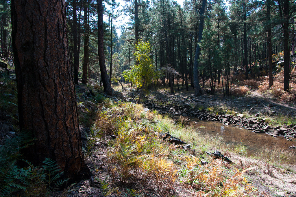
Soldier Trail is an easy, short out-and-back hike in Arizona's Apache-Sitgreaves National Forests, within the Black Mesa Ranger District. The Forest Service manages the land, and the trail is among the closest options for a quick outing in this corner of the forest. The route is 1.6 miles long, starting and ending at 6,750 feet with a total elevation gain of 106 feet. The climb is back-loaded, so the steepest section, a 4% grade, comes about 0.74 miles from the start. The trip takes about half an hour, and the trail's shallow climb makes it a natural stop before or after another outing in the district. For comfortable weather, late spring and early fall are the best bets. Typical averages from a nearby weather station at a similar elevation show May highs around 70°F and September highs around 76°F, with July warming to about 83°F. Soldiers Crossing is 1.3 miles away, and Cross Road and Leonard Point are both within about 3 miles. For paddling, Willow Creek is about 6 miles off.
Elks
Campground
Places © Overture Maps Foundation
More in Blue RidgeNot on Roamze yet. Their page has how to reach them.
 The ChossmineRock climbingPhoto: Brady Smith; Coconino National Forest, CC BY-SA 2.0 (via Wikimedia Commons)8.5 miThe AsylumRock climbingPhoto: Brady Smith; Coconino National Forest, CC BY-SA 2.0 (via Wikimedia Commons)9.5 mi
Source: Roamze catalog (indexable pages within 10 miles, PostGIS distance)
 Rock CrossingHiking · ~19 min drivePhoto: Coconino NF Photography, Public Domain Mark (via Flickr)
 U-BarHiking · ~23 min drivePhoto: Kristof Zyskowski & Yulia Bereshpolova, CC BY 2.0 (via Flickr)
 Horton Springs Trail #292Hiking · ~28 min drivePhoto: cogdogblog, CC BY 2.0 (via Flickr)
 Arizona TrailHiking · ~28 min drivePhoto: Coconino NF Photography, Public Domain Dedication (CC0) (via Flickr)
 Escudilla National Recreation - ArizonaHiking · ~26 min drivePhoto: cogdogblog, CC BY 2.0 (via Flickr)Horton SpringHiking · ~29 min drivePhoto: cogdogblog, CC BY 2.0 (via Flickr)
 Fred HaughtHiking · ~24 min drivePhoto: Coconino NF Photography, Public Domain Dedication (CC0) (via Flickr)
 Horton Creek Trail #285Hiking · ~33 min drivePhoto: USDAgov, Public Domain Mark (via Flickr)
Also worth it near here
Best months: May–October. Best months have typical highs of 55–85 °F, lows of 30 °F or warmer (32 °F where the station doesn't record snow), at most one snowy day and no more than 12 wet days.
Jan
45° / 17°
Feb
49° / 20°
Mar
55° / 25°
Apr
61° / 30°
May
70° / 38°
Jun
80° / 47°
Jul
83° / 55°
Aug
81° / 53°
Sep
76° / 46°
Oct
67° / 34°
Nov
55° / 24°
Dec
45° / 17°
Typical high / low (°F) and days with rain or snow, 1991–2020. Measured at Blue Ridge Rs, AZ, 9 mi away at 6,880 ft. This station doesn't record snowfall. Source: NOAA NCEI U.S. Climate Normals 1991–2020.
Map and trail data © OpenStreetMap contributors
