Shake Tree Trail # 44
- 11.6 mi
- round trip
- 322 ft
- climb
- 6,556 ft
- high point
- Out and back
- route
- Mar–May, Sep–Nov
- best months
Is Shake Tree Trail # 44 open right now?
Closure in the area
There's a closure order in Tonto National Forest. It doesn't name Shake Tree Trail # 44, so check the source for the area it covers.
Rattlesnake Recreation Site Public Safety Closure
Agency closure covering Tonto National Forest · Order 3-12-01-26-36 · USFS · Tonto National Forest
Emergency Closure of Needle Rock and Box Bar Recreation Sites for Public Safety
Agency alert covering Cave Creek Ranger District · Order 03-12-01-26-32 · USFS · Cave Creek Ranger District
Horseshoe Dam Road (NFSR 205) Emergency Closure for Public Safety
Agency alert covering Cave Creek Ranger District · Order 03-12-01-26-31 · USFS · Cave Creek Ranger District
Riverside Post Fire Recovery and Safety Closure – Extension
Agency alert covering Cave Creek Ranger District · Order 03-12-01-26-24 · USFS · Cave Creek Ranger District
Canyon Lake Drawdown Public Safety Closure
Agency alert covering Tonto National Forest · Order 03-12-00-26-22 · USFS · Tonto National Forest
As of · Source: USFS · Tonto National Forest. Agencies don't list every closure — check before you go.
Shake Tree Trail #44 is an out-and-back hike of about 11.6 miles, with a moderate climb of 322 feet, in the Mazatzal Wilderness of Arizona's Tonto National Forest. It crosses the boundaries of the Cave Creek and Tonto Basin ranger districts and is managed by the Forest Service. The trail starts at the Barnhardt trailhead. The route runs from a low point of about 4,207 feet to a high of about 6,556 feet. Spring and fall are the most comfortable seasons to go. Typical averages from the nearby Pleasant Valley weather station show October highs around 72°F with lows near 40°F, and May highs around 76°F. That station sits well below the trail, so temperatures on the high part of the route run cooler. Nearby hikes include Brody Seep, about a mile away, and Fisher, a little farther. Davenport and Barnhardt are both within about 3 miles.
Local outfitters
- Arizona Desert Mountain Jeep Tours25 mi away
- Black Canyon Campground39 mi away
Not on Roamze yet. Their page has how to reach them.
Best time to go · Mar–May, Sep–Nov
Best time to visit Shake Tree Trail # 44
Best months: March–May and September–November. Best months have typical highs of 55–85 °F, lows of 30 °F or warmer (32 °F where the station doesn't record snow), at most one snowy day and no more than 12 wet days.
Jan
53° / 25°
5 wet
Feb
56° / 27°
5 wet · 1 snow
Mar
61° / 31°
5 wet
Apr
68° / 36°
3 wet
May
76° / 42°
3 wet
Jun
86° / 49°
3 wet
Jul
88° / 59°
9 wet
Aug
87° / 59°
10 wet
Sep
82° / 52°
6 wet
Oct
72° / 40°
3 wet
Nov
62° / 30°
3 wet
Dec
52° / 25°
4 wet
Typical high / low (°F) and days with rain or snow, 1991–2020. Measured at Pleasant Valley, AZ, 29 mi away at 5,183 ft. The station sits about 1,400 ft lower than this place, so expect it a little cooler here. Source: NOAA NCEI U.S. Climate Normals 1991–2020.
Keep exploring — more trails worth the drive
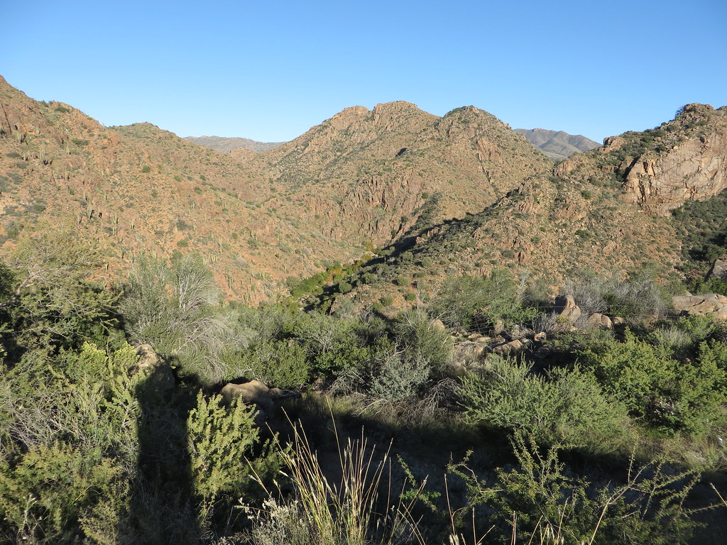 Photo: Ken Lund, CC BY-SA 2.0 (via Flickr)
Diamond
~24 min drive
Diamond is a 4.22-mile out-and-back trail in Arizona with 749 ft of elevation gain.
 Photo: Tanque Verde, CC BY 2.0 (via Flickr)
Fig Spring
~24 min drive
7.13-mile out-and-back trail to Fig Spring in Arizona with 336 ft of elevation gain.
 Photo: cogdogblog, CC BY 2.0 (via Flickr)
Bolder Trail
~27 min drive
2.58-mile loop in Arizona with 325 ft elevation gain and loss.
HIKE
Rock Creek
~8 min drive
8.21-mile out-and-back trail in Arizona with 2,643 ft elevation gain.
 Photo: Ken Lund from Reno, Nevada, USA, CC BY-SA 2.0 (via Wikimedia Commons)
Palo Verde
~29 min drive
4.27-mile out-and-back trail in Arizona with 265 ft of elevation gain.
HIKE
Fisher
~2 min drive
6.12-mile out-and-back trail in Arizona with 784 ft gain.
HIKE
Lost Trail #279
~11 min drive
0.84-mile out-and-back trail in Arizona with 710 ft elevation gain
HIKE
Arizona Trail
~20 min drive
A 15.23-mile out-and-back trail in Arizona that connects to Passage 42, ideal for a full-day hiking adventure.
HIKE
Brody Seep
~2 min drive
3.09-mile out-and-back trail in Arizona with 136 ft of elevation gain.
HIKE
Barnhardt
~5 min drive
11.74-mile out-and-back trail in Arizona with 1,864 ft gain.

Map and trail data © OpenStreetMap contributors
