Saguaro
- 2.1 mi
- round trip
- 271 ft
- climb
- 1,628 ft
- high point
- Out and back
- route
- Nov–Apr
- best months
Is Saguaro open right now?
Closure in the area
There's a closure order in Tonto National Forest. It doesn't name Saguaro, so check the source for the area it covers.
Rattlesnake Cove Developed Recreation Site - Post Flood Recovery and Public Safety Closure
Agency closure covering Tonto National Forest · Order 3-12-01-26-36 · USFS · Tonto National Forest
Temporary Public Health and Safety Closure Granite Reef Recreation Site Area Closure
Agency alert covering Mesa Ranger District · Order 03-12-03-26-33 · USFS · Mesa Ranger District
Canyon Lake Drawdown Public Safety Closure
Agency alert covering Tonto National Forest · Order 03-12-00-26-22 · USFS · Tonto National Forest
No Fire Restrictions
Agency alert covering Tonto National Forest · USFS · Tonto National Forest
Lower Salt River Seasonal Bald Eagle Closures
Agency alert covering Mesa Ranger District · Order 03-12-03-24-65 · USFS · Mesa Ranger District
As of · Source: USFS · Tonto National Forest. Agencies don't list every closure — check before you go.
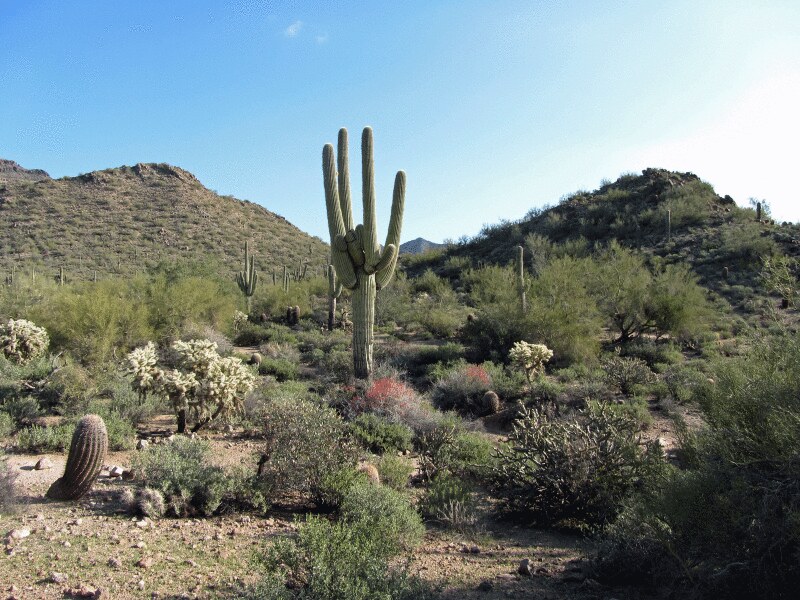
Saguaro is an easy hike of about 2 miles in the Mesa Ranger District of Tonto National Forest in Arizona, managed by the Forest Service. The trail is an out-and-back with a total elevation gain of about 270 feet, rising from roughly 1,360 feet to about 1,628 feet. Spring and fall are the most comfortable times to go. Typical averages from the nearby Fountain Hills weather station show March highs around 74°F and November highs around 74°F, while June and July average in the low to mid 100s. The trail is natural-surface and bikes are allowed, so it works for hikers and mountain bikers alike. The Granite Trail and Saguaro Trail sit within a quarter mile, and the Mo Ridge Trail is about 0.3 miles away. For an overnight stay, Larry Forbis campground is about 6.7 miles off.
Local outfitters
- VIP RV Resort10 mi away
- Arizona Desert Mountain Jeep Tours18 mi away
Not on Roamze yet. Their page has how to reach them.
- Granite TrailMountain biking0.1 mi
- Saguaro TrailMountain biking0.2 mi
- Mo Ridge TrailMountain biking0.3 mi
- Ridge TrailMountain biking0.3 mi
- Larry ForbisCamping6.7 mi
 Greevers' NeedleRock climbingPhoto: Z Glyph, CC BY 3.0 (via Wikimedia Commons)8.2 mi
 Lost Whiskey WallRock climbingPhoto: davidpinter, CC BY 3.0 (via Wikimedia Commons)9.8 mi
- River CragRock climbingPhoto: davidpinter, CC BY 3.0 (via Wikimedia Commons)9.8 mi
Source: Roamze catalog (indexable pages within 10 miles, PostGIS distance)
 RidgeHiking · Next doorPhoto: waterarchives, CC BY-SA 2.0 (via Flickr)
- HawesHiking · Next doorPhoto: waterarchives, CC BY-SA 2.0 (via Flickr)
 NRA All Mountain Party DHiking · ~5 min drivePhoto: Z Glyph, CC BY 3.0 (via Wikimedia Commons)
- SaddleHiking · ~2 min drive
- Scorpion Alley TrailHiking · ~6 min drivePhoto: Z Glyph, CC BY 3.0 (via Wikimedia Commons)
- Boulderdash TrailHiking · ~3 min drive
- Lone Mountain TrailHiking · ~6 min drivePhoto: Z Glyph, CC BY 3.0 (via Wikimedia Commons)
- Sunset Ridge TrailHiking · ~3 min drive
 Nature TrailHiking · ~7 min drivePhoto: homeredwardprice, CC BY 2.0 (via Flickr)
- Hawes Loop TrailHiking · ~4 min drive
Best time to visit Saguaro
Best months: November–April. Best months have typical highs of 55–85 °F, lows of 30 °F or warmer (32 °F where the station doesn't record snow), at most one snowy day and no more than 12 wet days.
Jan
64° / 45°
4 wet
Feb
67° / 46°
4 wet
Mar
74° / 51°
3 wet
Apr
82° / 56°
2 wet
May
91° / 64°
1 wet
Jun
101° / 73°
1 wet
Jul
103° / 80°
3 wet
Aug
102° / 80°
4 wet
Sep
97° / 74°
3 wet
Oct
87° / 63°
2 wet
Nov
74° / 51°
2 wet
Dec
63° / 44°
3 wet
Typical high / low (°F) and days with rain or snow, 1991–2020. Measured at Fountain Hills, AZ, 6.6 mi away at 1,580 ft. Source: NOAA NCEI U.S. Climate Normals 1991–2020.

