Point Imperial Trail
 Photo: Grand Canyon National Park, CC BY 2.0 (via Wikimedia Commons)
- 5.2 mi
- round trip
- 85 ft
- climb
- 8,892 ft
- high point
- Out and back
- route
- May–Oct
- best months
Caution at last check
Agency alerts are in effect for this area; weather is good · USFS, OpenWeather · checked 21 h ago
Is Point Imperial Trail open right now?
Closure in the area
There's a closure order in Kaibab National Forest. It doesn't name Point Imperial Trail, so check the source for the area it covers (4 listed).
Heavy storm damages received - use extreme caution
Agency closure covering Kaibab National Forest · USFS · Kaibab National Forest
Christmas tree permits available online beginning October 8
Agency closure covering Kaibab National Forest · USFS · Kaibab National Forest
Forest Road 354 on Kaibab & Prescott NF Temporarily Closed for Repairs
Agency closure covering Kaibab National Forest · Order 03-07-26-02 · USFS · Kaibab National Forest
Effective April 17, 2026 - UPDATED - White Sage & Dragon Bravo Fires Temporary Area Closure
Agency closure covering North Kaibab Ranger District · Order 03-07-03-26-03 · USFS · North Kaibab Ranger District
As of · Source: USFS · Kaibab National Forest. Agencies don't list every closure — check before you go.
Point Imperial Trail is an easy out-and-back hike in Arizona's Kaibab National Forest, within the North Kaibab Ranger District and managed by the Forest Service. The trail is about 5 miles long, with a gentle climb of 85 feet from the low point at 8,751 feet to the high point at 8,892 feet. The most comfortable months for a visit are typically June and September, when typical averages from a nearby weather station run around 73°F highs and 67°F highs, with summer bringing more wet days. That station sits about 900 feet below the trail, so temperatures on the route run cooler. The trail sits close to several other routes, including the Nankoweap Trail #57 and the Saddle Mountain trail, each about 0.2 miles away. The Ken Patrick Trail - East (Point Imperial) lies roughly 1.9 miles off. North Rim Campground (AZ) is about 7 miles away.
Local outfitters
- Buck Wild Hummer Tours24 mi away
- Wander Camp39 mi away
Not on Roamze yet. Their page has how to reach them.
 Nankoweap Trail #57HikingPhoto: deborah.soltesz, Public Domain Dedication (CC0) (via Flickr)0.2 mi
- Saddle MountainHikingPhoto: deborah.soltesz, Public Domain Dedication (CC0) (via Flickr)0.2 mi
 Ken Patrick Trail - East (Point Imperial)HikingPhoto: rob stoeltje, CC BY 2.0 (via Flickr)1.9 mi
- Saddle Mountain Trail #31Hiking3.2 mi
- South CanyonHiking3.6 mi
 Greenland Lake TrailHikingPhoto: mtnscll, CC BY-SA 2.0 (via Flickr)4 mi
- North Rim Campground (AZ)Camping7.2 mi
 Grand Canyon National ParkRock climbingPhoto: brewbooks from near Seattle, USA, CC BY-SA 2.0 (via Wikimedia Commons)9.1 mi
Source: Roamze catalog (indexable pages within 10 miles, PostGIS distance)
- Nankoweap Trail #57Hiking · Next doorPhoto: deborah.soltesz, Public Domain Dedication (CC0) (via Flickr)
- Saddle MountainHiking · Next doorPhoto: deborah.soltesz, Public Domain Dedication (CC0) (via Flickr)
- Ken Patrick Trail - East (Point Imperial)Hiking · ~3 min drivePhoto: rob stoeltje, CC BY 2.0 (via Flickr)
- Greenland Lake TrailHiking · ~7 min drivePhoto: mtnscll, CC BY-SA 2.0 (via Flickr)
 Old Bright Angel TrailHiking · ~14 min drivePhoto: Robert Anders, CC BY 2.0 (via Flickr)
 Komo Point TrailHiking · ~8 min drivePhoto: RuggyBearLA, CC BY 2.0 (via Flickr)
 Walhalla Glades TrailHiking · ~10 min drivePhoto: RuggyBearLA, CC BY 2.0 (via Flickr)
 Bridle Path (North End)Hiking · ~12 min drivePhoto: Yssso, CC BY-SA 2.0 (via Flickr)
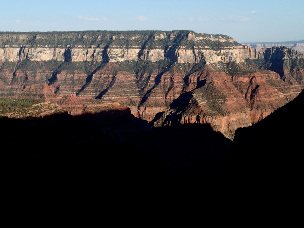 Uncle Jim TrailHiking · ~10 min drivePhoto: cogdogblog, CC BY 2.0 (via Flickr)
- Saddle Mountain Trail #31Hiking · ~6 min drive
Also worth it near here
- Kolb ArchNatural arch · ~3 min drive
 Alsap ButteSummit · ~8 min drivePhoto: George Billingsley, U.S. Geological Survey, Public domain (via Wikimedia Commons)
- North Rim CampgroundCamping · ~12 min drive
- Grand Canyon National ParkRock climbing · ~16 min drivePhoto: brewbooks from near Seattle, USA, CC BY-SA 2.0 (via Wikimedia Commons)
Best time to visit Point Imperial Trail
Best months: May–October. Best months have typical highs of 55–85 °F, lows of 30 °F or warmer (32 °F where the station doesn't record snow), at most one snowy day and no more than 12 wet days.
Jan
36° / 18°
7 wet
Feb
37° / 19°
7 wet
Mar
44° / 23°
6 wet
Apr
52° / 28°
4 wet
May
62° / 36°
4 wet
Jun
73° / 43°
3 wet
Jul
77° / 49°
8 wet
Aug
74° / 48°
11 wet
Sep
67° / 42°
7 wet
Oct
56° / 33°
5 wet
Nov
45° / 24°
5 wet
Dec
36° / 17°
6 wet
Typical high / low (°F) and days with rain or snow, 1991–2020. Measured at Bright Angel Rs, AZ, 7 mi away at 8,000 ft. The station sits about 900 ft lower than this place, so expect it a little cooler here. This station doesn't record snowfall. Source: NOAA NCEI U.S. Climate Normals 1991–2020.
Map and trail data © OpenStreetMap contributors
