Town Creek Campground
Campground
Campground · 6.4 mi from the trail
Short Creek Falls is a waterfall in Alabama, about 4 miles from the town of Albertville. It sits at roughly 770 feet of elevation, and the surrounding area offers a mix of hiking and climbing within a few miles. Spring and fall are the most comfortable times to visit. Typical averages from a nearby weather station in Guntersville show October highs around 73°F with lows near 53°F, and April is similar at about 72°F by day and 50°F at night. That station sits a few hundred feet lower than the falls, so temperatures at the falls may run slightly cooler. Several trails lie close by. Cutchemine Trail is about 2.5 miles away, and Tom Bevill Trail is about 3.4 miles off. Climbers can head to Guntersville Roof, about 3.5 miles away, and paddlers will find Scarham Creek roughly 9 miles from the falls.
Town Creek Campground
Campground
SMPA Artist House
Museum
Places © OpenStreetMap contributors, Places © Overture Maps Foundation
More in AlbertvilleElevation from USGS 3D Elevation Program terrain data (about 10 m resolution).
Source: Roamze catalog (indexable pages within 10 miles, PostGIS distance)
 Little River FallsWaterfall · ~57 min drivePhoto: Jsfouche, CC BY-SA 3.0 (via Wikimedia Commons)
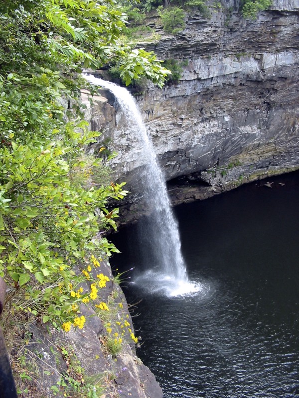 De Soto FallsWaterfall · ~1h 6m drivePhoto: Jsfouche, CC BY-SA 3.0 (via Wikimedia Commons)
Best months: March–May and September–November. Best months have typical highs of 55–85 °F, lows of 30 °F or warmer (32 °F where the station doesn't record snow), at most one snowy day and no more than 12 wet days.
Jan
50° / 32°
11 wet
Feb
54° / 35°
10 wet
Mar
63° / 43°
11 wet
Apr
72° / 50°
10 wet
May
79° / 60°
9 wet
Jun
86° / 68°
10 wet
Jul
89° / 71°
10 wet
Aug
88° / 71°
8 wet
Sep
83° / 65°
7 wet
Oct
73° / 53°
7 wet
Nov
62° / 42°
9 wet
Dec
53° / 36°
11 wet
Typical high / low (°F) and days with rain or snow, 1991–2020. Measured at Guntersville No.2, AL, 7.2 mi away at 595 ft. This station doesn't record snowfall. Source: NOAA NCEI U.S. Climate Normals 1991–2020.
