Little River Falls
 Photo: Jsfouche, CC BY-SA 3.0 (via Wikimedia Commons)
- 1,139 ft
- elevation
- Feb–May, Oct–Dec
- best months
Is Little River Falls open right now?
Alert in the area
The National Park Service lists an alert for Little River Canyon National Preserve.
SEASONAL SAFETY MESSAGE
Park alert covering Little River Canyon National Preserve · NPS · Little River Canyon National Preserve
As of · Source: NPS · Little River Canyon National Preserve. Agencies don't list every closure — check before you go.
Little River Falls is a waterfall in Alabama's Little River Canyon National Preserve, about 5.6 miles from Fort Payne. It sits at roughly 1,140 feet, and the Little River Falls Trail starts just 0.1 mile away, making it the natural way to reach the falls. Spring and fall are the most comfortable times to visit. Typical averages from a nearby weather station in Fort Payne show April highs around 74°F and October highs around 76°F, while July averages about 91°F. Several other spots lie close by. The Beaver Pond Trail and the Lynn Overlook climbing area are each about 0.9 mile away, and the Little River paddling route is about 2.4 miles off.
- Elevation
- 1,139 ft
Elevation from USGS 3D Elevation Program terrain data (about 10 m resolution).
- Little River Falls TrailHiking0.1 mi
- Road 10Hiking0.7 mi
 Lynn OverlookRock climbingPhoto: Rick Shu, CC BY-SA 3.0 (via Wikimedia Commons)0.9 mi
- Beaver Pond TrailHiking0.9 mi
- The ConcaveRock climbingPhoto: Rick Shu, CC BY-SA 3.0 (via Wikimedia Commons)1.2 mi
- Little RiverCanoeing2.4 mi
- RocktoberfestRock climbing2.5 mi
- East Fork Little RiverCanoeing7.3 mi
Source: Roamze catalog (indexable pages within 10 miles, PostGIS distance)
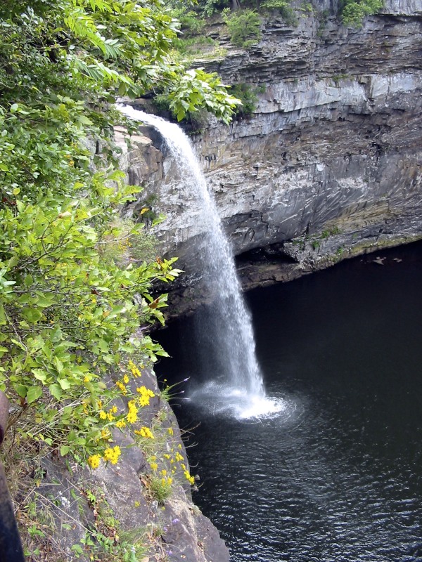 De Soto FallsWaterfall · ~19 min drivePhoto: Jsfouche, CC BY-SA 3.0 (via Wikimedia Commons)
- Little FallsWaterfall · ~15 min drive
- Griffin FallsWaterfall · ~32 min drive
- Swindell FallsWaterfall · ~34 min drive
- High FallsWaterfall · ~43 min drive
- High FallsWaterfall · ~52 min drive
- Little FallsWaterfall · ~53 min drive
- Noccalula FallsWaterfall · ~57 min drive
- Short Creek FallsWaterfall · ~57 min drive
- Keown FallsWaterfall · ~58 min drive
Best time to visit Little River Falls
Best months: February–May and October–December. Best months have typical highs of 55–85 °F, lows of 30 °F or warmer (32 °F where the station doesn't record snow), at most one snowy day and no more than 12 wet days.
Jan
52° / 31°
Feb
57° / 36°
Mar
65° / 42°
Apr
74° / 50°
May
81° / 58°
Jun
88° / 67°
Jul
91° / 70°
Aug
90° / 69°
Sep
86° / 64°
Oct
76° / 52°
Nov
64° / 41°
Dec
55° / 35°
Typical high / low (°F) and days with rain or snow, 1991–2020. Measured at Ft Payne, AL, 6.4 mi away at 917 ft. This station doesn't record snowfall. Source: NOAA NCEI U.S. Climate Normals 1991–2020.
Closures we've recorded since August 2026
Little River Falls Overlook Parking Lot closed October 22-23, 2026.
Little River Canyon National Preserve · seen Oct 9, 2026 → lifted Oct 24, 2026 · National Park Service
