Taum Sauk Mountain
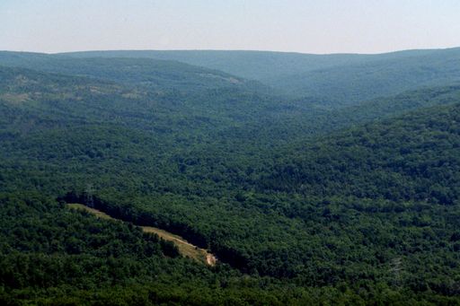 Photo: Kbh3rd, CC BY-SA 3.0 (via Wikimedia Commons)
At a glance
Taum Sauk Mountain is a summit in Missouri, rising to 1,771 feet about 5.6 miles from the town of Arcadia. It sits at the center of a cluster of trails and climbing areas, with the Mina Sauk Falls Trail starting just 0.1 mile away. For comfortable weather, aim for late spring or early fall. Typical averages from a nearby weather station show May highs around 74°F and September highs around 78°F, with July the warmest month at about 86°F. That station sits roughly 666 feet lower than the summit, so temperatures on top run cooler. Paddlers can head to Stouts Creek or the East Fork Black River, both about 4.2 miles away. Climbers will find the A: Picnic Area and B: Upper Picnic Area climbing areas about 6 miles off.
- summit
- 1,771 ft
- way up
- 1
- best months
- Early Mar–mid-May, late Sep–early Dec
Near: Ironton
Best weeks to go
Early March to mid-May and late September to early December are usually best for the summit here.
Typical highs of 48–74°F and lows of 31°F or warmer in those weeks. Rain falls on about 40% of days at the wettest of them, so plan around showers.
Typical weather: NOAA 1991–2020 normals at Potosi 4 Sw, MO, 23 mi away. Not a forecast.
Typical weather by monthBest time to visit Taum Sauk Mountain
Best months: March–May and October–November. Best months are the ones mostly made of the best weeks for the summit: typical temperatures in its comfortable range, few snowy days and not usually wet, judged with the same limits as our good-day forecasts.
Jan
40°
21°
8 wet
Feb
45°
25°
8 wet
Mar
55°
33°
10 wet
Apr
66°
44°
11 wet
May
74°
54°
12 wet
Jun
82°
63°
10 wet
Jul
86°
67°
9 wet
Aug
85°
65°
8 wet
Sep
78°
57°
7 wet
Oct
68°
46°
9 wet
Nov
54°
35°
8 wet
Dec
43°
26°
8 wet
Typical high / low (°F) and days with rain or snow, 1991–2020. Measured at Potosi 4 Sw, MO, 23.2 mi away at 1,105 ft. The station sits about 700 ft lower than this place, so expect it a little cooler here. This station doesn't record snowfall. Source: NOAA NCEI U.S. Climate Normals 1991–2020.
Been here? Tell people how it was.
Map © Mapbox © OpenStreetMap contributors - Mina Sauk Falls TrailHiking0.1 mi
 Stouts CreekCanoeingPhoto: Adam Moss from Macomb, IL, United States, CC BY-SA 2.0 (via Wikimedia Commons)4.2 mi
- East Fork Black RiverCanoeing4.2 mi
 A: Picnic AreaRock climbingPhoto: Fredlyfish4, CC BY-SA 3.0 (via Wikimedia Commons)6 mi
- Brogans TrailHiking6 mi
- B: Upper Picnic AreaRock climbingPhoto: Fredlyfish4, CC BY-SA 3.0 (via Wikimedia Commons)6 mi
 C: The Front RangeRock climbingPhoto: Fredlyfish4, CC BY-SA 3.0 (via Wikimedia Commons)6.1 mi
 Scour TrailHikingPhoto: CC BY-SA 3.0 (via Wikimedia Commons)6.1 mi
 Russell MountainSummitPhoto: US Geologic Survey, Public domain (via Wikimedia Commons)~3 min drive
- Lindsey MountainSummit~13 min drive
- Bell MountainSummit~14 min drive
- Green MountainSummit~39 min drive
- Mudlick MountainSummit~41 min drive
- Pilot KnobSummit~11 min drive
Also worth it near here
- Mina Sauk FallsWaterfall~2 min drive
- Stouts CreekCanoeingPhoto: Adam Moss from Macomb, IL, United States, CC BY-SA 2.0 (via Wikimedia Commons)~7 min drive
- A: Picnic AreaRock climbingPhoto: Fredlyfish4, CC BY-SA 3.0 (via Wikimedia Commons)~10 min drive
- Scour TrailHikingPhoto: CC BY-SA 3.0 (via Wikimedia Commons)~11 min drive
Conditions and forecast
Daily highs and lows, wind and the chance of precipitation at the summit and route start for the next 7 days, from the Open-Meteo model.
Questions about Taum Sauk Mountain
How tall is Taum Sauk Mountain?
1,771 ft (540 m).
How many routes go to the summit of Taum Sauk Mountain?
One: Mina Sauk Falls Trail.
Ask about this place
Questions about Taum Sauk Mountain: conditions, access, timing. Answers say when something isn't known.
