Mudlick Mountain
- 1,312 ft
- summit
- 2
- ways up
- Mar–Jun, Sep–Nov
- best months
Mudlick Mountain is a summit in Missouri, rising to 1,312 feet about 6 miles from the town of Des Arc. It sits at the center of a cluster of trails, with the Mudlick Equestrian Hike Trail starting just 0.1 mile away and the Shut-Ins Trail and Mudlick Hike OnlyTrail each about a mile off. Spring and fall are the most comfortable times to visit. Typical averages from a nearby weather station at Clearwater Dam show October highs around 70°F with lows near 45°F, and April is similar at about 69°F by day and 44°F at night. That station sits roughly 650 feet lower than the summit, so temperatures on top run cooler. The Saint Francis River, about 2.6 miles away, offers paddling.
Conditions and forecast
Daily highs and lows, wind and the chance of precipitation at the summit and route start for the next 7 days, from the Open-Meteo model.
- Summit elevation
- 1,312 ft
Elevation from USGS 3D Elevation Program terrain data (about 10 m resolution).
- Fire Tower TrailExpertabout 2,397 ft of climbing6.5 mi round trip
- Mudlick Equestrian Hike TrailExpertabout 5,323 ft of climbing18.5 mi round trip
Compare the routes Fire Tower Trail Mudlick Equestrian Hike Trail Climbing About 2,397 ft About 5,323 ft Round trip 6.5 mi 18.5 mi Difficulty Expert Expert Terrain Hike Hike Map © Mapbox © OpenStreetMap contributors Questions about Mudlick Mountain
How tall is Mudlick Mountain?
1,312 ft (400 m).
How many routes go to the summit of Mudlick Mountain?
2: Fire Tower Trail and Mudlick Equestrian Hike Trail.
What is the shortest route up Mudlick Mountain?
Fire Tower Trail, about 6.5 mi round trip.
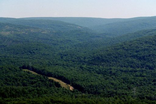 Taum Sauk Mountain1,771 ft · Missouri1 route24 mi awayPhoto: Kbh3rd, CC BY-SA 3.0 (via Wikimedia Commons)
- Pilot Knob1,496 ft · Missouri1 route25 mi away
- Lindsey Mountain1,657 ft · Missouri1 route30 mi away
- Bell Mountain1,703 ft · Missouri2 routes31 mi away
- Vick Hill765 ft · Illinois1 route64 mi away
- Iron Mountain709 ft · Illinois1 route69 mi away
- Mudlick Equestrian Hike TrailHiking0.1 mi
- Shut-Ins TrailHiking1 mi
- Mudlick Hike OnlyTrailHiking1 mi
- Paved Bicycle TrailHiking1.2 mi
 Saint Francis RiverCanoeingPhoto: NOAA employee, Public domain (via Wikimedia Commons)2.6 mi
Source: Roamze catalog (indexable pages within 10 miles, PostGIS distance)
 Russell MountainSummit · ~40 min drivePhoto: US Geologic Survey, Public domain (via Wikimedia Commons)
- Taum Sauk MountainSummit · ~41 min drivePhoto: Kbh3rd, CC BY-SA 3.0 (via Wikimedia Commons)
- Green MountainSummit · ~3 min drive
- Pilot KnobSummit · ~43 min drive
- Bell MountainSummit · ~54 min drive
- Lindsey MountainSummit · ~52 min drive
Best time to visit Mudlick Mountain
Best months: March–June and September–November. Best months have typical highs of 55–85 °F, lows of 30 °F or warmer (32 °F where the station doesn't record snow), at most one snowy day and no more than 12 wet days.
Jan
43° / 23°
8 wet
Feb
48° / 27°
8 wet
Mar
58° / 35°
9 wet
Apr
69° / 44°
9 wet
May
77° / 54°
10 wet
Jun
85° / 63°
9 wet
Jul
89° / 68°
8 wet
Aug
88° / 66°
8 wet
Sep
80° / 57°
7 wet
Oct
70° / 45°
7 wet
Nov
57° / 35°
8 wet
Dec
46° / 27°
8 wet
Typical high / low (°F) and days with rain or snow, 1991–2020. Measured at Clearwater Dam, MO, 16.5 mi away at 660 ft. The station sits about 700 ft lower than this place, so expect it a little cooler here. This station doesn't record snowfall. Source: NOAA NCEI U.S. Climate Normals 1991–2020.
