Russell Mountain
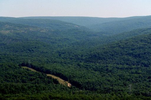
 Photo: US Geologic Survey, Public domain (via Wikimedia Commons)
- 1,725 ft
- summit
- Mar–Jun, Aug–Oct
- best months
Russell Mountain is a summit in Iron County, Missouri, rising to about 1,725 feet. The nearest town is Arcadia, about 3.7 miles away. Fall is the most comfortable time to visit. Typical averages from a nearby weather station show October highs around 68°F with lows near 46°F, and the summit sits higher than that station, so temperatures on top run a little cooler. Mina Sauk Falls Trail is the closest neighbor at about 1.8 miles, and Stouts Creek offers canoeing about 2.5 miles away. Brogans Trail and the Pilot Knob Guided Hike Route are both within about 5 miles.
Conditions and forecast
Daily highs and lows, wind and the chance of precipitation at the summit for the next 7 days, from the Open-Meteo model.
- Summit elevation
- 1,725 ft
Elevation from USGS 3D Elevation Program terrain data (about 10 m resolution).
We don't know of a mapped trail or route to the summit of Russell Mountain. Plan the approach with local maps, a guidebook or a local guide, and check conditions before you go.
Questions about Russell Mountain
How tall is Russell Mountain?
1,725 ft (526 m).
Is there a trail to the top of Russell Mountain?
We don't know of a mapped trail or route to the summit. Plan the approach with local maps, a guidebook or a local guide.
 Taum Sauk Mountain1,771 ft · Missouri1 route1.9 mi awayPhoto: Kbh3rd, CC BY-SA 3.0 (via Wikimedia Commons)
- Pilot Knob1,496 ft · Missouri1 route5.0 mi away
- Lindsey Mountain1,657 ft · Missouri1 route9.0 mi away
- Bell Mountain1,703 ft · Missouri2 routes10 mi away
- Mudlick Mountain1,312 ft · Missouri2 routes23 mi away
- Vick Hill765 ft · Illinois1 route76 mi away
- Mina Sauk Falls TrailHiking1.8 mi
 Stouts CreekCanoeingPhoto: Adam Moss from Macomb, IL, United States, CC BY-SA 2.0 (via Wikimedia Commons)2.5 mi
- Brogans TrailHiking4.4 mi
 Pilot Knob Guided Hike RouteHikingPhoto: Missouri State Archives, No restrictions (via Wikimedia Commons)5 mi
 A: Picnic AreaRock climbingPhoto: Fredlyfish4, CC BY-SA 3.0 (via Wikimedia Commons)5.5 mi
- B: Upper Picnic AreaRock climbingPhoto: Fredlyfish4, CC BY-SA 3.0 (via Wikimedia Commons)5.5 mi
 C: The Front RangeRock climbingPhoto: Fredlyfish4, CC BY-SA 3.0 (via Wikimedia Commons)5.6 mi
- East Fork Black RiverCanoeing6.1 mi
Source: Roamze catalog (indexable pages within 10 miles, PostGIS distance)
- Taum Sauk MountainSummit · ~3 min drivePhoto: Kbh3rd, CC BY-SA 3.0 (via Wikimedia Commons)
- Pilot KnobSummit · ~9 min drive
- Bell MountainSummit · ~17 min drive
- Green MountainSummit · ~37 min drive
- Mudlick MountainSummit · ~40 min drive
- Lindsey MountainSummit · ~15 min drive
Also worth it near here
- Stouts CreekCanoeing · ~4 min drivePhoto: Adam Moss from Macomb, IL, United States, CC BY-SA 2.0 (via Wikimedia Commons)
- Mina Sauk FallsWaterfall · ~5 min drive
- Pilot Knob Guided Hike RouteHiking · ~8 min drivePhoto: Missouri State Archives, No restrictions (via Wikimedia Commons)
- A: Picnic AreaRock climbing · ~9 min drivePhoto: Fredlyfish4, CC BY-SA 3.0 (via Wikimedia Commons)
Best time to visit Russell Mountain
Best months: March–June and August–October. Best months have typical highs of 55–85 °F, lows of 30 °F or warmer (32 °F where the station doesn't record snow), at most one snowy day and no more than 12 wet days.
Jan
40° / 21°
8 wet
Feb
45° / 25°
8 wet
Mar
55° / 33°
10 wet
Apr
66° / 44°
11 wet
May
74° / 54°
12 wet
Jun
82° / 63°
10 wet
Jul
86° / 67°
9 wet
Aug
85° / 65°
8 wet
Sep
78° / 57°
7 wet
Oct
68° / 46°
9 wet
Nov
54° / 35°
8 wet
Dec
43° / 26°
8 wet
Typical high / low (°F) and days with rain or snow, 1991–2020. Measured at Potosi 4 Sw, MO, 23.6 mi away at 1,105 ft. The station sits about 600 ft lower than this place, so expect it a little cooler here. This station doesn't record snowfall. Source: NOAA NCEI U.S. Climate Normals 1991–2020.
