No Mans Mesa
At a glance
No Mans Mesa is a summit of 6,216 feet in Utah's Paria River District, a Bureau of Land Management unit about 21 miles from the town of Cannonville. Spring and fall are the most comfortable times to visit. Typical averages from a nearby weather station at Kodachrome Basin Park show May highs around 74°F and October highs around 68°F, while July averages about 91°F and January highs sit near 45°F. Two hikes start within a mile of the summit: the Hike to Starlight Arch and the Bypass to Height 6216. The Trail Through Ghost Town Pahreah is about 2.3 miles away, and the North CRC climbing area lies roughly 7.6 miles off.
- summit
- 6,216 ft
- ways up
- 2
- best months
- May, Sep
Where it is: Paria River District
Near: Tropic
Best time to visit No Mans Mesa
Best months: May and September. Best months have typical highs of 55–85 °F, lows of 30 °F or warmer (32 °F where the station doesn't record snow), at most one snowy day and no more than 12 wet days.
Jan
45°
15°
5 wet
Feb
49°
19°
5 wet
Mar
58°
24°
5 wet
Apr
65°
29°
5 wet
May
74°
36°
5 wet
Jun
86°
43°
3 wet
Jul
91°
52°
6 wet
Aug
88°
51°
8 wet
Sep
81°
42°
6 wet
Oct
68°
31°
4 wet
Nov
55°
21°
3 wet
Dec
44°
15°
4 wet
Typical high / low (°F) and days with rain or snow, 1991–2020. Measured at Kodachrome Basin Park, UT, 17.9 mi away at 5,805 ft. This station doesn't record snowfall. Source: NOAA NCEI U.S. Climate Normals 1991–2020.
Been here? Tell people how it was.
- Bypass to Height 6216Moderateabout 1,096 ft of climbing1.8 mi round trip
- Hike to Starlight ArchModerateabout 1,094 ft of climbing7.2 mi round trip
Compare the routes Bypass to Height 6216 Hike to Starlight Arch Climbing About 1,096 ft About 1,094 ft Round trip 1.8 mi 7.2 mi Difficulty Moderate Moderate Terrain Hike Hike Map © Mapbox © OpenStreetMap contributors - Top Rock5,556 ft · Arizona1 route18 mi away
- Buckskin Mountains6,386 ft · Arizona2 routes23 mi away
 The Cathedral7,823 ft · Utah2 routes26 mi awayPhoto: George A. Grant, Public domain (via Wikimedia Commons)
- Stud Horse Point4,601 ft · Utah1 route27 mi away
- Savage Point5,957 ft · Utah2 routes30 mi away
 Powell Point10,214 ft · Utah1 route30 mi awayPhoto: A. E. Crane, U.S. Department of Transportation, Public domain (via Wikimedia Commons)
- Hike to Starlight ArchHiking0.8 mi
- Bypass to Height 6216Hiking0.8 mi
 Trail Through Ghost Town PahreahHikingPhoto: John Fowler from Placitas, NM, USA, CC BY 2.0 (via Wikimedia Commons)2.3 mi
 Box TrailHikingPhoto: Greg Willis from Denver, CO, usa, CC BY-SA 2.0 (via Wikimedia Commons)3.4 mi
- Hogeye CanyonHiking3.4 mi
- Track to Mollies NippleHiking3.6 mi
 Red Top Climbers Acess (Approx)HikingPhoto: Greg Willis from Denver, CO, usa, CC BY-SA 2.0 (via Wikimedia Commons)3.6 mi
 North CRCRock climbingPhoto: Ken Lund from Reno, Nevada, USA, CC BY-SA 2.0 (via Wikimedia Commons)7.6 mi
 Coyote ButtesSummitPhoto: Bureau of Land Management, Public domain (via Wikimedia Commons)~34 min drive
- The CathedralSummitPhoto: George A. Grant, Public domain (via Wikimedia Commons)~45 min drive
 Mormon TempleSummitPhoto: George A. Grant, Public domain (via Wikimedia Commons)~46 min drive
 Sinking ShipSummitPhoto: Christopher Michel, CC BY 2.0 (via Wikimedia Commons)~47 min drive
 Boat MesaSummitPhoto: Chris Light, CC BY-SA 4.0 (via Wikimedia Commons)~48 min drive
- Powell PointSummitPhoto: A. E. Crane, U.S. Department of Transportation, Public domain (via Wikimedia Commons)~52 min drive
 Flake MountainSummitPhoto: An Errant Knight, CC BY-SA 4.0 (via Wikimedia Commons)~1h 1m drive
 Romana MesaSummitPhoto: ALAN SCHMIERER, CC0 (via Wikimedia Commons)~1h 4m drive
 Gunsight ButteSummitPhoto: Wilson Bilkovich, CC BY 2.0 (via Wikimedia Commons)~1h 7m drive
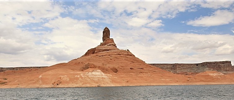 Cookie Jar ButteSummitPhoto: MS-R / Michael S-R, CC BY-SA 2.0 (via Wikimedia Commons)~1h 8m drive
Also worth it near here
Conditions and forecast
Daily highs and lows, wind and the chance of precipitation at the summit and route start for the next 7 days, from the Open-Meteo model.
Questions about No Mans Mesa
How tall is No Mans Mesa?
6,216 ft (1,895 m).
How many routes go to the summit of No Mans Mesa?
2: Bypass to Height 6216 and Hike to Starlight Arch.
What is the shortest route up No Mans Mesa?
Bypass to Height 6216, about 1.8 mi round trip.

Ask about this place
Questions about No Mans Mesa: conditions, access, timing. Answers say when something isn't known.
