Tabeguache Creek
At a glance
Tabeguache Creek is a canoeing route in Colorado's Grand Mesa, Uncompahgre and Gunnison National Forests, within the Norwood Ranger District. The Forest Service manages the land, and the nearest town is Placerville, about 32 miles away. The creek is a paddling destination rather than a route with a set climb or distance. Summer is the most comfortable season. Typical averages from a nearby weather station in Placerville put July highs around 83°F and lows near 50°F. That station sits roughly 1,500 feet lower than the creek, so expect cooler temperatures on the water. Several hikes start close by, including Pinto Mesa Spur, about half a mile away, and Pinto Mesa and Paradox, each about 1.6 miles off. For overnight stays, Columbine Campground is about 7.7 miles away.
- distance
- 32.2 mi
- high point
- 8,869 ft
- best months
- Late Apr–mid-Oct
Where it is: Norwood Ranger District · Grand Mesa, Uncompahgre and Gunnison National Forests
Near: Nucla
Best weeks to go
Late April to mid-October is usually best for paddling here.
Typical highs of 60–84°F and lows of 30°F or warmer in those weeks.
Typical weather: NOAA 1991–2020 normals at Placerville, CO, 34 mi away. Not a forecast.
Typical weather by monthBest time to visit Tabeguache Creek
Best months: May–September. Best months are the ones mostly made of the best weeks for paddling: typical temperatures in its comfortable range, few snowy days and not usually wet, judged with the same limits as our good-day forecasts.
Jan
40°
12°
Feb
43°
16°
Mar
52°
22°
Apr
58°
28°
May
68°
35°
Jun
80°
45°
Jul
83°
50°
Aug
80°
49°
Sep
74°
42°
Oct
62°
30°
Nov
50°
19°
Dec
40°
12°
Typical high / low (°F) and days with rain or snow, 1991–2020. Measured at Placerville, CO, 33.8 mi away at 7,383 ft. The station sits about 1,500 ft lower than this place, so expect it a little cooler here. This station doesn't record snowfall. Source: NOAA NCEI U.S. Climate Normals 1991–2020.
Been here? Tell people how it was.
 San Miguel RiverCanoeingPhoto: Cawright2007, CC BY-SA 3.0 (via Wikimedia Commons)~26 min drive
- Cottonwood Ledges Boat RampBoat launch~17 min drive
 Leopard CreekCanoeingPhoto: Jeffrey Beall, CC BY 4.0 (via Wikimedia Commons)~58 min drive
- Ledges Rockhouse Boat RampBoat launch~19 min drive
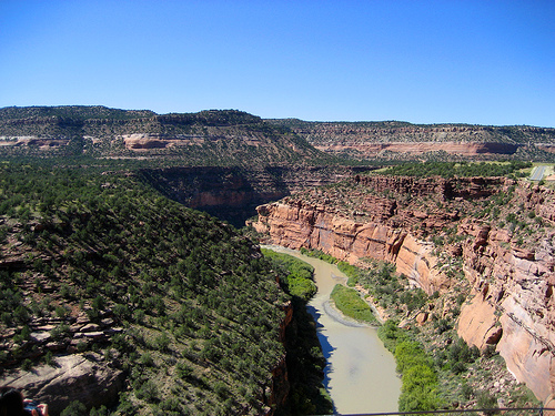 Dolores RiverCanoeingPhoto: Argyleist. Original uploader was Argyleist at en.wikipedia, CC BY 3.0 (via Wikimedia Commons)~59 min drive
- Bedrock Boat RampBoat launch~38 min drive
 Uncompahgre RiverCanoeingPhoto: Sally Pearce, Colorado Department of Transportation; brightened and color-corrected by Howcheng, Public domain (via Wikimedia Commons)~1h 6m drive
- Lower Beaver Boat RampBoat launch~41 min drive
 East Fork Dallas CreekCanoeingPhoto: Boyd Norton, Public domain (via Wikimedia Commons)~1h 12m drive
- Gypsum Valley Recreation Site Boat RampBoat launch~45 min drive
Conditions and forecast
Caution todayAgency alerts are in effect for this areaUSFS · checked 13 min agoDaily highs and lows, wind and the chance of precipitation at Start for the next 7 days, from the Open-Meteo model.

Ask about this place
Questions about Tabeguache Creek: conditions, access, timing. Answers say when something isn't known.
Local outfitters
- CampV11 mi away
- Cedar Creek RV Park and Lodging36 mi away
Not on Roamze yet. Their page has how to reach them.
