

Cedar Creek RV Park and Lodging
Kayaking business nearby (~29 mi away) — hasn't claimed their Roamze page yet
Free — you'll pick up right here.
Watch this water
Sign up to watch it — saving subscribes you to gate, closure and report changes.
Colorado
Weather is good
1 factor · 1 source
Observed 6 h ago
clear: Weather
Clouds, high 69°F / low 45°F, 0% precip — 95/100 for canoeing
OpenWeather6 h ago
Been out here in the last few days? One report keeps this current for everyone.
Why you'll love it
Long-term averages modeled by USGS (NHDPlus HR), not today's conditions. Check a gauge before you go.
Leopard Creek
AI-suggested draft · review before you go
No permit or access details on file for this water — check with the local land manager before you go.
Leopard Creek is a 14-mile paddling stretch near Placerville, Colorado. It flows year-round. USGS models an average flow of about 56 cfs and a gradient of about 146.0 feet per mile.
 Photo: Boyd Norton, Public domain (via Wikimedia Commons)
East Fork Dallas Creek
~16 min drive
East Fork Dallas Creek is a 11-mile paddling stretch near Ridgway, Colorado. It is intermittent and may run dry in some seasons. USGS models an average flow of about 34 cfs and a gradient of about 318.4 feet per mile.
Lake Fork
~1h 16m drive
Lake Fork is a boat launch in Colorado.
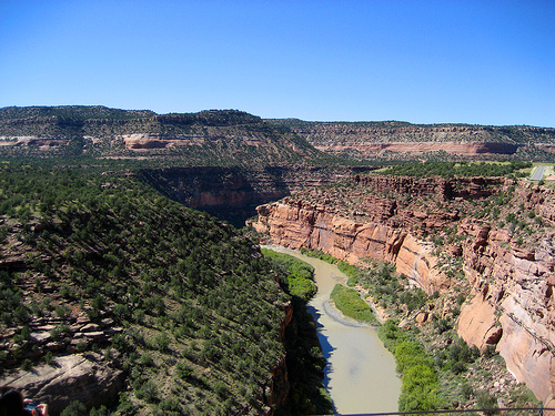 Photo: Argyleist. Original uploader was Argyleist at en.wikipedia, CC BY 3.0 (via Wikimedia Commons)
Dolores River
~28 min drive
Dolores River is a 13-mile paddling stretch near Norwood, Colorado. It flows year-round. USGS models an average flow of about 626 cfs and a gradient of about 163.6 feet per mile. Land along it is managed by the U.S. Forest Service.
 Photo: Sally Pearce, Colorado Department of Transportation; brightened and color-corrected by Howcheng, Public domain (via Wikimedia Commons)
Uncompahgre River
~28 min drive
Uncompahgre River is a 13-mile paddling stretch near Montrose, Colorado. It flows year-round. USGS models an average flow of about 281 cfs and a gradient of about 280.1 feet per mile. Land along it is managed by the Bureau of Land Management.
 Photo: Jeffrey Beall, CC BY 4.0 (via Wikimedia Commons)
West Dolores River
~34 min drive
West Dolores River is a 12-mile paddling stretch near Dolores, Colorado. It flows year-round. USGS models an average flow of about 64 cfs and a gradient of about 241.8 feet per mile. Land along it is managed by the U.S. Forest Service.
 Photo: Cawright2007, CC BY-SA 3.0 (via Wikimedia Commons)
San Miguel River
~36 min drive
San Miguel River is a 2.3-mile paddling stretch near Norwood, Colorado. It flows year-round. USGS models an average flow of about 309 cfs and a gradient of about 138.1 feet per mile.
 Photo: Clyde frogg, CC BY-SA 3.0 (via Wikimedia Commons)
Animas River
~45 min drive
Animas River is a 15-mile paddling stretch near Silverton, Colorado. It flows year-round. USGS models an average flow of about 544 cfs and a gradient of about 131.4 feet per mile.
 Photo: Jeffrey Beall, CC BY 4.0 (via Wikimedia Commons)
Henson Creek
~51 min drive
Henson Creek is a 17-mile paddling stretch near Lake City, Colorado. It flows year-round. USGS models an average flow of about 107 cfs and a gradient of about 174.4 feet per mile. Land along it is managed by the Bureau of Land Management.
 Photo: Jeffrey Beall, CC BY 4.0 (via Wikimedia Commons)
Hermosa Creek
~1h 3m drive
Hermosa Creek is a 29-mile paddling stretch near Durango, Colorado. It flows year-round. USGS models an average flow of about 270 cfs and a gradient of about 134.6 feet per mile. Land along it is managed by the U.S. Forest Service.
 Photo: Jeffrey Beall, CC BY 4.0 (via Wikimedia Commons)
Blue Creek
~1h 8m drive
Blue Creek is a 3.5-mile paddling stretch near Cimarron, Colorado. It flows year-round. USGS models an average flow of about 55 cfs and a gradient of about 286.5 feet per mile. Land along it is managed by the Bureau of Land Management.
Also worth it near here
Local operators near Placervilleoffering guided trips. You book directly with them — Roamze doesn’t take a cut.
Cedar Creek RV Park and Lodging
Kayaking business nearby (~29 mi away) — hasn't claimed their Roamze page yet
CampV
Kayaking business nearby (~35 mi away) — hasn't claimed their Roamze page yet
