Lower Beaver Rec. Site
Campground
Campground · 0.2 mi from the trail
Lower Beaver Boat Ramp is a boat launch on Bureau of Land Management land in Colorado's Southwest District, about 6 miles from the town of Norwood. It serves as a put-in for boaters heading onto the water in this corner of the state. Summer is the most comfortable time to visit. Typical averages from a nearby weather station in Norwood show July highs around 83°F with lows near 52°F, while winter highs stay in the upper 30s. Several other outdoor spots lie within a short drive. Clay Creek Crag, a climbing area, is about 5 miles away, and Specie Creek Boat Launch offers river fishing roughly 7 miles off. Horsefly Creek, a canoeing route, and the San Miguel River are both within about 10 miles.
Lower Beaver Rec. Site
Campground
Places © OpenStreetMap contributors, Places © Overture Maps Foundation
More in Telluride San Miguel RiverCanoeingPhoto: Cawright2007, CC BY-SA 3.0 (via Wikimedia Commons)9.7 mi
Source: Roamze catalog (indexable pages within 10 miles, PostGIS distance)
San Miguel RiverCanoeing · ~17 min drivePhoto: Cawright2007, CC BY-SA 3.0 (via Wikimedia Commons) Leopard CreekCanoeing · ~20 min drivePhoto: Jeffrey Beall, CC BY 4.0 (via Wikimedia Commons)
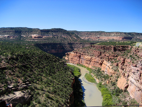 Dolores RiverCanoeing · ~23 min drivePhoto: Argyleist. Original uploader was Argyleist at en.wikipedia, CC BY 3.0 (via Wikimedia Commons)
 East Fork Dallas CreekCanoeing · ~35 min drivePhoto: Boyd Norton, Public domain (via Wikimedia Commons)
 West Dolores RiverCanoeing · ~38 min drivePhoto: Jeffrey Beall, CC BY 4.0 (via Wikimedia Commons)
Best months: May–October. Best months have typical highs of 55–85 °F, lows of 30 °F or warmer (32 °F where the station doesn't record snow), at most one snowy day and no more than 12 wet days.
Jan
38° / 10°
Feb
41° / 17°
Mar
51° / 24°
Apr
58° / 29°
May
67° / 35°
Jun
78° / 47°
Jul
83° / 52°
Aug
80° / 51°
Sep
73° / 44°
Oct
62° / 32°
Nov
49° / 21°
Dec
38° / 12°
Typical high / low (°F) and days with rain or snow, 1991–2020. Measured at Norwood #2, CO, 5.4 mi away at 7,011 ft. We don't have this place's elevation, so higher spots nearby can run cooler. This station doesn't record snowfall. Source: NOAA NCEI U.S. Climate Normals 1991–2020.
