Mount San Antonio
At a glance
Mount San Antonio is a summit in California's Angeles National Forest, within the San Gabriel Mountains National Monument Ranger District. The nearest town is Wrightwood, about 4 miles away. The Mount San Antonio (Mt. Baldy) climbing area sits right by the summit, and the Baldy Bowl Trail starts under a mile away. Manker Flat campground and Mt. Baldy Resort are both about 2 miles off.
- summit
- 10,067 ft
- ways up
- 4
Where it is: San Gabriel Mountains National Monument Ranger District · Angeles National Forest
Near: Rancho Cucamonga
Been here? Tell people how it was.
- Baldy Bowl TrailModerateabout 2,057 ft of climbing3.0 mi round trip
- Devils Backbone TrailModerateabout 2,244 ft of climbing5.4 mi round trip
- North Devils BackboneHardabout 3,105 ft of climbing7.4 mi round trip
- Mt. Baldy TrailHardabout 4,829 ft of climbing9.3 mi round trip
Compare the routes Baldy Bowl Trail Devils Backbone Trail North Devils Backbone Mt. Baldy Trail Climbing About 2,057 ft About 2,244 ft About 3,105 ft About 4,829 ft Round trip 3.0 mi 5.4 mi 7.4 mi 9.3 mi Difficulty Moderate Moderate Hard Hard Terrain Hike Hike Hike Hike Season Year-round Year-round Year-round Year-round Map © Mapbox © OpenStreetMap contributors - Thunder Mountain8,565 ft · California1 route2.9 mi away
- Telegraph Peak8,980 ft · California2 routes3.3 mi away
 Iron Mountain8,009 ft · California1 route3.9 mi awayPhoto: Self, CC BY 3.0 (via Wikimedia Commons)
- Ontario Peak8,694 ft · California1 route4.4 mi away
- Bighorn Peak8,441 ft · California1 route4.7 mi away
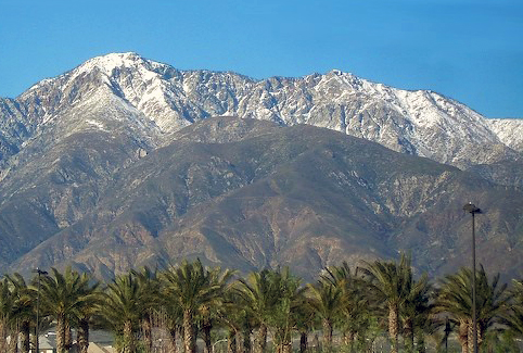 Cucamonga Peak8,859 ft · California1 route5.8 mi awayPhoto: Cliff Hutson; later cropping and color editing by Daniel Case., CC BY 2.0 (via Wikimedia Commons)
- Mount San Antonio (Mt. Baldy)Rock climbing0.1 mi
- Other RoutesRock climbing0.6 mi
- Rock GardenRock climbing0.6 mi
 Baldy Bowl TrailHikingPhoto: feverblue, CC BY-SA 2.0 (via Flickr)0.8 mi
 Register RidgeHikingPhoto: inkknife_2000 (7.5 million views +), CC BY-SA 2.0 (via Wikimedia Commons)1.7 mi
- Manker FlatCamping1.9 mi
- Mt. Baldy ResortDownhill skiing1.9 mi
- LupineCamping3 mi
- Iron MountainSummitPhoto: Self, CC BY 3.0 (via Wikimedia Commons)~7 min drive
- Cucamonga PeakSummitPhoto: Cliff Hutson; later cropping and color editing by Daniel Case., CC BY 2.0 (via Wikimedia Commons)~10 min drive
 Mount IslipSummitPhoto: Eeekster, CC BY 3.0 (via Wikimedia Commons)~20 min drive
 Mount JurupaSummitPhoto: Scottthezombie, CC BY-SA 4.0 (via Wikimedia Commons)~36 min drive
 Timber MountainSummitPhoto: Mitch Barrie (simonov), CC BY-SA 2.0 (via Wikimedia Commons)~7 min drive
 Mount Baden-PowellSummitPhoto: The original uploader was Jakerome at English Wikipedia./ Simonov, CC BY-SA 2.0 (via Wikimedia Commons)~14 min drive
 Mount BurnhamSummitPhoto: Ctatkinson, Public domain (via Wikimedia Commons)~16 min drive
 Throop PeakSummitPhoto: Eeekster, CC BY 3.0 (via Wikimedia Commons)~17 min drive
 Slover MountainSummitPhoto: Unknown authorUnknown author, Public domain (via Wikimedia Commons)~40 min drive
 Mount WilsonSummitPhoto: The original uploader was Geographer at English Wikipedia., CC BY 1.0 (via Wikimedia Commons)~41 min drive
Conditions and forecast
Daily highs and lows, wind and the chance of precipitation at the summit and route start for the next 7 days, from the Open-Meteo model.
Questions about Mount San Antonio
How tall is Mount San Antonio?
10,067 ft (3,068 m).
How many routes go to the summit of Mount San Antonio?
4: Baldy Bowl Trail, Devils Backbone Trail, North Devils Backbone and Mt. Baldy Trail.
What is the shortest route up Mount San Antonio?
Baldy Bowl Trail, about 3.0 mi round trip.
When is the best time to climb Mount San Antonio?
Year-round.

Ask about this place
Questions about Mount San Antonio: conditions, access, timing. Answers say when something isn't known.
