Mt. Baldy Trail
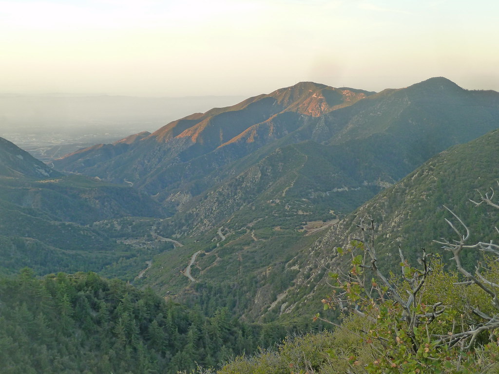 Photo: scorpio-tiger, CC BY-SA 2.0 (via Flickr)
- 9.3 mi
- round trip
- 4,829 ft
- climb
- 10,067 ft
- high point
- Out and back
- route
Is Mt. Baldy Trail open right now?
Alert in the area
The Forest Service lists 7 alerts for Angeles National Forest.
Rincon-Redbox Road (2N24) Closure
Agency alert covering Angeles National Forest · Order 05-01-26-13 · USFS · Angeles National Forest
Fire Danger Level Elevated to "Very High"
Agency alert covering Angeles National Forest · USFS · Angeles National Forest
San Gabriel Canyon OHV Area Prohibitions
Agency alert covering Angeles National Forest · Order 05-01-26-09 · USFS · Angeles National Forest
San Dimas Experimental Forest Closure
Agency alert covering Angeles National Forest · USFS · Angeles National Forest
Eaton Fire Area Closure
Agency alert covering Angeles National Forest · Order 05-01-26-04 · USFS · Angeles National Forest
As of · Source: USFS · Angeles National Forest. Agencies don't list every closure — check before you go.
Mt. Baldy Trail is a hard hike in California's Angeles National Forest, within the San Gabriel Mountains National Monument Ranger District. The route is an out-and-back of about 9.3 miles, with a total elevation gain of 4,829 feet. The trail starts at a low point of about 5,224 feet and climbs to a high point of about 10,067 feet, making it a long, steep day on foot. The trail is on natural surface, and bikes are allowed. The Forest Service manages the land, and the trail is open year-round. For supplies and a place to stay, Manker Flat campground sits about 2.1 miles away, and the Chapman Trail is a similar distance. Climbers can head to Mount Baldy Road, about 1.6 miles off, or Icehouse Canyon, about 2.2 miles away.
Conditions and forecast on Mount San Antonio
Daily highs and lows, wind and the chance of precipitation at the summit and route start for the next 7 days, from the Open-Meteo model.
- Mount Baldy RoadRock climbing1.6 mi
- Manker FlatCamping2.1 mi
 Chapman TrailHikingPhoto: inkknife_2000 (7.5 million views +), CC BY-SA 2.0 (via Wikimedia Commons)2.1 mi
- Icehouse CanyonRock climbing2.2 mi
 Register RidgeHikingPhoto: inkknife_2000 (7.5 million views +), CC BY-SA 2.0 (via Wikimedia Commons)2.3 mi
- Sunset Peak ShortcutHiking2.3 mi
- LupineCamping5.8 mi
 San Gabriel RiverCanoeingPhoto: Emarateyya, Muna Al Zaabi, CC BY-SA 3.0 (via Wikimedia Commons)9.3 mi
Source: Roamze catalog (indexable pages within 10 miles, PostGIS distance)
- Chapman TrailHiking · ~4 min drivePhoto: inkknife_2000 (7.5 million views +), CC BY-SA 2.0 (via Wikimedia Commons)
- Register RidgeHiking · ~4 min drivePhoto: inkknife_2000 (7.5 million views +), CC BY-SA 2.0 (via Wikimedia Commons)
 Telegraph Peak TrailHiking · ~6 min drivePhoto: Moo.The.Cow, CC BY 2.0 (via Flickr)
 Baldy Bowl TrailHiking · ~5 min drivePhoto: feverblue, CC BY-SA 2.0 (via Flickr)
 Icehouse Canyon TrailHiking · ~5 min drivePhoto: simonov, CC BY-SA 2.0 (via Flickr)
 BIGHORN PEAK TRAILHiking · ~6 min drivePhoto: Mitch from Costa Mesa, CA, USA, CC BY-SA 2.0 (via Wikimedia Commons)
 Devils Backbone TrailHiking · ~6 min drivePhoto: inkknife_2000 (7.5 million views +), CC BY-SA 2.0 (via Wikimedia Commons)
 Eagle Mine TrailHiking · ~5 min drivePhoto: Eeek, CC BY 3.0 (via Wikimedia Commons)
 Cucamonga Peak - Non WildernesHiking · ~11 min drivePhoto: GSEC, CC BY 2.0 (via Flickr)
- Three Ts TrailHiking · ~6 min drivePhoto: inkknife_2000 (7.5 million views +), CC BY-SA 2.0 (via Wikimedia Commons)

Route details
- Distance
- 9.3 mi round trip
- Climbing
- About 4,829 ft
- Summit
- 10,067 ft
- Difficulty
- Hard
Season
Season: Year-round.
Other routes up Mount San Antonio
Questions about this route
How long is the Mt. Baldy Trail on Mount San Antonio?
About 9.3 mi round trip.
How much elevation gain is on the Mt. Baldy Trail?
About 4,829 ft of climbing round trip.
How hard is the Mt. Baldy Trail?
It is rated hard.
When is the best time for the Mt. Baldy Trail?
Year-round.
How many routes go up Mount San Antonio?
4: Baldy Bowl Trail, Devils Backbone Trail, North Devils Backbone and Mt. Baldy Trail.
