Diamond R.R. Trail
At a glance
Diamond R.R. Trail is a moderate out-and-back hike in California, about 2.2 miles from the community of Grizzly Flat. The route is roughly 3.1 miles long, with a total elevation gain of 1,146 feet, and it reaches a high point of 4,243 feet. The climb is steady, and the steepest stretch comes early, around 0.15 miles from the start, where the grade reaches about 13%. The most comfortable months for a visit are typically May and September. Typical averages from a nearby weather station at Pacific House show May highs around 72°F and September highs around 83°F, while July and August average near 90°F. That station sits about 790 feet lower than the trail's high point, so temperatures on the trail run cooler. The hike takes about 1.5 hours. The Nature Center Trail and Tree House Trail both lie within a mile, and the Steely Fork Cosumnes River offers canoeing about 1.6 miles away. For an overnight stay, Pipi Campground is about 4.7 miles off.
- round trip
- 1.6 mi
- climb
- 1,146 ft
- high point
- 4,243 ft
- route
- Out and back
- time
- About 45 minutes
- best months
- Late Jan–early Jun, late Sep–early Dec
Near: Placerville
Best weeks to go
Late January to early June and late September to early December are usually best for hiking here.
Typical highs of 45–78°F and lows of 31°F or warmer in those weeks. Rain falls on about 40% of days at the wettest of them, so plan around showers.
Typical weather: NOAA 1991–2020 normals at Pacific House, CA, 11 mi away. Not a forecast.
Typical weather by monthBest time to visit Diamond R.R. Trail
Best months: February–May and October–November. Best months are the ones mostly made of the best weeks for hiking: typical temperatures in its comfortable range, few snowy days and not usually wet, judged with the same limits as our good-day forecasts.
Jan
44°
32°
12 wet
Feb
50°
31°
12 wet
Mar
56°
33°
12 wet
Apr
63°
36°
9 wet
May
72°
42°
7 wet
Jun
82°
47°
3 wet
Jul
90°
53°
1 wet
Aug
89°
52°
1 wet
Sep
83°
49°
2 wet
Oct
66°
41°
5 wet
Nov
51°
35°
9 wet
Dec
43°
31°
12 wet
Typical high / low (°F) and days with rain or snow, 1991–2020. Measured at Pacific House, CA, 10.5 mi away at 3,450 ft. The station sits about 800 ft lower than this place, so expect it a little cooler here. This station doesn't record snowfall. Source: NOAA NCEI U.S. Climate Normals 1991–2020.
Been here? Tell people how it was.
- Nature Center TrailHiking0.6 mi
- Tree House TrailHiking0.7 mi
- PLUMMER RIDGE LOOPHiking1.4 mi
- Steely Fork Cosumnes RiverCanoeing1.6 mi
- Dogtown CreekCanoeing1.9 mi
- Middle Fork Cosumnes RiverCanoeing2.7 mi
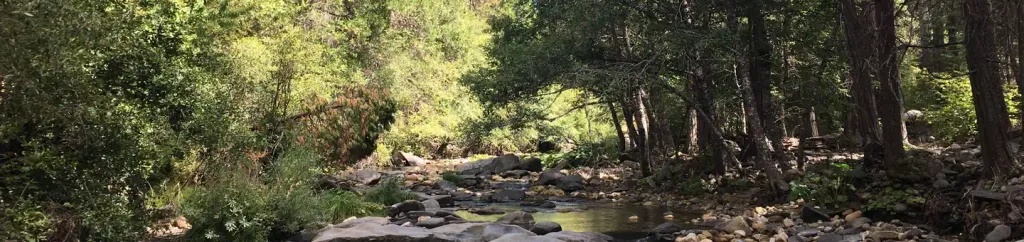 Pipi CampgroundCampingPhoto: Recreation.gov (RIDB) / public domain4.7 mi
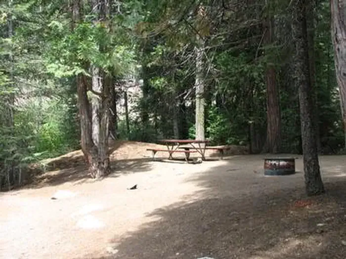 Capps CrossingCampingPhoto: Recreation.gov (RIDB) / public domain6.6 mi
 Camp CreekHikingPhoto: ray_explores, CC BY 2.0 (via Flickr)~12 min drive
 Jenkinson Lake LoopHikingPhoto: UncleVinny, CC BY 3.0 (via Wikimedia Commons)~14 min drive
- Fleming Meadow LoopHikingPhoto: UncleVinny, CC BY 3.0 (via Wikimedia Commons)~12 min drive
- SUGARPINE LOOPHiking~25 min drive
 Jenkinson Lake LoopHikingPhoto: ray_explores, CC BY 2.0 (via Flickr)~15 min drive
 Jenkinson Lake LoopHikingPhoto: ray_explores, CC BY 2.0 (via Flickr)~14 min drive
- BIG MTN. LOOPHiking~3 min drive
- COLE CREEK LOOPHiking~27 min drive
 Big Hill TrailHikingPhoto: Pacific Southwest Region 5, Public domain (via Wikimedia Commons)~28 min drive
- Fleming Meadow LoopHikingPhoto: ray_explores, CC BY 2.0 (via Flickr)~12 min drive
Conditions and forecast
Daily highs and lows, wind and the chance of precipitation at Start for the next 7 days, from the Open-Meteo model.

Ask about this place
Questions about Diamond R.R. Trail: conditions, access, timing. Answers say when something isn't known.
Local outfitters
- Alpenglow Expeditions43 mi away
Not on Roamze yet. Their page has how to reach them.
Map and trail data © OpenStreetMap contributors
