Middle Fork Cosumnes River
- 42.9 mi
- distance
- 6,800 ft
- high point
- May–Sep
- best months
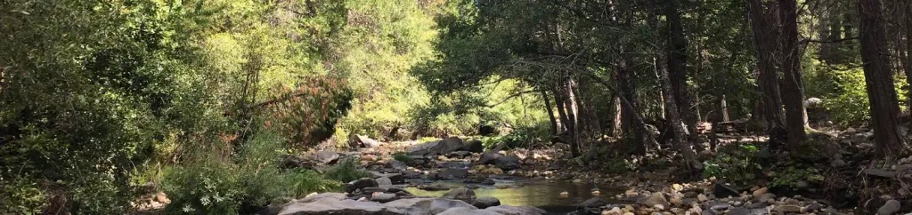
The Middle Fork Cosumnes River is a 43-mile paddling stretch in Eldorado National Forest, near Somerset, California. The U.S. Forest Service manages the land along it, and the river flows year-round. USGS models an average flow of about 319 cubic feet per second and a gradient of about 138.8 feet per mile. Summer is the most comfortable time to paddle. Typical averages from a nearby weather station show July and August highs around 80°F with only about two wet days a month, while winter highs sit near 43°F with lows in the teens. The Steely Fork Cosumnes River and the North Fork Cosumnes River are both paddling options within about 4 miles. Pipi Campground, about 6.6 miles away, and Sly Guard Cabin, about 8.5 miles away, offer places to stay.
Local outfitters
- West Shore Sports40 mi away
- Obexer's Boat Company40 mi away
Not on Roamze yet. Their page has how to reach them.
- Diamond R.R. TrailHiking2.7 mi
- Steely Fork Cosumnes RiverCanoeing2.8 mi
- Nature Center TrailHiking3.3 mi
- North Fork Cosumnes RiverCanoeing4 mi
 Pipi CampgroundCampingPhoto: Recreation.gov (RIDB) / public domain6.6 mi
- Sly Guard CabinCamping8.5 mi
 Gutenberger WallRock climbingPhoto: jfdervin, CC BY-SA 2.0 (via Flickr)9 mi
 Cosumnes River BoulderingRock climbingPhoto: jfdervin, CC BY-SA 2.0 (via Flickr)9.1 mi
Source: Roamze catalog (indexable pages within 10 miles, PostGIS distance)
 Sutter CreekCanoeing · ~30 min drivePhoto: Missvain, CC BY 4.0 (via Wikimedia Commons)
- Ice House Boat RampBoat launch · ~34 min drive
 South Fork American RiverCanoeing · ~40 min drivePhoto: Tim Who wants to know, CC BY-SA 2.0 (via Wikimedia Commons)
- West Point Boat RampBoat launch · ~35 min drive
- Steely Fork Cosumnes RiverCanoeing · ~5 min drive
- Sunset Boat RampBoat launch · ~36 min drive
- North Fork Cosumnes RiverCanoeing · ~7 min drive
- Yellowjacket Boat RampBoat launch · ~39 min drive
- Dogtown CreekCanoeing · ~7 min drive
- East Slab Creek Boat RampBoat launch · ~25 min drive
Best time to visit Middle Fork Cosumnes River
Best months: May–September. Best months have typical highs of 55–85 °F, lows of 30 °F or warmer (32 °F where the station doesn't record snow), at most one snowy day and no more than 12 wet days.
Jan
43° / 18°
9 wet
Feb
43° / 19°
9 wet
Mar
48° / 24°
10 wet
Apr
53° / 28°
8 wet
May
62° / 33°
7 wet
Jun
72° / 38°
3 wet
Jul
80° / 43°
2 wet
Aug
80° / 41°
2 wet
Sep
73° / 35°
3 wet
Oct
62° / 29°
5 wet
Nov
51° / 23°
7 wet
Dec
43° / 18°
10 wet
Typical high / low (°F) and days with rain or snow, 1991–2020. Measured at South Lake Tahoe Ap, CA, 37.2 mi away at 6,314 ft. This station doesn't record snowfall. Source: NOAA NCEI U.S. Climate Normals 1991–2020.

