Sweetwater Creek
- 12.5 mi
- distance
- 8,503 ft
- high point
- Jun–Aug
- best months
Is Sweetwater Creek open right now?
Alert in the area
The Forest Service lists an alert for Shoshone National Forest.
Morrison Jeep Trail
Agency alert covering Shoshone National Forest · USFS · Shoshone National Forest
As of · Source: USFS · Shoshone National Forest. Agencies don't list every closure — check before you go.
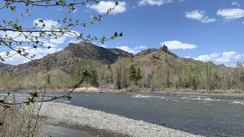
Sweetwater Creek is a canoeing route in the North Absaroka Wilderness, part of the Wapiti Ranger District of Shoshone National Forest in Wyoming. The Forest Service manages the surrounding land, and the paddling lies within designated wilderness. Summer is the most comfortable time to paddle here. Typical averages from a nearby weather station show July highs around 78°F with lows near 39°F, while winter highs stay around freezing. That station sits roughly 1,500 feet below the creek, so temperatures along the water run cooler. Several trails and campgrounds lie within a few miles. The Clearwater Cr Trail is about 4 miles away, and Clearwater Campground is just under 5 miles off. The Elk Fork Trail is a little over 5 miles away, and the Elk Fork paddling route is nearly 10 miles away.
- Clearwater Cr TrailHiking3.9 mi
- HORSE CR TRAILHiking4.7 mi
 Clearwater CampgroundCampingPhoto: Recreation.gov (RIDB) / public domain4.9 mi
 Wapiti CampgroundCampingPhoto: Recreation.gov (RIDB) / public domain5.4 mi
 Elk Fork CampgroundCampingPhoto: George Bannister from Woodville, MS, USA, CC BY 2.0 (via Wikimedia Commons)5.5 mi
- Elk Fork TrailHiking5.6 mi
- Rex HaleCamping5.7 mi
- Elk ForkCanoeing9.9 mi
Source: Roamze catalog (indexable pages within 10 miles, PostGIS distance)
 North Fork Shoshone RiverCanoeing · ~20 min drivePhoto: Paul Hermans, CC BY-SA 4.0 (via Wikimedia Commons)
- North Fork Shoshone River Boat RampBoat launch · ~23 min drive
 Sunlight CreekCanoeing · ~21 min drivePhoto: Yellowstone National Park, Public domain (via Wikimedia Commons)
- Andy Martin Hill Boat RampBoat launch · ~38 min drive
 Lamar RiverCanoeing · ~31 min drivePhoto: J. Schmidt, Public domain (via Wikimedia Commons)
- Luce Reservoir Boat LaunchBoat launch · ~47 min drive
 Greybull RiverCanoeing · ~1h 10m drivePhoto: James St. John, CC BY 2.0 (via Wikimedia Commons)
- Hogan Reservoir Boat LaunchBoat launch · ~47 min drive
 Clarks Fork Yellowstone RiverCanoeing · ~47 min drivePhoto: T. A. Jagger, Public domain (via Wikimedia Commons)
- Bridge Bay Boat Launch RampBoat launch · ~1h 4m drive
Also worth it near here
- Big Creek FallsWaterfall · ~9 min drive
 Goff Cr TrailHiking · ~15 min drivePhoto: Barbara Ann Spengler from Arizona & Florida, USA, CC BY 2.0 (via Wikimedia Commons)
 Eagle Creek CampgroundCamping · ~19 min drivePhoto: Betty Jo Tindle, CC BY-SA 3.0 (via Wikimedia Commons)
- Blackwater Natural BridgeNatural arch · ~21 min drive
Best time to visit Sweetwater Creek
Best months: June–August. Best months have typical highs of 55–85 °F, lows of 30 °F or warmer (32 °F where the station doesn't record snow), at most one snowy day and no more than 12 wet days.
Jan
30° / 4°
Feb
32° / 6°
Mar
39° / 11°
Apr
47° / 22°
May
57° / 30°
Jun
67° / 35°
Jul
78° / 39°
Aug
77° / 37°
Sep
67° / 31°
Oct
51° / 23°
Nov
37° / 13°
Dec
28° / 5°
Typical high / low (°F) and days with rain or snow, 1991–2020. Measured at Yellowstone Np E Ent, WY, 16.3 mi away at 6,954 ft. The station sits about 1,500 ft lower than this place, so expect it a little cooler here. This station doesn't record snowfall. Source: NOAA NCEI U.S. Climate Normals 1991–2020.
