Lakeside
- 6.4 mi
- round trip
- 85 ft
- climb
- 8,131 ft
- high point
- Out and back
- route
- Jun–Aug
- best months
Caution at last check
Agency alerts are in effect for this area; weather is good · USFS, OpenWeather · checked 17 h ago
Is Lakeside open right now?
No closures listed
The Forest Service lists no closures for Bridger-Teton National Forest.
As of · Source: USFS · Bridger-Teton National Forest. Agencies don't list every closure — check before you go.
Lakeside is a moderate out-and-back hike in Wyoming's Bridger-Teton National Forest, within the Pinedale Ranger District. The trail is about 6.4 miles long, with an elevation gain of 85 feet, and the route rises from a low point of 7,973 feet to a high of 8,131 feet. The Forest Service manages the surrounding land, and the trailhead is known as Green River Lake Trailhead. Summer is the most comfortable time to go. Typical July averages at a nearby weather station run to a high of 72°F and a low of 35°F, and the station sits at nearly the same elevation as the trail. Winter is severe, with typical January highs around 26°F. The hike sits right next to Green River Lakes, where the Green River Lakes - Bridger-Teton NF campground and Green River Lake Lodge are both about 0.2 miles away. The Green River/highline Connector is 0.4 miles off, and Clear Creek is about 1.8 miles away.
Local outfitters
- Yellowstone Trail RV Park31 mi away
- The Virginian RV Park48 mi away
Not on Roamze yet. Their page has how to reach them.
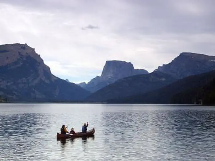 Green River Lakes - Bridger-Teton NFLake fishing0.2 mi
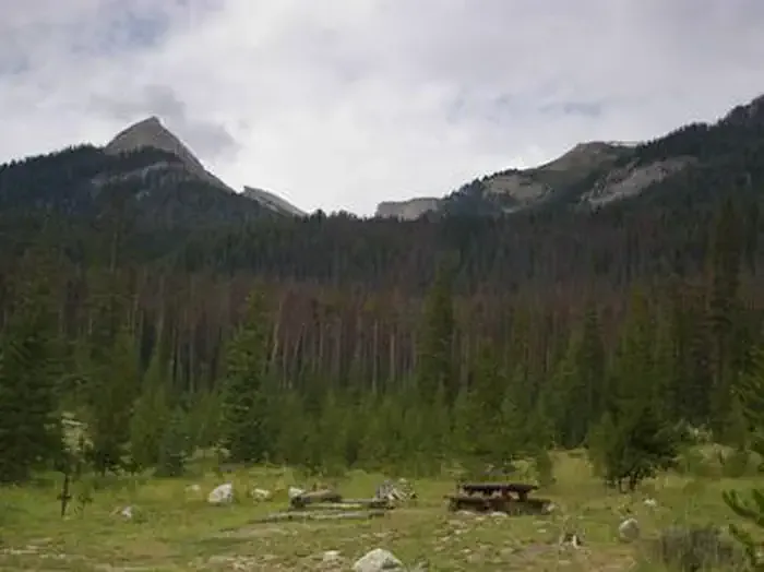 Green River Lakes - Bridger-Teton NF (WY)CampingPhoto: Recreation.gov (RIDB) / public domain0.2 mi
- Green River Lake LodgeCamping0.2 mi
- Green River/highline ConnectorHiking0.4 mi
- Green River Lake CgCamping0.5 mi
- Clear CreekHiking1.8 mi
- Jim Creek RoadRock climbing9.4 mi
- Fateful Findings AreaRock climbing9.9 mi
Source: Roamze catalog (indexable pages within 10 miles, PostGIS distance)
- Green River/highline ConnectorHiking · Next door
- Slide LakeHiking · ~4 min drive
- New ForkHiking · ~14 min drive
- Boulder Basin/Lowline TrailHiking · ~23 min drive
- SANDRA LAKE CUTOFFHiking · ~16 min drive
- Shirley LakeHiking · ~5 min drive
- Clark CreekHiking · ~16 min drive
- Gannett Peak TrailHiking · ~25 min drive
- Sandra Lake Cutoff TrailHiking · ~18 min drive
- Jim Creek LakeHiking · ~15 min drive
Best time to visit Lakeside
Best months: June–August. Best months have typical highs of 55–85 °F, lows of 30 °F or warmer (32 °F where the station doesn't record snow), at most one snowy day and no more than 12 wet days.
Jan
26° / -6°
9 wet
Feb
29° / -4°
9 wet
Mar
36° / 5°
10 wet
Apr
43° / 16°
10 wet
May
54° / 26°
11 wet
Jun
64° / 32°
10 wet
Jul
72° / 35°
8 wet
Aug
71° / 34°
9 wet
Sep
62° / 28°
8 wet
Oct
48° / 19°
8 wet
Nov
35° / 6°
9 wet
Dec
25° / -5°
10 wet
Typical high / low (°F) and days with rain or snow, 1991–2020. Measured at Darwin Rch, WY, 16.9 mi away at 8,190 ft. This station doesn't record snowfall. Source: NOAA NCEI U.S. Climate Normals 1991–2020.
