Forces of the Northern Range Self-guided Trail
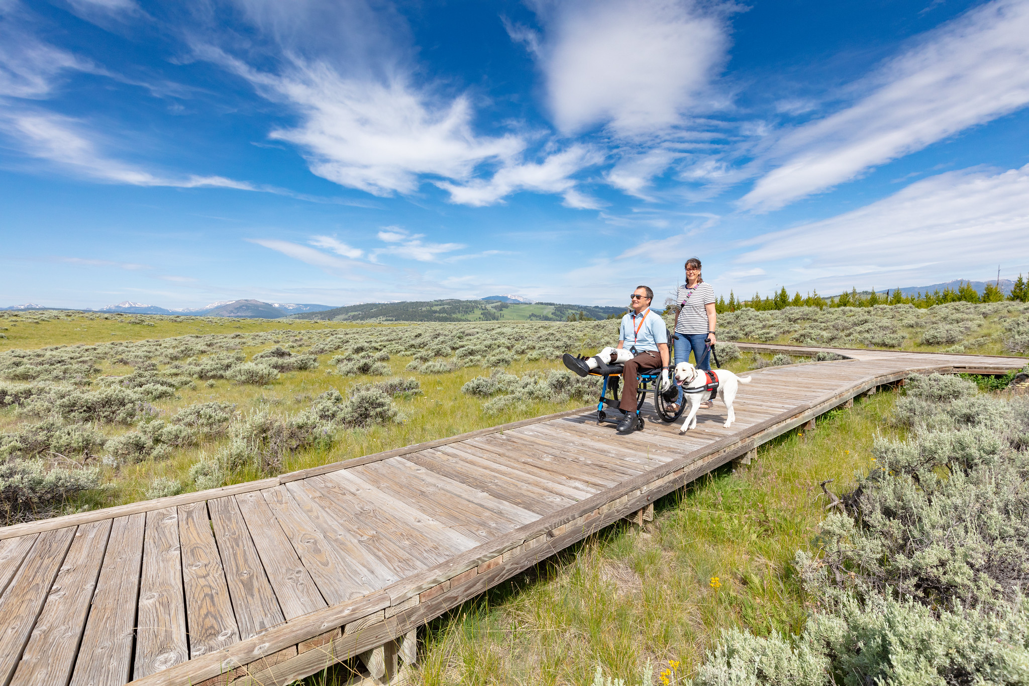 Photo: bgwashburn — Wikimedia Commons (CC BY 2.0)
- 0.4 mi
- distance
- Easy
- difficulty
- Jul–Sep
- best months
Is Forces of the Northern Range Self-guided Trail open right now?
Closure in the area
There's a closure order in Yellowstone National Park. It doesn't name Forces of the Northern Range Self-guided Trail, so check the source for the area it covers (2 listed).
Most Park Roads Closed to All Vehicles
Park closure covering Yellowstone National Park · NPS · Yellowstone National Park
Biscuit Basin Closed Due to Hydrothermal Explosion
Park closure covering Yellowstone National Park · NPS · Yellowstone National Park
As of · Source: NPS · Yellowstone National Park. Agencies don't list every closure — check before you go.
This .5 mile (.8 km) boardwalk has 11 stops with exhibits. No restroom. Yellowstone’s northern range is a grassland north of the Yellowstone and Lamar Rivers. This area sustains one of the largest and most diverse communities of free-roaming large animals in the world. Yellowstone National Park is a place where scientists can study nature in a nearly unchanged condition. Animals are Dangerous Do not approach or feed any animal. Bison and elk have injured people. Stay 100 yards (91 m) from bears and wolves. Stay 25 yards (23 m) from all other animals. You are responsible for your safety. Think Safety, Act Safely. Yellowstone is a Dangerous Place. Accessibility The entire boardwalk is accessible. There is no designated accessible parking. Some gaps between boards may exceed .5 inches. The boardwalk surface is somewhat uneven and bumpy. There are some tactile exhibits. The audio description describes the wayside exhibits. The closest accessible toilet is at the Blacktail Creek pullout.
- Forces of the Northern Range TrailHiking0.1 mi
 Wolf TracksHikingPhoto: bgwashburn — Wikimedia Commons (CC BY 2.0)0.1 mi
 Mountain ViewHikingPhoto: NPS / public domain0.1 mi
- Campsite 2H3 bouldersRock climbing5.4 mi
 The HoodoosRock climbingPhoto: Ken Lund, CC BY-SA 2.0 (via Flickr)7.5 mi
- Eagle CreekCamping8.1 mi
- Gardiner DistrictLake fishing8.9 mi
 Gardner RiverCanoeingPhoto: Jo Suderman, Public domain (via Wikimedia Commons)9.4 mi
Source: Roamze catalog (indexable pages within 10 miles, PostGIS distance)
- Mountain ViewHiking · Next door
 Blacktail Ponds Spur TrailHiking · ~3 min drivePhoto: cchadek, CC BY 3.0 (via Wikimedia Commons)
- Blacktail Deer Creek TrailHiking · ~3 min drivePhoto: cchadek, CC BY 3.0 (via Wikimedia Commons)
- Crevice Creek TrailHiking · ~6 min drive
- Hellroaring Creek TrailHiking · ~10 min drive
- Fire is a Fundamental ForceHiking · Next door
 Wraith Falls TrailHiking · ~5 min drivePhoto: cchadek, CC BY 3.0 (via Wikimedia Commons)
 Lava Creek TrailHiking · ~6 min drivePhoto: R. Sieben, CC BY 3.0 (via Wikimedia Commons)
- Garnet Hill Loop TrailHiking · ~10 min drive
- Rescue Creek TrailHiking · ~5 min drive
Also worth it near here
 Osprey FallsWaterfall · ~10 min drivePhoto: Unknown authorUnknown author, Public domain (via Wikimedia Commons)
 Mammoth CampgroundCamping · ~11 min drivePhoto: Yellowstone National Park from Yellowstone NP, USA, Public domain (via Wikimedia Commons)
 Bunsen PeakSummit · ~12 min drivePhoto: Mike, Public domain (via Wikimedia Commons)
- The HoodoosRock climbing · ~13 min drivePhoto: Ken Lund, CC BY-SA 2.0 (via Flickr)
Best time to visit Forces of the Northern Range Self-guided Trail
Best months: July–September. Best months have typical highs of 55–85 °F, lows of 30 °F or warmer (32 °F where the station doesn't record snow), at most one snowy day and no more than 12 wet days.
Jan
31° / 12°
11 wet · 9 snow
Feb
34° / 12°
11 wet · 9 snow
Mar
42° / 19°
11 wet · 7 snow
Apr
50° / 26°
11 wet · 5 snow
May
60° / 35°
13 wet · 2 snow
Jun
69° / 42°
13 wet
Jul
81° / 48°
10 wet
Aug
80° / 47°
9 wet
Sep
69° / 39°
9 wet · 1 snow
Oct
54° / 29°
9 wet · 3 snow
Nov
39° / 19°
10 wet · 7 snow
Dec
30° / 12°
12 wet · 10 snow
Typical high / low (°F) and days with rain or snow, 1991–2020. Measured at Yellowstone Park Mammoth, WY, 6.5 mi away at 6,195 ft. The station sits about 700 ft lower than this place, so expect it a little cooler here. Source: NOAA NCEI U.S. Climate Normals 1991–2020.
