Chittenden Road
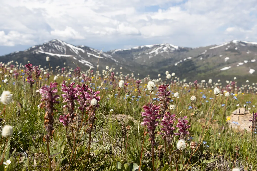 Photo: NPS / public domain
- Jul–Sep
- best months
Is Chittenden Road open right now?
Closure in the area
There's a closure order in Yellowstone National Park. It doesn't name Chittenden Road, so check the source for the area it covers (2 listed).
Most Park Roads Closed to All Vehicles
Park closure covering Yellowstone National Park · NPS · Yellowstone National Park
Biscuit Basin Closed Due to Hydrothermal Explosion
Park closure covering Yellowstone National Park · NPS · Yellowstone National Park
As of · Source: NPS · Yellowstone National Park. Agencies don't list every closure — check before you go.
Chittenden Road is a route in Yellowstone National Park in Wyoming, managed by the National Park Service. It starts at the Chittenden Road Trailhead, and a fee is charged for the visit. Summer is the most comfortable time to go. Typical averages from the Lake Yellowstone weather station, about 18 miles away, show July and August highs around 71°F with lows in the low 40s. That station sits roughly 850 feet lower than the trailhead, so temperatures on the road run cooler. The Chittenden Road - Mount Washburn Trail begins just 0.1 mile away, and Mount Washburn is about 2 miles off. Dunraven Pass and the Dunraven Pass - Mount Washburn Trail are each about 3 miles away.
Best time to go · Jul–Sep
Best time to visit Chittenden Road
Best months: July–September. Best months have typical highs of 55–85 °F, lows of 30 °F or warmer (32 °F where the station doesn't record snow), at most one snowy day and no more than 12 wet days.
Jan
23° / 3°
17 wet
Feb
27° / 3°
15 wet
Mar
35° / 11°
14 wet
Apr
42° / 19°
12 wet
May
50° / 29°
12 wet
Jun
61° / 36°
13 wet
Jul
71° / 43°
10 wet
Aug
71° / 42°
10 wet
Sep
61° / 34°
10 wet
Oct
46° / 25°
9 wet
Nov
33° / 15°
12 wet
Dec
24° / 7°
16 wet
Typical high / low (°F) and days with rain or snow, 1991–2020. Measured at Lake Yellowstone, WY, 18.3 mi away at 7,892 ft. The station sits about 900 ft lower than this place, so expect it a little cooler here. This station doesn't record snowfall. Source: NOAA NCEI U.S. Climate Normals 1991–2020.
Keep exploring — more trails worth the drive
HIKE
Mount Washburn
~3 min drive
Mount Washburn is one of the most popular day hiking destinations in Yellowstone. Its peak elevation is 10,219 feet (3,115 m) and panoramic views for about 20 to 50 miles (32 to 80 km). At the top, check out interpretive exhibits inside the base of a fire lookout and enjoy…
 Photo: Greg Willis from Denver, CO, usa, CC BY-SA 2.0 (via Wikimedia Commons)
Mount Washburn South Trail
~4 min drive
Out-and-back climb to Mount Washburn's summit with panoramic views.
 Photo: Greg Willis from Denver, CO, usa, CC BY-SA 2.0 (via Wikimedia Commons)
Roosevelt Lodge-Tower Falls Trail
~9 min drive
Out-and-back trail from Roosevelt Lodge to Tower Falls in Wyoming.
 Photo: Don Graham from Redlands, CA, USA - God bless it!, CC BY-SA 2.0 (via Wikimedia Commons)
Mount Washburn Spur Trail
~11 min drive
16.89-mile out-and-back trail with 2,347 ft gain on Mount Washburn Spur Trail in Wyoming.
HIKE
Dunraven Pass
~5 min drive
Look for abundant wildflowers in high-elevation wetlands near the road in this area. The volcanic rocks that underlie the Absaroka Mountains are rich in calcium, magnesium, and iron. These minerals weather into soils that can store more water and provide better nutrients…
 Photo: Greg Willis from Denver, CO, usa, CC BY-SA 2.0 (via Wikimedia Commons)
Dunraven Pass - Mount Washburn Trail
~5 min drive
7.00-mile out-and-back trail in Wyoming with 1,380 ft gain.
 Photo: cchadek, CC BY 3.0 (via Wikimedia Commons)
Campground Loop Trail
~9 min drive
Easy loop trail near a Wyoming campground, ideal for families.
 Photo: timlitw, CC BY-SA 3.0 (via Wikimedia Commons)
Bear Aware (Canyon)
~11 min drive
Looking to rent some bear spray to carry with you on your adventure around Yellowstone, instead of purchasing a canister? To learn more and rent some bear spray, stop by the kiosk located near the Canyon Visitor Education Center or the Yurt south of the Yellowstone Tribal…
Photo: cchadek, CC BY 3.0 (via Wikimedia Commons)Tower Creek Trail
~9 min drive
Scenic out-and-back creek hike in Wyoming's backcountry.
Photo: Greg Willis from Denver, CO, usa, CC BY-SA 2.0 (via Wikimedia Commons)Chittenden Loop Trail
~9 min drive
Scenic 4.77-mile loop in Wyoming with moderate hiking and varied terrain.


