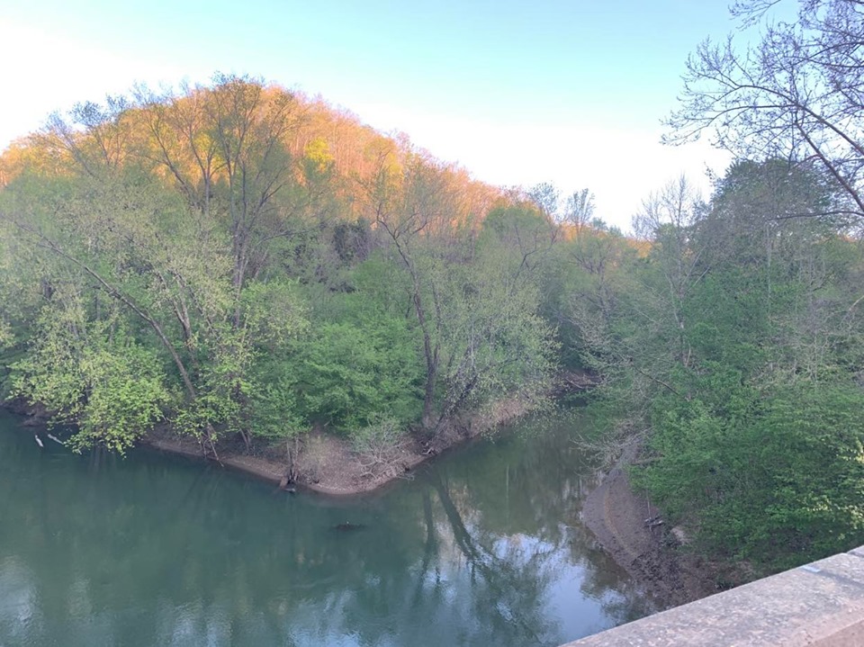
 Photo: Brandon Ray Kirk, CC BY-SA 4.0 (via Wikimedia Commons)
West Virginia · Paddling
Paddling in West Virginia
79 spots9 townsUpdated weeklyFree to access
View on mapPaddling · 79 spots
Featured spots
Photo: Brandon Ray Kirk, CC BY-SA 4.0 (via Wikimedia Commons)Canoeing
Big Harts Creek
Harts, West Virginia
 Photo: Justin A. Wilcox from Washington, D.C., United States, CC BY-SA 2.0 (via Wikimedia Commons)
Canoeing
Cacapon River
Wardensville, West Virginia
 Photo: Brian M. Powell (user Bitmapped on en.wikipedia), CC BY-SA 3.0 (via Wikimedia Commons)
Canoeing
Glade Creek
Daniels, West Virginia
 Photo: Tim Kiser (w:User:Malepheasant), CC BY-SA 3.0 (via Wikimedia Commons)
Canoeing
Greenbrier River
Ronceverte, West Virginia
 Photo: Justin A. Wilcox, Romney, West Virginia, United States, CC BY-SA 3.0 (via Wikimedia Commons)
Canoeing
Little Cacapon River
Romney, West Virginia
All spots · 79 spots

Boat launch
Anthony Boat Launch
West Virginia

Boat launch
Barnum Whitewater Area
West Virginia

Canoeing
Big Coal River
Alum Creek, West Virginia

Canoeing
Big Horse Creek
Morrisvale, West Virginia
Canoeing
Big Sandy Creek
Newton, West Virginia
Canoeing
Big Ugly Creek
Harts, West Virginia
Canoeing
Blue Creek
Clendenin, West Virginia
Boat launch
Boat Ramp at Buffalo Lake
West Virginia
Canoeing
Booths Creek
Fairmont, West Virginia
Boat launch
Brooks Falls River Access
West Virginia

Canoeing
Brush Creek
Princeton, West Virginia
Boat launch
Buffalo Boat Ramp
West Virginia
Canoeing
Camp Creek
Camp Creek, West Virginia
Boat launch
Canoe & Kajak access only
West Virginia
Canoeing
Clear Fork
Beckley, West Virginia
Canoeing
Copperas Mine Fork
Holden, West Virginia
Boat launch
Cunard River Access
West Virginia

Boat launch
Duck
West Virginia
Canoeing
Dunloup Creek
Glen Jean, West Virginia
Canoeing
Elkhorn Creek
Eckman, West Virginia
Boat launch
Fayette River Access
West Virginia
Canoeing
Files Creek
Beverly, West Virginia
Canoeing
Fish Creek
Cameron, West Virginia
Boat launch
French Creek public access site
West Virginia
Keep exploring — more water worth the drive
 Photo: Tim Kiser (wikipedia user Malepheasant), CC BY-SA 3.0 (via Wikimedia Commons)
West Fork Little Kanawha River
~43 min drive
West Fork Little Kanawha River is a 11-mile paddling stretch near Orma, West Virginia. It flows year-round. USGS models an average flow of about 110 cfs and a gradient of about 8.1 feet per mile.
Duck
~22 min drive
Duck is a boat launch in West Virginia.
Summersville Lake Shelters
~35 min drive
A worthwhile stop near West Virginia.
 Photo: Tim Kiser (User:Malepheasant), CC BY-SA 3.0 (via Wikimedia Commons)
Paint Creek
~1h 23m drive
Paint Creek is a 21-mile paddling stretch near Mount Hope, West Virginia. It is intermittent and may run dry in some seasons. USGS models an average flow of about 123 cfs and a gradient of about 34.4 feet per mile.
Fayette River Access
~59 min drive
Fayette River Access is a boat launch in West Virginia.
Muddlety Creek
~13 min drive
Muddlety Creek is an 8.2-mile paddling stretch near Summersville, West Virginia. It is intermittent and may run dry in some seasons. USGS models an average flow of about 63 cfs and a gradient of about 23.0 feet per mile.
Cunard River Access
~1h 4m drive
Cunard River Access is a boat launch in West Virginia.
Big Sandy Creek
~44 min drive
Big Sandy Creek is a 0-mile paddling stretch near Newton, West Virginia. It flows year-round. USGS models an average flow of about 59 cfs.
Gerald L. Scott Boat Ramp
~1h 10m drive
Gerald L. Scott Boat Ramp is a boat launch in West Virginia.
Greenbrier River Water Trail
~53 min drive
Greenbrier River Water Trail is a paddling stretch in West Virginia. Land along it is managed by the U.S. Forest Service.
Stone Cliff River Access
~1h 12m drive
Stone Cliff River Access is a boat launch in West Virginia.
Manns Creek
~1h 1m drive
Manns Creek is a 10-mile paddling stretch near Danese, West Virginia. It flows year-round. USGS models an average flow of about 116 cfs and a gradient of about 144.2 feet per mile. Land along it is managed by the state natural resources department.

