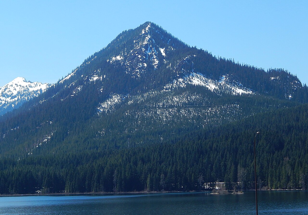
Hibox Mountain
 Photo: Michael Cline, CC BY-SA 2.0 (via Wikimedia Commons)
- 6,556 ft
- summit
- 1
- way up
- Forest Service
- managed by
Is Hibox Mountain open right now?
Closure in the area
There's a closure order in Okanogan-Wenatchee National Forest. It doesn't name Hibox Mountain, so check the source for the area it covers (2 listed).
Little Giant Fire Closure Superseding
Agency closure covering Okanogan-Wenatchee National Forest · Order 06-17-07-2026-48 · USFS · Okanogan-Wenatchee National Forest
Railroad and Preston Creek Road Closure
Agency closure covering Okanogan-Wenatchee National Forest · Order 06-17-05-26-04 · USFS · Okanogan-Wenatchee National Forest
Three Queens Fire Area Closure Reduced on the Cle Elum Ranger District Nov 1
Agency alert covering Cle Elum Ranger District · Order 06-17-03-2026-47 · USFS · Cle Elum Ranger District
Three Queens Fire Area Closure and Pacific Crest Trail closure/re-route
Agency alert covering Cle Elum Ranger District · Order 06-17-03-2026-32 · USFS · Cle Elum Ranger District
Cle Elum River Restoration Area Closure on the Cle Elum Ranger District
Agency alert covering Okanogan-Wenatchee National Forest · USFS · Okanogan-Wenatchee National Forest
As of · Source: USFS · Okanogan-Wenatchee National Forest. Agencies don't list every closure — check before you go.
Hibox Mountain is a summit of about 6,556 feet in Kittitas County, Washington, inside the Alpine Lakes Wilderness. It lies within the Cle Elum Ranger District of the Okanogan-Wenatchee National Forest, which the Forest Service manages, and the nearest town is Snoqualmie Pass, about 5.6 miles away. The Hibox Mountain climber's trail starts about a mile away, and the East Alta Trail is about 1.3 miles off. Gold Creek, a canoeing spot, is about 2.6 miles away, and Kachess campground is about 5.9 miles away.
Conditions and forecast
Daily highs and lows, wind and the chance of precipitation at the summit and route start for the next 7 days, from the Open-Meteo model.
- Summit elevation
- 6,556 ft
- Land manager
- Forest Service
Elevation from USGS 3D Elevation Program terrain data (about 10 m resolution).
Map © Mapbox © OpenStreetMap contributors Questions about Hibox Mountain
How tall is Hibox Mountain?
6,556 ft (1,998 m).
How many routes go to the summit of Hibox Mountain?
One: Hibox Mountain climber's trail.
 Alta Mountain6,250 ft · Washington1 route1.6 mi awayPhoto: Ron Clausen, CC BY-SA 4.0 (via Wikimedia Commons)
 Red Mountain5,884 ft · Washington1 route4.5 mi awayPhoto: Ron Clausen, CC BY-SA 4.0 (via Wikimedia Commons)
 Snoqualmie Mountain6,273 ft · Washington1 route5.7 mi awayPhoto: J Brew, CC BY-SA 2.0 (via Wikimedia Commons)
 Mount Catherine5,050 ft · Washington1 route7.2 mi awayPhoto: Ron Clausen, CC BY-SA 4.0 (via Wikimedia Commons)
- Red Mountain5,734 ft · Washington2 routes7.9 mi away
- Wright Mountain5,411 ft · Washington1 route8.5 mi away
 Hibox Mountain climber's trailHikingPhoto: Walter Siegmund, CC BY 2.5 (via Wikimedia Commons)1 mi
- East Alta TrailHiking1.3 mi
- Gold CreekCanoeing2.6 mi
- Western Alpine LakesRock climbing3.8 mi
- Burnboot CreekCanoeing4.5 mi
- East FaceRock climbing4.6 mi
 KachessCampingPhoto: Recreation.gov (RIDB) / public domain5.9 mi
- OwhiCamping6.2 mi
Source: Roamze catalog (indexable pages within 10 miles, PostGIS distance)
- Alta MountainSummit · ~3 min drivePhoto: Ron Clausen, CC BY-SA 4.0 (via Wikimedia Commons)
 Chikamin PeakSummit · ~5 min drivePhoto: Ron Clausen, CC BY-SA 4.0 (via Wikimedia Commons)
 Huckleberry MountainSummit · ~6 min drivePhoto: Walter Siegmund, CC BY 2.5 (via Wikimedia Commons)
 Kendall PeakSummit · ~7 min drivePhoto: Ron Clausen, CC BY-SA 4.0 (via Wikimedia Commons)
- Red MountainSummit · ~8 min drivePhoto: Ron Clausen, CC BY-SA 4.0 (via Wikimedia Commons)
 Guye PeakSummit · ~9 min drivePhoto: Laurel F from Seattle, WA, CC BY-SA 2.0 (via Wikimedia Commons)
 Chimney RockSummit · ~9 min drivePhoto: U.S. Forest Service- Pacific Northwest Region, Public domain (via Wikimedia Commons)
- Overcoat PeakSummit · ~10 min drivePhoto: U.S. Forest Service- Pacific Northwest Region, Public domain (via Wikimedia Commons)
- Snoqualmie MountainSummit · ~10 min drivePhoto: J Brew, CC BY-SA 2.0 (via Wikimedia Commons)
 Summit Chief MountainSummit · ~11 min drivePhoto: U.S. Forest Service- Pacific Northwest Region, Public domain (via Wikimedia Commons)
Also worth it near here

