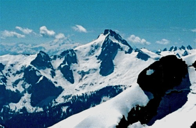
Lincoln Peak
 Photo: Walter Siegmund (talk), CC BY 2.5 (via Wikimedia Commons)
- 9,065 ft
- summit
- Forest Service
- managed by
Is Lincoln Peak open right now?
Closure in the area
There's a closure order in Mt. Baker-Snoqualmie National Forest. It doesn't name Lincoln Peak, so check the source for the area it covers (2 listed).
Grand Park 2 Fire Closure Update
Agency closure covering Mt. Baker-Snoqualmie National Forest · Order 06-05-26-16 · USFS · Mt. Baker-Snoqualmie National Forest
Bell Creek Bridge Damaged
Agency closure covering Mt. Baker-Snoqualmie National Forest · USFS · Mt. Baker-Snoqualmie National Forest
Rescission of Shooting Restrictions
Agency alert covering Mt. Baker-Snoqualmie National Forest · USFS · Mt. Baker-Snoqualmie National Forest
Electric Fire Closure Order
Agency alert covering Mt. Baker-Snoqualmie National Forest · Order 06-05-26-19 · USFS · Mt. Baker-Snoqualmie National Forest
Mountain Goats Have Been Present on Yellow Aster Butte
Agency alert covering Mt. Baker-Snoqualmie National Forest · USFS · Mt. Baker-Snoqualmie National Forest
As of · Source: USFS · Mt. Baker-Snoqualmie National Forest. Agencies don't list every closure — check before you go.
Lincoln Peak is a summit of about 9,065 feet in Whatcom County, Washington, within the Mount Baker Wilderness. The land is managed by the Forest Service as part of the Mt. Baker Ranger District of Mt. Baker-Snoqualmie National Forest, and the nearest town is Glacier, about 9 miles away. The closest neighbors are the North Ridge Route and Hogsback Route, both under 2 miles away. The Middle Fork Nooksack River offers canoeing about 3.6 miles off, and Boulder Creek Campground sits about 8.3 miles away.
Conditions and forecast
Daily highs and lows, wind and the chance of precipitation at the summit for the next 7 days, from the Open-Meteo model.
- Summit elevation
- 9,065 ft
- Land manager
- Forest Service
Elevation from USGS 3D Elevation Program terrain data (about 10 m resolution).
We don't know of a mapped trail or route to the summit of Lincoln Peak. Plan the approach with local maps, a guidebook or a local guide, and check conditions before you go.
Questions about Lincoln Peak
How tall is Lincoln Peak?
9,065 ft (2,763 m).
Is there a trail to the top of Lincoln Peak?
We don't know of a mapped trail or route to the summit. Plan the approach with local maps, a guidebook or a local guide.
- Grant Peak10,777 ft · Washington2 routes2.1 mi away
- Park Butte5,453 ft · Washington1 route3.5 mi away
 Table Mountain5,740 ft · Washington3 routes8.6 mi awayPhoto: Ron Clausen, CC BY-SA 4.0 (via Wikimedia Commons)
- Panorama Dome5,041 ft · Washington1 route10 mi away
- Excelsior Peak5,702 ft · Washington2 routes12 mi away
- Ruth Mountain7,106 ft · Washington1 route16 mi away
- North Ridge RouteHiking1.6 mi
- Hogsback RouteHiking1.7 mi
- Glacier View TrailHiking1.9 mi
- Middle Fork Nooksack RiverCanoeing3.6 mi
- Glacier CreekCanoeing6.2 mi
 Boulder Creek CampgroundCampingPhoto: Recreation.gov (RIDB) / public domain8.3 mi
- Park Creek CampgroundCamping9 mi
- The PumphouseRock climbing9.6 mi
Source: Roamze catalog (indexable pages within 10 miles, PostGIS distance)
 Church MountainSummit · ~19 min drivePhoto: Danust, CC BY-SA 4.0 (via Wikimedia Commons)
 Mount ShuksanSummit · ~21 min drivePhoto: Frank Kovalchek from Anchorage, Alaska, USA, CC BY 2.0 (via Wikimedia Commons)
 Nooksack TowerSummit · ~23 min drivePhoto: Ron Clausen, CC BY-SA 4.0 (via Wikimedia Commons)
 Seahpo PeakSummit · ~25 min drivePhoto: Ron Clausen, CC BY-SA 4.0 (via Wikimedia Commons)
 Goat MountainSummit · ~26 min drivePhoto: Ron Clausen, CC BY-SA 4.0 (via Wikimedia Commons)
 Tomyhoi PeakSummit · ~27 min drivePhoto: Ron Clausen, CC BY-SA 4.0 (via Wikimedia Commons)
 Hagan MountainSummit · ~29 min drivePhoto: jaisril, CC BY 2.0 (via Wikimedia Commons)
 Bacon PeakSummit · ~29 min drivePhoto: Walter Siegmund (talk), CC BY-SA 3.0 (via Wikimedia Commons)
 Mount BlumSummit · ~30 min drivePhoto: Ron Clausen, CC BY-SA 4.0 (via Wikimedia Commons)
 American Border PeakSummit · ~31 min drivePhoto: Nwcamera1, CC BY-SA 3.0 (via Wikimedia Commons)


