Smith Creek Butte Trail
- 0.9 mi
- round trip
- 555 ft
- climb
- 3,063 ft
- high point
- Out and back
- route
- Apr–Oct
- best months
Is Smith Creek Butte Trail open right now?
Alert in the area
The Forest Service lists 6 alerts for Gifford Pinchot National Forest.
Fire Restrictions
Agency alert covering Gifford Pinchot National Forest · USFS · Gifford Pinchot National Forest
Seasonal Road Closures
Agency alert covering Gifford Pinchot National Forest · USFS · Gifford Pinchot National Forest
Road Repairs & Road Closures in 2026
Agency alert covering Gifford Pinchot National Forest · USFS · Gifford Pinchot National Forest
Washout on Forest Road 93
Agency alert covering Gifford Pinchot National Forest · USFS · Gifford Pinchot National Forest
Upper State Route 504 closed at milepost 45.2 due to large slide
Agency alert covering Gifford Pinchot National Forest · USFS · Gifford Pinchot National Forest
As of · Source: USFS · Gifford Pinchot National Forest. Agencies don't list every closure — check before you go.
Smith Creek Butte Trail is an easy out-and-back hike in Washington's Gifford Pinchot National Forest, within the Mount St. Helens National Volcanic Monument ranger district. The trail is short, about 1.7 miles in length, and the climb is only about 555 feet from start to finish, so a round trip is about 1,100 feet. The high point is 3,063 feet, and the steepest stretch comes early, about 0.34 miles from the start, where the grade reaches 18 percent. The trail begins at the high point, so the first few hundred feet are the most challenging part of the climb. The most comfortable months for a visit are typically June through September, when typical averages from a nearby weather station run from highs around 74°F in June to 84°F in July and August, and from 45°F to 49°F at night. That station sits about 27 miles away and roughly 1,100 feet lower, so temperatures on the trail run cooler. The hike takes about an hour. Smith Creek and Smith Creek Butte are both within about a mile. Lava Canyon and the Muddy River, about 2 miles away, round out the nearby options.
Local outfitters
- Riffe Lake Campground28 mi away
- Bike the Gorge37 mi away
Not on Roamze yet. Their page has how to reach them.
- Smith CreekHiking0.9 mi
- Smith Creek ButteHiking1.1 mi
 Muddy RiverCanoeingPhoto: Lyn Topinka, USGS, Public domain (via Wikimedia Commons)2.2 mi
 Lava CanyonHikingPhoto: daveynin — CC BY 2.0 (via Flickr)2.3 mi
- Lava Canyon TrailHiking2.7 mi
- Clearwater CreekCanoeing3.3 mi
- Bean CreekCanoeing4.2 mi
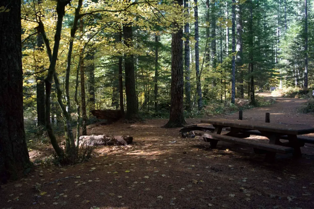 Lower Falls CampgroundCampingPhoto: Recreation.gov (RIDB) / public domain8.3 mi
Source: Roamze catalog (indexable pages within 10 miles, PostGIS distance)
- Lava CanyonHiking · ~4 min drivePhoto: daveynin — CC BY 2.0 (via Flickr)
 Loowit TrailHiking · ~8 min drivePhoto: InSapphoWeTrust from Los Angeles, California, USA, CC BY-SA 2.0 (via Wikimedia Commons)
 Cedar FlatsHiking · ~10 min drivePhoto: BFS Man from Webster, TX, USA, CC BY 2.0 (via Wikimedia Commons)
- Smith CreekHiking · ~2 min drive
- AbrahamHiking · ~8 min drivePhoto: InSapphoWeTrust from Los Angeles, California, USA, CC BY-SA 2.0 (via Wikimedia Commons)
 Independence Pass TrailHiking · ~13 min drivePhoto: Greg Willis from Denver, CO, usa, CC BY-SA 2.0 (via Wikimedia Commons)
- Lava Canyon TrailHiking · ~5 min drive
- Smith Creek ButteHiking · ~2 min drive
 Harmony TrailHiking · ~11 min drivePhoto: Steven Pavlov, CC BY-SA 3.0 (via Wikimedia Commons)
- Wright Meadow TrailHiking · ~11 min drive
Also worth it near here
- Muddy RiverCanoeing · ~4 min drivePhoto: Lyn Topinka, USGS, Public domain (via Wikimedia Commons)
- Paradise FallsWaterfall · ~5 min drive
- Sasquatch TrailCross-country skiing · ~9 min drive
 Spencer ButteMountain biking · ~9 min drivePhoto: U.S. Forest Service- Pacific Northwest Region, Public domain (via Wikimedia Commons)
Best time to visit Smith Creek Butte Trail
Best months: April–October. Best months have typical highs of 55–85 °F, lows of 30 °F or warmer (32 °F where the station doesn't record snow), at most one snowy day and no more than 12 wet days.
Jan
39° / 26°
Feb
43° / 27°
Mar
49° / 29°
Apr
58° / 33°
May
68° / 40°
Jun
74° / 45°
Jul
84° / 50°
Aug
84° / 49°
Sep
75° / 42°
Oct
60° / 35°
Nov
45° / 30°
Dec
37° / 25°
Typical high / low (°F) and days with rain or snow, 1991–2020. Measured at Mt Adams Rs, WA, 27.6 mi away at 1,950 ft. The station sits about 1,100 ft lower than this place, so expect it a little cooler here. This station doesn't record snowfall. Source: NOAA NCEI U.S. Climate Normals 1991–2020.
Map and trail data © OpenStreetMap contributors
