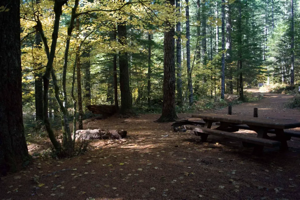
Swift Forest Camp
Campground
Campground · 4.2 mi from the trail
 Photo: BFS Man from Webster, TX, USA, CC BY 2.0 (via Wikimedia Commons)
Alert in the area
The Forest Service lists 6 alerts for Gifford Pinchot National Forest.
Fire Restrictions
Agency alert covering Gifford Pinchot National Forest · USFS · Gifford Pinchot National Forest
Seasonal Road Closures
Agency alert covering Gifford Pinchot National Forest · USFS · Gifford Pinchot National Forest
Road Repairs & Road Closures in 2026
Agency alert covering Gifford Pinchot National Forest · USFS · Gifford Pinchot National Forest
Washout on Forest Road 93
Agency alert covering Gifford Pinchot National Forest · USFS · Gifford Pinchot National Forest
Upper State Route 504 closed at milepost 45.2 due to large slide
Agency alert covering Gifford Pinchot National Forest · USFS · Gifford Pinchot National Forest
As of · Source: USFS · Gifford Pinchot National Forest. Agencies don't list every closure — check before you go.
Cedar Flats is an easy hike in Washington's Gifford Pinchot National Forest, within the Mount St. Helens National Volcanic Monument ranger district. The trail is about 1.9 miles long, with a low point of 1,205 feet and a high of 1,345 feet, and it gains about 107 feet in elevation. The Forest Service manages the land, and the trail is not accessible. Summer is the most comfortable time to go. Typical averages from a nearby weather station show July and August highs around 81 to 82°F with only four or five wet days a month, while winter months bring highs in the mid-40s and rain on 20 or more days. That station sits well below the trail, so temperatures on the route run cooler. Nearby options include House Rock, about 3.6 miles away, and the Lewis River hike at 4.2 miles. Paddlers can try Pine Creek, 3.8 miles off, and Lower Falls Campground is about 7.4 miles away.
Swift Forest Camp
Campground
Trout Lake Hall
Restaurant
Places © OpenStreetMap contributors
More in Trout LakeNot on Roamze yet. Their page has how to reach them.
 Muddy RiverCanoeingPhoto: Lyn Topinka, USGS, Public domain (via Wikimedia Commons)4.9 mi
 Lower Falls CampgroundCampingPhoto: Recreation.gov (RIDB) / public domain7.4 mi
Source: Roamze catalog (indexable pages within 10 miles, PostGIS distance)
 Lava CanyonHiking · ~9 min drivePhoto: daveynin — CC BY 2.0 (via Flickr)
 Lower Falls Horse BypassHiking · ~12 min drivePhoto: U.S. Forest Service- Pacific Northwest Region, Public domain (via Wikimedia Commons)BluffHiking · ~10 min drivePhoto: U.S. Forest Service- Pacific Northwest Region, Public domain (via Wikimedia Commons)Middle FallsHiking · ~14 min drivePhoto: U.S. Forest Service- Pacific Northwest Region, Public domain (via Wikimedia Commons)
Best months: June–September. Best months have typical highs of 55–85 °F, lows of 30 °F or warmer (32 °F where the station doesn't record snow), at most one snowy day and no more than 12 wet days.
Jan
45° / 34°
21 wet
Feb
49° / 35°
18 wet
Mar
53° / 37°
21 wet
Apr
59° / 40°
19 wet
May
68° / 46°
15 wet
Jun
73° / 50°
11 wet
Jul
81° / 54°
5 wet
Aug
82° / 54°
4 wet
Sep
75° / 51°
9 wet
Oct
62° / 45°
15 wet
Nov
51° / 39°
20 wet
Dec
44° / 34°
21 wet
Typical high / low (°F) and days with rain or snow, 1991–2020. Measured at Cougar 6 E, WA, 9.6 mi away at 659 ft. The station sits about 700 ft lower than this place, so expect it a little cooler here. This station doesn't record snowfall. Source: NOAA NCEI U.S. Climate Normals 1991–2020.

