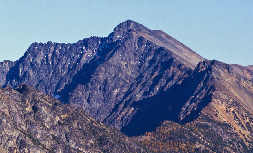
Ballard Campground
Campground
Campground · 0.3 mi from the trail
Closure in the area
There's a closure order in Okanogan-Wenatchee National Forest. It doesn't name Robinson Creek Trail, so check the source for the area it covers (3 listed).
Little Giant Fire Closure Superseding
Agency closure covering Okanogan-Wenatchee National Forest · Order 06-17-07-2026-48 · USFS · Okanogan-Wenatchee National Forest
Railroad and Preston Creek Road Closure
Agency closure covering Okanogan-Wenatchee National Forest · Order 06-17-05-26-04 · USFS · Okanogan-Wenatchee National Forest
MVRD Storm Damaged Roads
Agency closure covering Methow Valley Ranger District · Order 06-17-04-26-09 · USFS · Methow Valley Ranger District
Cle Elum River Restoration Area Closure on the Cle Elum Ranger District
Agency alert covering Okanogan-Wenatchee National Forest · USFS · Okanogan-Wenatchee National Forest
Storm Damaged Roads Closure on Methow Valley District
Agency alert covering Methow Valley Ranger District · Order 06-17-04-26-18 · USFS · Methow Valley Ranger District
As of · Source: USFS · Okanogan-Wenatchee National Forest. Agencies don't list every closure — check before you go.
Robinson Creek Trail is a 1.26-mile out-and-back hike in the Methow Valley Ranger District of Washington's Okanogan-Wenatchee National Forest, managed by the Forest Service. The trail is about 2.5 miles long with a total elevation gain of 1,358 feet, and it climbs steeply at the start before leveling off. The high point is 3,206 feet, and the trail begins at 2,584 feet, so plan on about 1.5 hours for the round trip. The climb is front-loaded, with the steepest stretch at about 0.2 miles in, where the grade reaches 25%. That makes the first part of the route the most demanding, and the rest eases up after that. Summer is the most comfortable time to go. Typical averages from the Mazama weather station, about 6.8 miles away, run from highs near 75°F in June to around 84°F in July and August, with fewer wet days than the rest of the year. That station sits about 1,000 feet lower than the trail's high point, so temperatures up top run cooler. Ballard Campground is just 0.3 miles away, and River Bend Campground is 0.9 miles off. Climbers can head to Nugget Wall, 0.5 miles away, and the West Fork Methow River Trail is 3.1 miles from the trailhead.
Ballard Campground
Campground
Places © OpenStreetMap contributors
More in Winthrop Methow RiverCanoeingPhoto: Benjamin Cody, CC BY-SA 3.0 (via Wikimedia Commons)3.9 mi
Source: Roamze catalog (indexable pages within 10 miles, PostGIS distance)
 Rattlesnake CutoffHiking · ~10 min drivePhoto: Robert Ashworth from Bellingham, WA., USA, CC BY 2.0 (via Wikimedia Commons)
 Creek Overlook LoopHiking · ~11 min drivePhoto: Robert Ashworth from Bellingham, WA., USA, CC BY 2.0 (via Wikimedia Commons)Methow Valley Community Trail- Mazama to Freestone InnHiking · ~12 min drivePhoto: Robert Ashworth from Bellingham, WA., USA, CC BY 2.0 (via Wikimedia Commons)
Best months: April–October. Best months have typical highs of 55–85 °F, lows of 30 °F or warmer (32 °F where the station doesn't record snow), at most one snowy day and no more than 12 wet days.
Jan
29° / 16°
15 wet
Feb
37° / 19°
12 wet
Mar
46° / 26°
10 wet
Apr
58° / 33°
7 wet
May
68° / 41°
7 wet
Jun
75° / 48°
7 wet
Jul
84° / 55°
5 wet
Aug
84° / 53°
4 wet
Sep
74° / 44°
6 wet
Oct
56° / 34°
10 wet
Nov
39° / 25°
14 wet
Dec
28° / 16°
15 wet
Typical high / low (°F) and days with rain or snow, 1991–2020. Measured at Mazama, WA, 6.8 mi away at 2,141 ft. The station sits about 1,100 ft lower than this place, so expect it a little cooler here. This station doesn't record snowfall. Source: NOAA NCEI U.S. Climate Normals 1991–2020.
Map and trail data © OpenStreetMap contributors