<<< Connector from Timber Ridge
 Photo: TK905, CC BY-SA 3.0 (via Wikimedia Commons)
- 0.5 mi
- round trip
- 592 ft
- climb
- 2,696 ft
- high point
- Out and back
- route
- May–Oct
- best months
The Connector from Timber Ridge is a short, easy out-and-back hike in Vermont, about half a mile from the town of Thompsonburg. The route starts at 2,322 feet and climbs to a high point of 2,696 feet, with a total gain of 592 feet over the course of the trip. The climb is front-loaded, with the steepest stretch at the beginning, where the grade reaches about 25 percent. Summer is the most comfortable time to go. Typical averages from a nearby weather station in Peru, which sits roughly 1,000 feet lower, show July highs around 75°F with lows near 56°F. That station's figures are not directly comparable to the higher ground on this trail, so expect cooler temperatures up top. The hike takes about half an hour. The Connector to Magic Mountain and the Connector from Magic Mountain both lie about 0.4 miles away, and the Connector to Timber Ridge is a similar distance. For more time outdoors, the Southern Vermont climbing area is about 4 miles off.
- Connector from Magic Mountain >>>HikingPhoto: TK905, CC BY-SA 3.0 (via Wikimedia Commons)0.4 mi
- <<< Connector to Magic MountainHiking0.4 mi
- Connector to Timber Ridge >>>HikingPhoto: TK905, CC BY-SA 3.0 (via Wikimedia Commons)0.4 mi
- Southern VermontRock climbing3.9 mi
 Saxtons RiverCanoeingPhoto: Charles Fulton, CC BY 2.0 (via Wikimedia Commons)5.1 mi
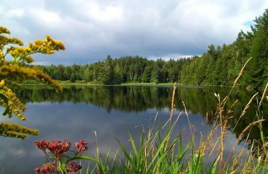 Hapgood PondPier fishingPhoto: Recreation.gov (RIDB) / public domain7.8 mi
- Entry BoulderRock climbing8.3 mi
- Bromley ShelterCamping10 mi
Source: Roamze catalog (indexable pages within 10 miles, PostGIS distance)
- Connector from Magic Mountain >>>Hiking · Next doorPhoto: TK905, CC BY-SA 3.0 (via Wikimedia Commons)
 West River TrailHiking · ~8 min drivePhoto: U.S. Army Corps of Engineers, photographer not specified or unknown, Public domain (via Wikimedia Commons)
- Corridor 7 - Fr 30 to 11Hiking · ~20 min drive
- Appalachian Trail;Long TrailHiking · ~16 min drive
- Connector to Timber Ridge >>>Hiking · Next doorPhoto: TK905, CC BY-SA 3.0 (via Wikimedia Commons)
- Hamilton Falls TrailHiking · ~9 min drivePhoto: U.S. Army Corps of Engineers, photographer not specified or unknown, Public domain (via Wikimedia Commons)
- Appalachian Trail;Long TrailHiking · ~21 min drive
 Ledges overlook trailHiking · ~17 min drivePhoto: U.S. Army Corps of Engineers, photographer not specified or unknown, Public domain (via Wikimedia Commons)
- West River Trail.Hiking · ~11 min drivePhoto: U.S. Army Corps of Engineers, photographer not specified or unknown, Public domain (via Wikimedia Commons)
 North Brookwood TrailHiking · ~19 min drivePhoto: Jason Hollinger, CC BY 2.0 (via Wikimedia Commons)
Also worth it near here
Best time to visit <<< Connector from Timber Ridge
Best months: May–October. Best months have typical highs of 55–85 °F, lows of 30 °F or warmer (32 °F where the station doesn't record snow), at most one snowy day and no more than 12 wet days.
Jan
27° / 8°
Feb
31° / 10°
Mar
38° / 17°
Apr
50° / 30°
May
64° / 42°
Jun
70° / 51°
Jul
75° / 56°
Aug
73° / 55°
Sep
67° / 47°
Oct
56° / 37°
Nov
43° / 26°
Dec
32° / 16°
Typical high / low (°F) and days with rain or snow, 1991–2020. Measured at Peru, VT, 8.7 mi away at 1,700 ft. The station sits about 1,000 ft lower than this place, so expect it a little cooler here. This station doesn't record snowfall. Source: NOAA NCEI U.S. Climate Normals 1991–2020.


Map and trail data © OpenStreetMap contributors
