Mountain · 1 route
Twin Peaks
11,484 ft · Utah
- Summit
- 11,484 ft
- Routes
- 1 way up
Route up Twin Peaks
About Twin Peaks
Twin Peaks is a summit of 11,484 feet in the Salt Lake Ranger District of the Uinta-Wasatch-Cache National Forest, about 2.8 miles from the town of Alta, Utah. The Mark Malu Trail starts just 0.4 miles away, and the Wildflower Trail is 0.6 miles off. Climbers can head to the Northern Wasatch area, about 1.7 miles away, and Tanners Flat Campground sits about 2.7 miles from the peak.
Forecast on Twin Peaks
Daily highs and lows, wind and the chance of precipitation at the summit and route start for the next 7 days, from the Open-Meteo model.
Questions about Twin Peaks
How tall is Twin Peaks?
11,484 ft (3,500 m).
How many routes go to the summit of Twin Peaks?
One: Twin Peaks Trail.
Mountains nearby
 Hidden Peak10,965 ft · Utah1 route0.9 mi awayPhoto: VeggieGarden, CC BY-SA 4.0 (via Wikimedia Commons)
 Mount Baldy11,068 ft · Utah3 routes1.5 mi awayPhoto: michaelwm25, CC BY 3.0 (via Wikimedia Commons)
- Sugarloaf Mountain11,049 ft · Utah1 route1.9 mi away
 The Pfeifferhorn11,311 ft · Utah1 route2.9 mi awayPhoto: Itineranttrader, Public domain (via Wikimedia Commons)
- Flagstaff Mountain10,522 ft · Utah1 route3.4 mi away
- Mount Wolverine10,788 ft · Utah2 routes3.6 mi away
Facts about this place
Where it is
- Salt Lake Ranger District · Ranger district
- Uinta-Wasatch-Cache National Forest · National forest
- Nearest town
- Alta, Utah · 2.8 mi
Conditions
Active alerts for Salt Lake Ranger District as of Oct 9, 2026:
Portions of Bonneville Shoreline Trail closure, Salt Lake Ranger District
information · posted Aug 29, 2026
information · posted Aug 24, 2026
information · posted Aug 24, 2026
Camping Fire Restrictions Mill Creek, Little and Big Cottonwood Canyons
information · posted Aug 24, 2026
Swimming Camping Animal in Watersheds
information · posted Aug 24, 2026
Source: USFS forest alerts
Nearby
 Mark Malu TrailHikingPhoto: kallahar, CC BY 3.0 (via Wikimedia Commons)0.4 mi
 Wildflower TrailHikingPhoto: kallahar, CC BY 3.0 (via Wikimedia Commons)0.6 mi
- Northern WasatchRock climbing1.7 mi
 Red Pine CragRock climbingPhoto: Derrellwilliams, CC BY-SA 4.0 (via Wikimedia Commons)1.7 mi
- Tanners Flat CgCamping2.7 mi
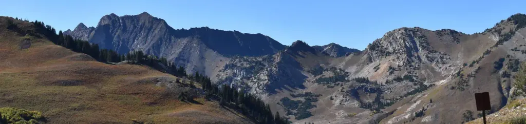 Albion BasinCampingPhoto: Recreation.gov (RIDB) / public domain2.9 mi
- Lake CatherineLake fishing3.9 mi
- Lake MarthaLake fishing4.1 mi
Source: Roamze catalog (indexable pages within 10 miles, PostGIS distance)
Is Twin Peaks open right now?
No closures listed
The Forest Service lists no closures for Uinta-Wasatch-Cache National Forest.
As of · Source: USFS · Uinta-Wasatch-Cache National Forest. Agencies don't list every closure — check before you go.
