Albion Basin
Campground
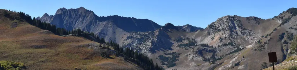
Campground · 2.6 mi from the trail
 Photo: kallahar, CC BY 3.0 (via Wikimedia Commons)
No closures listed
The Forest Service lists no closures for Uinta-Wasatch-Cache National Forest.
As of · Source: USFS · Uinta-Wasatch-Cache National Forest. Agencies don't list every closure — check before you go.
Mark Malu Trail is a moderate out-and-back hike in the Pleasant Grove Ranger District of the Uinta-Wasatch-Cache National Forest in Utah, managed by the Forest Service. The trail covers about 2.1 miles and climbs roughly 2,096 feet from the trailhead, which sits at about 10,793 feet. The route reaches a high point of about 10,821 feet and turns around, so the total elevation gain and loss for the trip are both about 2,096 feet. The steepest stretch comes at about 0.46 miles in, where the grade reaches 27%. The hike takes about 1.5 hours. It pairs easily with other outings in the area. Wildflower Trail is about 0.3 miles away and Twin Peaks Trail about 0.4 miles. For climbing, Stinky Stash Wall is about 1.7 miles off. Campers can head to Albion Basin, about 2.6 miles away.
Albion Basin
Campground
 If it rainsAndrew Branch denae_andrew, CC0 · Wikimedia Commons
Alpine Art Center
Museum
Places © OpenStreetMap contributors, Places © Overture Maps Foundation · Photos: Andrew Branch denae_andrew, CC0 (commons)
More in HeberNot on Roamze yet. Their page has how to reach them.
Daily highs and lows, wind and the chance of precipitation at the summit and route start for the next 7 days, from the Open-Meteo model.
 Wildflower TrailHikingPhoto: kallahar, CC BY 3.0 (via Wikimedia Commons)0.3 miTwin Peaks TrailHikingPhoto: kallahar, CC BY 3.0 (via Wikimedia Commons)0.4 mi
 Albion BasinCampingPhoto: Recreation.gov (RIDB) / public domain2.6 mi
Source: Roamze catalog (indexable pages within 10 miles, PostGIS distance)
Wildflower TrailHiking · Next doorPhoto: kallahar, CC BY 3.0 (via Wikimedia Commons)Twin Peaks TrailHiking · Next doorPhoto: kallahar, CC BY 3.0 (via Wikimedia Commons) Big Mountain TrailHiking · Next doorPhoto: michaelwm25, CC BY 3.0 (via Wikimedia Commons)Powder Paradise TrailHiking · Next doorPhoto: kallahar, CC BY 3.0 (via Wikimedia Commons)Gad ValleyHiking · ~1 min drivePhoto: michaelwm25, CC BY 3.0 (via Wikimedia Commons)Mineral FlatHiking · ~2 min drivePhoto: kallahar, CC BY 3.0 (via Wikimedia Commons)Mount Baldy TrailHiking · ~1 min drivePhoto: kallahar, CC BY 3.0 (via Wikimedia Commons)
 Mid-Way TrailHiking · ~2 min drivePhoto: kallahar, CC BY 3.0 (via Wikimedia Commons)
 Mount Baldy Southeast TrailHiking · ~2 min drivePhoto: michaelwm25, CC BY 3.0 (via Wikimedia Commons)
Also worth it near here
 Hidden PeakSummit · Next doorPhoto: VeggieGarden, CC BY-SA 4.0 (via Wikimedia Commons)
 Tacos Diablos BoulderRock climbing · ~4 min drivePhoto: paulinkenbrandt, CC BY-SA 2.0 (via Flickr)
 Alta Ski AreaDownhill skiing · ~4 min drivePhoto: Baileypalblue, Public domain (via Wikimedia Commons)
About 1.1 mi round trip.
About 2,096 ft of climbing round trip.
It is rated moderate.
About 0.5 hours round trip.
Map and trail data © OpenStreetMap contributors
