Dalton Springs Cg
Campground
Campground · 2.8 mi from the trail
 Photo: MICHAEL JIROCH & …, CC BY 3.0 (via Wikimedia Commons)
Alert in the area
The Forest Service lists an alert for Monticello Ranger District.
Hazardous Road Conditions – Moab Monticello Ranger Districts 11.4.2026
Agency alert covering Monticello Ranger District · USFS · Monticello Ranger District
As of · Source: USFS · Monticello Ranger District. Agencies don't list every closure — check before you go.
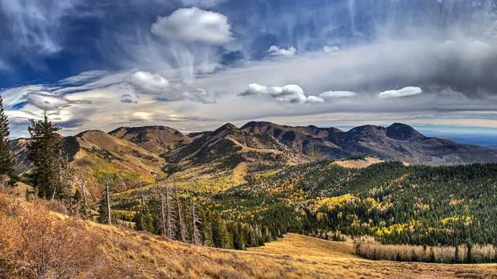
Abajo Peak is a summit of about 11,351 feet in San Juan County, Utah, on the Monticello Ranger District of the Manti-La Sal National Forest. The nearest town is Monticello, about 7 miles away, and the Forest Service manages the surrounding land. The closest trail is Cooley Pass Trail, about half a mile away, with Gold Queen Trail and Spring Creek Trail within about 2 miles. For an overnight base, Dalton Springs Campground sits roughly 3 miles off.
Dalton Springs Cg
Campground
 If it rainsDaBler, CC BY-SA 3.0 · Wikimedia Commons
Places © OpenStreetMap contributors, Places © Overture Maps Foundation · Photos: DaBler, CC BY-SA 3.0 (commons)
More in MonticelloDaily highs and lows, wind and the chance of precipitation at the summit for the next 7 days, from the Open-Meteo model.
Elevation from USGS 3D Elevation Program terrain data (about 10 m resolution).
We don't know of a mapped trail or route to the summit of Abajo Peak. Plan the approach with local maps, a guidebook or a local guide, and check conditions before you go.
11,351 ft (3,460 m).
We don't know of a mapped trail or route to the summit. Plan the approach with local maps, a guidebook or a local guide.


 Cooley Pass TrailHikingPhoto: Ken Lund from Reno, Nevada, USA, CC BY-SA 2.0 (via Wikimedia Commons)0.6 miSpring Creek TrailHikingPhoto: Ken Lund from Reno, Nevada, USA, CC BY-SA 2.0 (via Wikimedia Commons)1.9 mi
 NizhoniCampingPhoto: Recreation.gov (RIDB) / public domain5.8 mi
Source: Roamze catalog (indexable pages within 10 miles, PostGIS distance)
 Pinenut KnollSummit · ~23 min drivePhoto: Steven Baltakatei Sandoval, CC BY-SA 4.0 (via Wikimedia Commons)
 South Sixshooter PeakSummit · ~38 min drivePhoto: dfbphotos, CC BY 2.0 (via Wikimedia Commons)
 North Sixshooter PeakSummit · ~40 min drivePhoto: Bureau of Land Management, CC BY 2.0 (via Wikimedia Commons)
 South MountainSummit · ~1h 9m drivePhoto: RichieB_pics, CC BY 3.0 (via Wikimedia Commons)
 Ekker ButteSummit · ~1h 12m drivePhoto: Greg Willis from Denver, CO, usa, CC BY-SA 2.0 (via Wikimedia Commons)
 Castle ButteSummit · ~1h 12m drivePhoto: The Greater Southwestern Exploration Company from Claremont, California, United States, CC BY 2.0 (via Wikimedia Commons)Mount TukuhnikivatzSummit · ~1h 13m drivePhoto: Erik Wilde, CC BY-SA 2.0 (via Wikimedia Commons)Mount PealeSummit · ~1h 14m drivePhoto: Suffusion of Yellow, CC BY-SA 3.0 (via Wikimedia Commons)
 Rooster ButteSummit · ~1h 14m drivePhoto: mark byzewski, CC BY 2.0 (via Wikimedia Commons)
 Muffin ButteSummit · ~1h 14m drivePhoto: Peter & Joyce Grace, CC BY 2.0 (via Wikimedia Commons)

