Mount Peale Free Camping
Campground
Campground · 2.4 mi from the trail
 Photo: RichieB_pics, CC BY 3.0 (via Wikimedia Commons)
No closures listed
The Forest Service lists no closures for Manti-La Sal National Forest.
As of · Source: USFS · Manti-La Sal National Forest. Agencies don't list every closure — check before you go.
South Mountain is a summit of about 11,793 feet in San Juan County, Utah, on the Moab Ranger District of the Manti-La Sal National Forest. The nearest town is La Sal, about 7 miles away, and the Forest Service manages the land. Pole Canyon is about 0.7 miles away, and the South Mountain Trail for mountain biking is about a mile off. Upper Onion Creek Campground sits about 3.7 miles away, and the Trenchtown climbing area is about 4.8 miles away.
Mount Peale Free Camping
Campground
 If it rainsCarter Pape, CC BY-SA 4.0 · Wikimedia Commons
Hell's Revenge
Attraction
Places © OpenStreetMap contributors, Places © Overture Maps Foundation · Photos: Carter Pape, CC BY-SA 4.0 (commons)
More in MoabDaily highs and lows, wind and the chance of precipitation at the summit for the next 7 days, from the Open-Meteo model.
Elevation from USGS 3D Elevation Program terrain data (about 10 m resolution).
We don't know of a mapped trail or route to the summit of South Mountain. Plan the approach with local maps, a guidebook or a local guide, and check conditions before you go.
11,793 ft (3,595 m).
We don't know of a mapped trail or route to the summit. Plan the approach with local maps, a guidebook or a local guide.


 Pole CanyonHikingPhoto: Ken Lund from Reno, Nevada, USA, CC BY-SA 2.0 (via Wikimedia Commons)0.7 mi
 South Mountain (Sz)HikingPhoto: Ken Lund from Reno, Nevada, USA, CC BY-SA 2.0 (via Wikimedia Commons)1.1 mi
Source: Roamze catalog (indexable pages within 10 miles, PostGIS distance)
Mount TukuhnikivatzSummit · ~5 min drivePhoto: Erik Wilde, CC BY-SA 2.0 (via Wikimedia Commons)Mount PealeSummit · ~5 min drivePhoto: Suffusion of Yellow, CC BY-SA 3.0 (via Wikimedia Commons) Mount MellenthinSummit · ~8 min drivePhoto: RichieB_pics, CC BY 2.5 (via Wikimedia Commons)
 Mount WaasSummit · ~17 min drivePhoto: Steven Baltakatei Sandoval, CC BY-SA 4.0 (via Wikimedia Commons)
 Round MountainSummit · ~27 min drivePhoto: Ron Clausen, CC BY-SA 4.0 (via Wikimedia Commons)
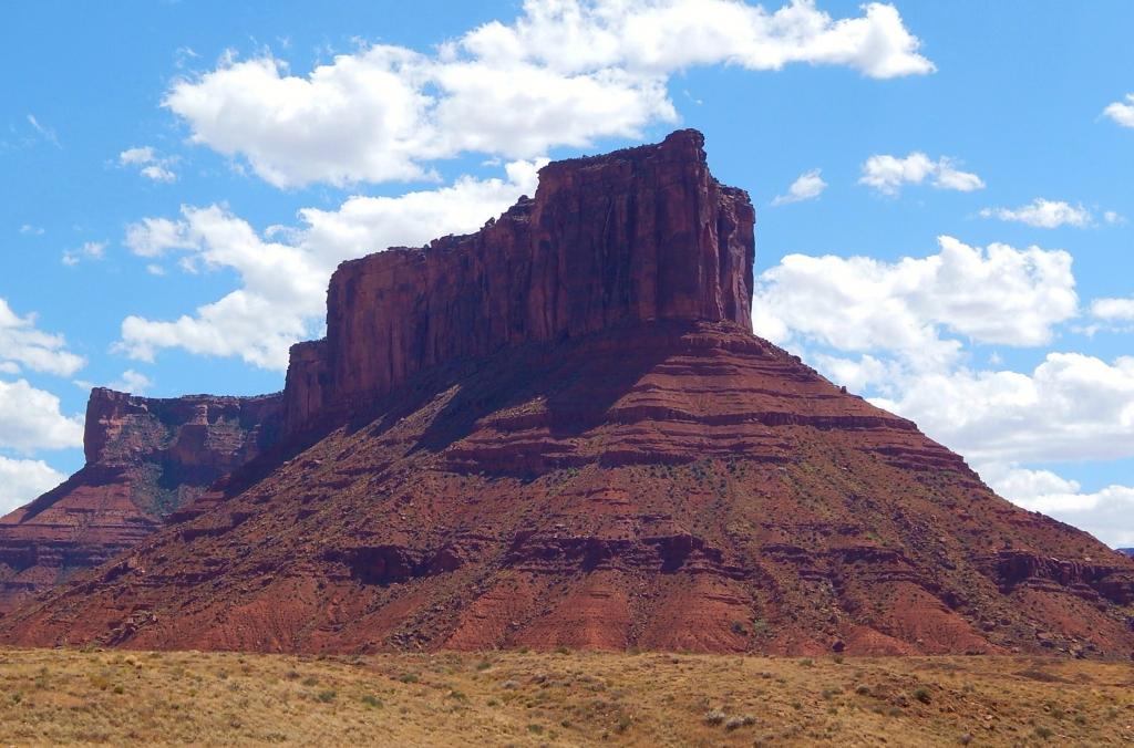 Parriott MesaSummit · ~33 min drivePhoto: Ron Clausen, CC BY-SA 4.0 (via Wikimedia Commons)
 Three PenguinsSummit · ~42 min drivePhoto: Ken Lund from Reno, Nevada, USA, CC BY-SA 2.0 (via Wikimedia Commons)
 Tower of BabelSummit · ~42 min drivePhoto: Alen Ištoković, CC BY 3.0 (via Wikimedia Commons)
 Elephant ButteSummit · ~43 min drivePhoto: Ron Clausen, CC BY-SA 4.0 (via Wikimedia Commons)
 North Sixshooter PeakSummit · ~49 min drivePhoto: Bureau of Land Management, CC BY 2.0 (via Wikimedia Commons)
Also worth it near here
South Mountain TrailHiking · ~2 min drivePhoto: Ken Lund from Reno, Nevada, USA, CC BY-SA 2.0 (via Wikimedia Commons) Tuk SpringsMountain biking · ~9 min drivePhoto: Greg Gebhardt, CC BY-SA 3.0 (via Wikimedia Commons)
