Group Site D
Campground
Campground · 0.1 mi from the trail
Clear today
Weather is good · OpenWeather · checked 3 h ago
Big Mesa Trail is a 6.5-mile out-and-back mountain biking route on Bureau of Land Management land within the Moab Field Office in Utah. The ride begins and ends at a low point of 5,239 feet and climbs to a high of 5,395 feet, a gain of 213 feet, and is rated moderate. Spring and fall are the most comfortable times to ride. Typical averages from the Canyonlands-The Neck weather station, about 12 miles away, put May highs near 72°F and October highs near 65°F, with lows around 50°F in May and 44°F in October. Lone Mesa Group Sites is a campground just 0.1 mile from the trail, and Coney Island, a mountain biking spot, is 0.8 mile away. Plateau Overlook Trail and Wipeout Hill Trail are also within a mile and a half.
Group Site D
Campground
Bar M Chuckwagon
Restaurant
 If it rainsBLMUtah, Public domain · Wikimedia Commons
Places © OpenStreetMap contributors · Photos: BLMUtah, Public domain (commons)
More in Moab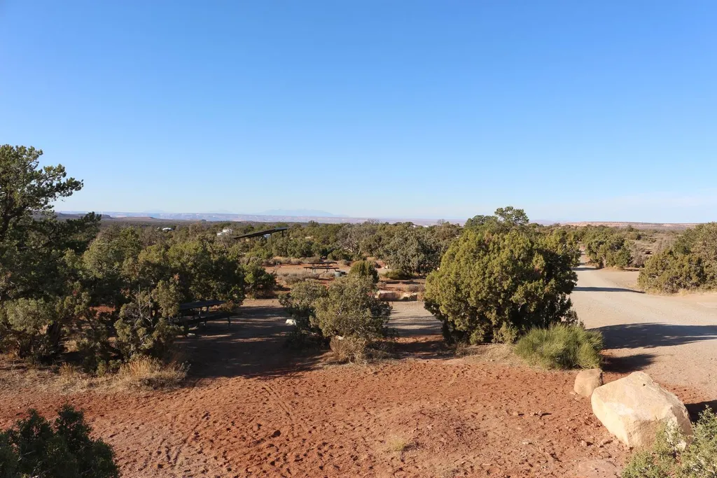 Horsethief CampgroundCampingPhoto: Recreation.gov (RIDB) / public domain3.5 mi
 Monitor and Merrimac ButtesRock climbingPhoto: BFS Man from Webster, TX, USA, CC BY 2.0 (via Wikimedia Commons)4 mi
 Neighbor Of PuttermanRock climbingPhoto: indigoprime, CC BY 2.0 (via Flickr)4.2 mi
Source: Roamze catalog (indexable pages within 10 miles, PostGIS distance)
 Buttes and Towers TrailMountain biking · ~10 min drivePhoto: Foreade, CC BY-SA 4.0 (via Wikimedia Commons)Sevenmile Rim TrailMountain biking · ~11 min drivePhoto: Foreade, CC BY-SA 4.0 (via Wikimedia Commons)
 North 40Mountain biking · ~13 min drivePhoto: Jacob Montgomery, CC BY-SA 3.0 (via Wikimedia Commons)
Also worth it near here
Monitor and Merrimac ButtesRock climbing · ~7 min drivePhoto: BFS Man from Webster, TX, USA, CC BY 2.0 (via Wikimedia Commons) Merrimac ButteSummit · ~7 min drivePhoto: dconvertini, CC BY-SA 2.0 (via Wikimedia Commons)
Best months: April–June and September–October. Best months have typical highs of 55–85 °F, lows of 30 °F or warmer (32 °F where the station doesn't record snow), at most one snowy day and no more than 12 wet days.
Jan
37° / 22°
4 wet · 4 snow
Feb
43° / 27°
4 wet · 3 snow
Mar
54° / 35°
5 wet · 2 snow
Apr
62° / 40°
5 wet · 1 snow
May
72° / 50°
5 wet
Jun
85° / 62°
3 wet
Jul
91° / 68°
6 wet
Aug
88° / 66°
7 wet
Sep
79° / 57°
6 wet
Oct
65° / 44°
5 wet
Nov
49° / 33°
4 wet · 2 snow
Dec
37° / 23°
4 wet · 4 snow
Typical high / low (°F) and days with rain or snow, 1991–2020. Measured at Canyonlands-The Neck, UT, 12.1 mi away at 5,871 ft. Source: NOAA NCEI U.S. Climate Normals 1991–2020.
Map and trail data © OpenStreetMap contributors
