Designated Campsite
Campground
Campground · 2.8 mi from the trail
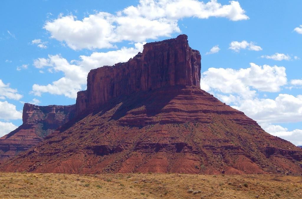
 Photo: dconvertini, CC BY-SA 2.0 (via Wikimedia Commons)
Merrimac Butte is a summit of 5,614 feet in Utah, on Bureau of Land Management land within the Moab Field Office. The nearest town is Moab, about 12 miles away. Spring and fall are the most comfortable times to visit. Typical averages from a nearby weather station in Moab show May highs around 78°F and October highs around 68°F, while July averages about 96°F and January lows drop to 17°F. That station sits roughly 1,000 feet below the butte, so temperatures on top run cooler. The Monitor and Merrimac Buttes climbing area lies just 0.1 mile away, and the Buttes and Towers Trail is under a mile off. Tusher Canyon, another climbing area, is about 1.3 miles away, and Lone Mesa Group Sites offers camping roughly 4 miles from the summit.
Designated Campsite
Campground
 If it rainsBLMUtah, Public domain · Wikimedia Commons
Places © OpenStreetMap contributors, Places © Overture Maps Foundation · Photos: BLMUtah, Public domain (commons)
More in MoabDaily highs and lows, wind and the chance of precipitation at the summit for the next 7 days, from the Open-Meteo model.
Elevation from USGS 3D Elevation Program terrain data (about 10 m resolution).
We don't know of a mapped trail or route to the summit of Merrimac Butte. Plan the approach with local maps, a guidebook or a local guide, and check conditions before you go.
5,614 ft (1,711 m).
We don't know of a mapped trail or route to the summit. Plan the approach with local maps, a guidebook or a local guide.


 Monitor and Merrimac ButtesRock climbingPhoto: BFS Man from Webster, TX, USA, CC BY 2.0 (via Wikimedia Commons)0.1 mi
 Sevenmile Rim TrailHikingPhoto: BFS Man from Webster, TX, USA, CC BY 2.0 (via Wikimedia Commons)1.2 mi
 Tusher CanyonRock climbingPhoto: Foreade, CC BY-SA 4.0 (via Wikimedia Commons)1.3 mi313 CorridorRock climbingPhoto: BFS Man from Webster, TX, USA, CC BY 2.0 (via Wikimedia Commons)1.4 miSeven Mile Wash TrailHikingPhoto: BFS Man from Webster, TX, USA, CC BY 2.0 (via Wikimedia Commons)1.4 mi
Source: Roamze catalog (indexable pages within 10 miles, PostGIS distance)
Monitor ButteSummit · Next doorPhoto: CC BY-SA 2.5 (via Wikimedia Commons) Three PenguinsSummit · ~13 min drivePhoto: Ken Lund from Reno, Nevada, USA, CC BY-SA 2.0 (via Wikimedia Commons)
 Tower of BabelSummit · ~13 min drivePhoto: Alen Ištoković, CC BY 3.0 (via Wikimedia Commons)
 Elephant ButteSummit · ~19 min drivePhoto: Ron Clausen, CC BY-SA 4.0 (via Wikimedia Commons)
 Parriott MesaSummit · ~32 min drivePhoto: Ron Clausen, CC BY-SA 4.0 (via Wikimedia Commons)Upheaval DomeSummit · ~33 min drivePhoto: Jim Stuby (user Jstuby), Public domain (via Wikimedia Commons)Aztec ButteSummit · ~34 min drivePhoto: G. Edward Johnson, CC BY 4.0 (via Wikimedia Commons)
 Bighorn MesaSummit · ~34 min drivePhoto: Greg Willis from Denver, CO, usa, CC BY-SA 2.0 (via Wikimedia Commons)
 Round MountainSummit · ~36 min drivePhoto: Ron Clausen, CC BY-SA 4.0 (via Wikimedia Commons)
 Muffin ButteSummit · ~36 min drivePhoto: Peter & Joyce Grace, CC BY 2.0 (via Wikimedia Commons)
Also worth it near here
Sevenmile Rim TrailHiking · ~2 min drivePhoto: BFS Man from Webster, TX, USA, CC BY 2.0 (via Wikimedia Commons)Tusher CanyonRock climbing · ~2 min drivePhoto: Foreade, CC BY-SA 4.0 (via Wikimedia Commons) Buttes and Towers TrailMountain biking · ~3 min drivePhoto: Foreade, CC BY-SA 4.0 (via Wikimedia Commons)
Best months: March–May and September–October. Best months have typical highs of 55–85 °F, lows of 30 °F or warmer (32 °F where the station doesn't record snow), at most one snowy day and no more than 12 wet days.
Jan
39° / 17°
5 wet
Feb
47° / 25°
5 wet
Mar
59° / 32°
4 wet
Apr
67° / 39°
4 wet
May
78° / 48°
4 wet
Jun
90° / 58°
3 wet
Jul
96° / 66°
4 wet
Aug
92° / 63°
5 wet
Sep
83° / 53°
5 wet
Oct
68° / 40°
5 wet
Nov
52° / 27°
4 wet
Dec
39° / 17°
5 wet
Typical high / low (°F) and days with rain or snow, 1991–2020. Measured at Moab Canyonland Ap, UT, 6.4 mi away at 4,561 ft. The station sits about 1,100 ft lower than this place, so expect it a little cooler here. This station doesn't record snowfall. Source: NOAA NCEI U.S. Climate Normals 1991–2020.
