Rim Overlook
- 2.0 mi
- round trip
- 1,362 ft
- climb
- 6,411 ft
- high point
- Out and back
- route
- Apr–Jun, Aug–Oct
- best months
Is Rim Overlook open right now?
No closures listed
The National Park Service lists no closures for Capitol Reef National Park.
As of · Source: NPS · Capitol Reef National Park. Agencies don't list every closure — check before you go.
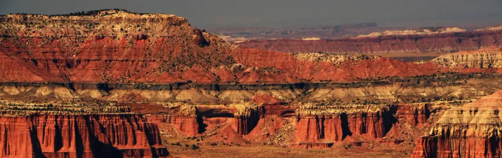
Rim Overlook is a moderate hike in Capitol Reef National Park in Utah, managed by the National Park Service. The route is about 2 miles long and rises roughly 900 feet, with a total round-trip gain of about 1,360 feet. The climb is front-loaded, with the steepest stretch at about 0.96 miles in, where the grade reaches 17%. Spring and fall are the most comfortable times to go. Typical averages from a nearby weather station show May highs around 70°F and October highs around 62°F, while July averages climb to about 87°F. The hike starts close to Hickman Bridge, about 0.1 mile away, and Frying Pan is about half a mile off. Climbers can head to the Fruita Area, about 1.4 miles away, and Capitol Reef Group Campground is about 1.5 miles away.
Local outfitters
- Sand Creek RV Park & Campground11 mi away
- Muddy Creek Mining Co.29 mi away
Not on Roamze yet. Their page has how to reach them.
- Hickman BridgeHiking0.1 mi
- Frying PanHiking0.5 mi
- Cohab CanyonHiking1.2 mi
 Fruita AreaRock climbingPhoto: brewbooks from near Seattle, USA, CC BY-SA 2.0 (via Wikimedia Commons)1.4 mi
 Capitol Reef Group CampgroundCampingPhoto: Recreation.gov (RIDB) / public domain1.5 mi
 Terrible Twos WallRock climbingPhoto: The Dye Clan, CC BY-SA 3.0 (via Wikimedia Commons)2 mi
 Grand Wash BouldersRock climbingPhoto: Famartin, CC BY-SA 3.0 (via Wikimedia Commons)2.4 mi
- Fremont River Cua DispersedCamping5.7 mi
Source: Roamze catalog (indexable pages within 10 miles, PostGIS distance)
 Chimney Rock CanyonHiking · ~6 min drivePhoto: Frans-Banja Mulder, CC BY 3.0 (via Wikimedia Commons)
 Sunset PointHiking · ~7 min drivePhoto: mtnscll — CC BY-SA 2.0 (via Flickr)
- Lower Spring Canyon TrailheadHiking · ~3 min drive
- Pleasant CreekHiking · ~15 min drive
 Chimney Rock LoopHiking · ~7 min drivePhoto: Ken Lund — CC BY-SA 2.0 (via Flickr)
 Capitol Gorge TrailHiking · ~11 min drivePhoto: Shaan Hurley — CC BY 2.0 (via Flickr)
- Sulphur Creek TrailHiking · ~3 min drive
 Golden ThroneHiking · ~10 min drivePhoto: Greg Willis from Denver, CO, usa, CC BY-SA 2.0 (via Wikimedia Commons)
 Jailhouse Rock/ Temple RockHiking · ~14 min drivePhoto: Greg Willis, CC BY-SA 3.0 (via Wikimedia Commons)
- Upper Spring CanyonHiking · ~15 min drive
Also worth it near here
 Pectols PyramidSummit · Next doorPhoto: Anna Irene, CC BY-SA 2.0 (via Wikimedia Commons)
 Hickman Natural BridgeNatural arch · Next doorPhoto: Aneta Kaluzna, CC BY-SA 2.5 (via Wikimedia Commons)
- Fruita AreaRock climbing · ~2 min drivePhoto: brewbooks from near Seattle, USA, CC BY-SA 2.0 (via Wikimedia Commons)
- Capitol Reef Group CampgroundCamping · ~3 min drive
Best time to visit Rim Overlook
Best months: April–June and August–October. Best months have typical highs of 55–85 °F, lows of 30 °F or warmer (32 °F where the station doesn't record snow), at most one snowy day and no more than 12 wet days.
Jan
38° / 22°
5 wet
Feb
43° / 26°
5 wet
Mar
53° / 32°
5 wet
Apr
60° / 38°
4 wet
May
70° / 46°
5 wet
Jun
82° / 56°
4 wet
Jul
87° / 62°
8 wet
Aug
85° / 60°
8 wet
Sep
76° / 53°
5 wet
Oct
62° / 41°
3 wet
Nov
48° / 29°
3 wet
Dec
37° / 21°
5 wet
Typical high / low (°F) and days with rain or snow, 1991–2020. Measured at Torrey 7 E, UT, 3.8 mi away at 6,204 ft. This station doesn't record snowfall. Source: NOAA NCEI U.S. Climate Normals 1991–2020.
