Navajo Knobs
- 2.5 mi
- round trip
- 1,626 ft
- climb
- 6,961 ft
- high point
- Out and back
- route
- Apr–Jun, Aug–Oct
- best months
Caution at last check
Weather is marginal · OpenWeather · checked 17 h ago
Is Navajo Knobs open right now?
No closures listed
The National Park Service lists no closures for Capitol Reef National Park.
As of · Source: NPS · Capitol Reef National Park. Agencies don't list every closure — check before you go.
Navajo Knobs is a moderate hike in Capitol Reef National Park in Utah, managed by the National Park Service. The route is about 2.45 miles from the park's visitor center and campground area, and it makes a natural addition to a day spent exploring the park's climbing and hiking around the Fruita area. The hike is an out-and-back that covers about 4.9 miles, with a total elevation gain of 1,626 feet. The steepest stretch comes at about 1.8 miles in, where the grade reaches 19 percent. The trail starts at about 6,308 feet and climbs to about 6,961 feet at the high point. Spring and fall are the most comfortable times to go. Typical averages from a nearby weather station in Torrey show May highs around 70°F and October highs around 62°F, while July averages climb to about 87°F. A fee is charged for the hike. The Fruita Area climbing area is just 0.2 miles away, and Cohab Canyon and the Visitor Center to Campground hike are both within a mile. Capitol Reef Group Campground is about 0.8 miles off.
Local outfitters
- Sand Creek RV Park & Campground10 mi away
- Muddy Creek Mining Co.30 mi away
Not on Roamze yet. Their page has how to reach them.
 Fruita AreaRock climbingPhoto: brewbooks from near Seattle, USA, CC BY-SA 2.0 (via Wikimedia Commons)0.2 mi
- Cohab CanyonHiking0.6 mi
- Visitor Center to CampgroundHiking0.7 mi
- Sulphur Creek TrailHiking0.7 mi
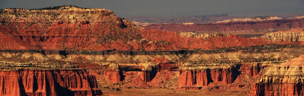 Capitol Reef Group CampgroundCampingPhoto: Recreation.gov (RIDB) / public domain0.8 mi
 Capitol ReefRock climbingPhoto: runt35, CC BY 3.0 (via Wikimedia Commons)2.4 mi
 Terrible Twos WallRock climbingPhoto: The Dye Clan, CC BY-SA 3.0 (via Wikimedia Commons)2.6 mi
- Fremont River Cua DispersedCamping4.6 mi
Source: Roamze catalog (indexable pages within 10 miles, PostGIS distance)
 Chimney Rock CanyonHiking · ~5 min drivePhoto: Frans-Banja Mulder, CC BY 3.0 (via Wikimedia Commons)
 Sunset PointHiking · ~5 min drivePhoto: mtnscll — CC BY-SA 2.0 (via Flickr)
- Lower Spring Canyon TrailheadHiking · ~5 min drive
- Pleasant CreekHiking · ~16 min drive
 Chimney Rock LoopHiking · ~5 min drivePhoto: Ken Lund — CC BY-SA 2.0 (via Flickr)
 Capitol Gorge TrailHiking · ~12 min drivePhoto: Shaan Hurley — CC BY 2.0 (via Flickr)
- Sulphur Creek TrailHiking · ~1 min drive
 Golden ThroneHiking · ~11 min drivePhoto: Greg Willis from Denver, CO, usa, CC BY-SA 2.0 (via Wikimedia Commons)
 Jailhouse Rock/ Temple RockHiking · ~14 min drivePhoto: Greg Willis, CC BY-SA 3.0 (via Wikimedia Commons)
- Upper Spring CanyonHiking · ~13 min drive
Also worth it near here
- Fruita AreaRock climbing · Next doorPhoto: brewbooks from near Seattle, USA, CC BY-SA 2.0 (via Wikimedia Commons)
 Hickman Natural BridgeNatural arch · ~1 min drivePhoto: Aneta Kaluzna, CC BY-SA 2.5 (via Wikimedia Commons)
- Capitol Reef Group CampgroundCamping · ~1 min drive
 Pectols PyramidSummit · ~2 min drivePhoto: Anna Irene, CC BY-SA 2.0 (via Wikimedia Commons)
Best time to visit Navajo Knobs
Best months: April–June and August–October. Best months have typical highs of 55–85 °F, lows of 30 °F or warmer (32 °F where the station doesn't record snow), at most one snowy day and no more than 12 wet days.
Jan
38° / 22°
5 wet
Feb
43° / 26°
5 wet
Mar
53° / 32°
5 wet
Apr
60° / 38°
4 wet
May
70° / 46°
5 wet
Jun
82° / 56°
4 wet
Jul
87° / 62°
8 wet
Aug
85° / 60°
8 wet
Sep
76° / 53°
5 wet
Oct
62° / 41°
3 wet
Nov
48° / 29°
3 wet
Dec
37° / 21°
5 wet
Typical high / low (°F) and days with rain or snow, 1991–2020. Measured at Torrey 7 E, UT, 2.5 mi away at 6,204 ft. The station sits about 800 ft lower than this place, so expect it a little cooler here. This station doesn't record snowfall. Source: NOAA NCEI U.S. Climate Normals 1991–2020.
