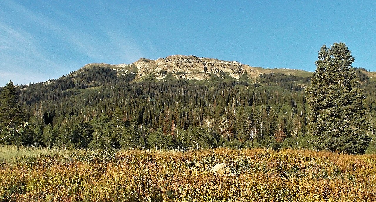
Farmington Creek
- 4.0 mi
- round trip
- 1,213 ft
- climb
- 6,467 ft
- high point
- Out and back
- route
- May–Jun, Aug–Sep
- best months
Caution today
Agency alerts are in effect for this area; weather is marginal · USFS, OpenWeather · checked 10 h ago
Is Farmington Creek open right now?
No closures listed
The Forest Service lists no closures for Uinta-Wasatch-Cache National Forest.
As of · Source: USFS · Uinta-Wasatch-Cache National Forest. Agencies don't list every closure — check before you go.
Farmington Creek is a 4-mile out-and-back hike in the Salt Lake Ranger District of the Uinta-Wasatch-Cache National Forest in Utah, managed by the Forest Service. The trail rises from about 5,200 feet to about 6,500 feet, with a total elevation gain of 1,213 feet, and is rated moderate. The route is natural-surfaced and allows bikes, and it is not an accessible trail. The most comfortable stretch for a visit runs from May through October, when the trail is typically open. Typical averages from a nearby weather station at Bountiful Bench, which sits about 1,500 feet lower, show June highs around 78°F and September highs around 74°F, with snow days dropping to zero from June through September. The Farmington Spine Trail lies about 0.4 miles away, and Farmington Canyon, a climbing area, is about half a mile off. The Old Aqueduct Trail is about 0.6 miles away, and Bountiful Peak Campground is about 3.5 miles away.
Local outfitters
- Mantua Waterfront RV Resort35 mi away
- Midway Adventure Company40 mi away
Not on Roamze yet. Their page has how to reach them.
Best time to go · May–Jun, Aug–Sep
Best time to visit Farmington Creek
Best months: May–June and August–September. Best months have typical highs of 55–85 °F, lows of 30 °F or warmer (32 °F where the station doesn't record snow), at most one snowy day and no more than 12 wet days.
Jan
36° / 23°
12 wet · 9 snow
Feb
41° / 27°
11 wet · 7 snow
Mar
51° / 34°
11 wet · 6 snow
Apr
57° / 39°
11 wet · 4 snow
May
67° / 48°
10 wet · 1 snow
Jun
78° / 57°
6 wet
Jul
87° / 66°
5 wet
Aug
84° / 64°
5 wet
Sep
74° / 55°
6 wet
Oct
60° / 43°
8 wet · 2 snow
Nov
46° / 31°
10 wet · 5 snow
Dec
36° / 23°
11 wet · 9 snow
Typical high / low (°F) and days with rain or snow, 1991–2020. Measured at Bountiful Bench, UT, 7.6 mi away at 4,950 ft. The station sits about 1,500 ft lower than this place, so expect it a little cooler here. Source: NOAA NCEI U.S. Climate Normals 1991–2020.
Keep exploring — more trails worth the drive
HIKE
Farmington Spine Trail
Next door
Short ridgeline trail with easy access to Farmington area views.
HIKE
Flag Rock Trail
~2 min drive
1.85-mile out-and-back hike in Utah with 567 ft elevation gain.
HIKE
Shepard Creek Trail
~3 min drive
Steep creek drainage climb with extreme elevation gain in under 3 miles.
HIKE
Steed Creek Trail
~3 min drive
Steep alpine climb with nearly 5,000 ft gain in 3.45 miles.
HIKE
Farmington Spine Trail
~1 min drive
Quick, steep climb with great views near Farmington.
HIKE
Bonneville Shoreline Trail
~2 min drive
Easy valley-rim trail following ancient Lake Bonneville shoreline with valley views.
HIKE
Farmington Spine Trail
~3 min drive
2.60-mile out-and-back hike in Utah with 110 ft elevation gain.
HIKE
Francis Peak Trail
~3 min drive
Steady Wasatch climb to Francis Peak with excellent summit views.
HIKE
Dirt Coaster Trail
~1 min drive
1.1-mile out-and-back trail in Utah with 567 ft elevation gain
HIKE
Farmington Upper Terrace
~3 min drive
Easy 2-mile terrace walk with local views near Farmington.