Cedar Canyon
Campground
Campground · 0.9 mi from the trail
Alert in the area
The Forest Service lists 3 alerts for Dixie National Forest.
Duck Creek OHV Trail Closure
Agency alert covering Dixie National Forest · Order 0407-26-11 · USFS · Dixie National Forest
Pine Valley Ranger District Area and Trail and Road Closure
Agency alert covering Dixie National Forest · Order 0407-26-01 · USFS · Dixie National Forest
Cedar City Temporary Road Closure Webster Flat Road (Order 0407-25-02)
Agency alert covering Dixie National Forest · Order 0407-25-02 · USFS · Dixie National Forest
As of · Source: USFS · Dixie National Forest. Agencies don't list every closure — check before you go.
Blowhard Trail is an easy out-and-back hike in the Cedar City Ranger District of Dixie National Forest in Utah. It covers 4.8 miles with a total elevation gain of 726 feet, rising from about 8,327 feet to a high point of 9,030 feet. The trail is managed by the Forest Service. Summer is the most comfortable time to go. Typical averages from the nearby Brian Head weather station show July highs around 71°F and lows near 42°F, while winter highs there sit in the 20s. Crystal Springs Road starts just 0.1 mile away and Long Hollow Trail is 0.3 mile off, so the trail pairs easily with either. Cedar Canyon campground is 0.9 mile away. For an overnight stay, Deer Haven campground lies about 2.2 miles away.
Cedar Canyon
Campground
Milts Stage Stop
Restaurant
State park and museum in the United States
Places © OpenStreetMap contributors
More in EnochNot on Roamze yet. Their page has how to reach them.
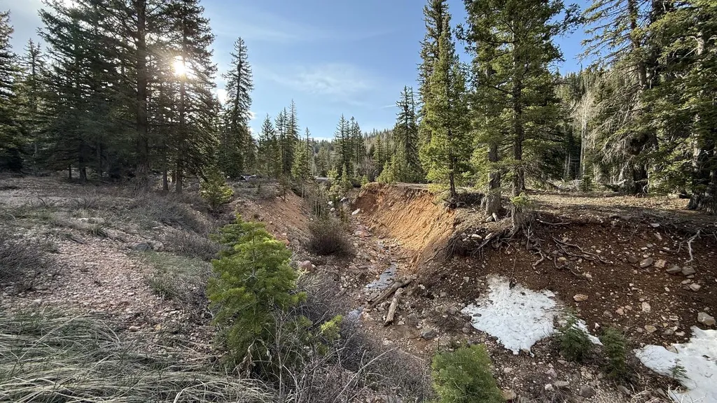 Cedar CanyonCampingPhoto: Recreation.gov (RIDB) / public domain0.9 mi
 Graveside Matter SlabRock climbingPhoto: inkknife_2000 (7.5 million views +), CC BY-SA 2.0 (via Wikimedia Commons)1.9 miLower TierRock climbingPhoto: inkknife_2000 (7.5 million views +), CC BY-SA 2.0 (via Wikimedia Commons)2 mi
Source: Roamze catalog (indexable pages within 10 miles, PostGIS distance)
 Nature TrailHiking · ~6 min drivePhoto: inkknife_2000 (7.5 million views +), CC BY-SA 2.0 (via Wikimedia Commons)
 Town TrailHiking · ~13 min drivePhoto: A. E. Crane, Public domain (via Wikimedia Commons)
Also worth it near here
Graveside Matter SlabRock climbing · ~3 min drivePhoto: inkknife_2000 (7.5 million views +), CC BY-SA 2.0 (via Wikimedia Commons) Flanigan ArchNatural arch · ~4 min drivePhoto: The Dye Clan, CC BY-SA 3.0 (via Wikimedia Commons)
Best months: June–September. Best months have typical highs of 55–85 °F, lows of 30 °F or warmer (32 °F where the station doesn't record snow), at most one snowy day and no more than 12 wet days.
Jan
30° / 10°
Feb
32° / 12°
Mar
39° / 17°
Apr
44° / 18°
May
55° / 27°
Jun
67° / 36°
Jul
71° / 42°
Aug
68° / 43°
Sep
61° / 35°
Oct
48° / 24°
Nov
38° / 17°
Dec
28° / 10°
Typical high / low (°F) and days with rain or snow, 1991–2020. Measured at Brian Head, UT, 6.7 mi away at 9,770 ft. The station sits about 700 ft higher than this place, so expect it a little warmer here. This station doesn't record snowfall. Source: NOAA NCEI U.S. Climate Normals 1991–2020.
Map and trail data © OpenStreetMap contributors
