Benchmark Primitive Trail
- 0.4 mi
- round trip
- 583 ft
- climb
- 5,472 ft
- high point
- Out and back
- route
- Apr–Jun, Sep–Oct
- best months
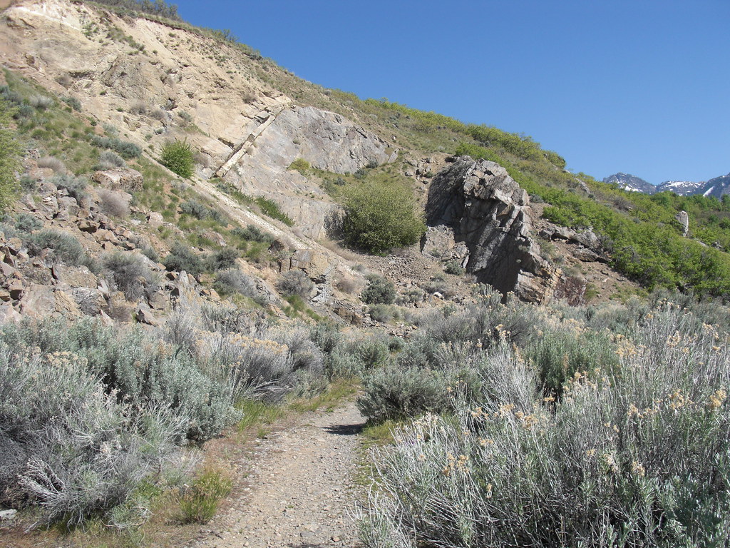
Benchmark Primitive Trail is a short, out-and-back hike in Utah, about 1.4 miles from the town of Canyon Rim. The trail is 0.78 miles long, with a total elevation gain of 583 feet, and it starts at 5,472 feet, the high point of the route. The steepest stretch comes at about 0.26 miles, where the grade reaches 21 percent. The most comfortable months for a visit are typically May and September, when typical averages from the nearby Mtn Dell Dam weather station run around 70°F and 79°F, with lows near 43°F and 48°F. July is the warmest month, with typical highs near 89°F, and winter brings typical highs around 40°F and lows near 20°F. The hike takes about half an hour to complete. The Bonneville Shoreline Trail - Parley's Pointe Section lies about 0.6 miles away, and Jack's Peak Trail is about 0.7 miles off. Climbers can find Iron Curtain Wall and Parley's Canyon within about 0.8 miles.
Local outfitters
- Midway Adventure Company22 mi away
- Rocky Mountain Outfitters23 mi away
Not on Roamze yet. Their page has how to reach them.
 Bonneville Shoreline Trail - Parley's Pointe SectionHikingPhoto: Famartin, CC BY-SA 3.0 (via Wikimedia Commons)0.6 mi
- Jack's Peak TrailHiking0.7 mi
- Iron Curtain WallRock climbing0.8 mi
- Riptide WallRock climbing0.8 mi
- Parley's CanyonRock climbing0.8 mi
 Jordan RiverCanoeingPhoto: Andrey Zharkikh from Salt Lake City, USA, CC BY 2.0 (via Wikimedia Commons)8.2 mi
- Jordan Pines CgCamping9.5 mi
- Lake FlorenceLake fishing9.6 mi
Source: Roamze catalog (indexable pages within 10 miles, PostGIS distance)
- Bonneville Shoreline Trail - Parley's Pointe SectionHiking · Next doorPhoto: Famartin, CC BY-SA 3.0 (via Wikimedia Commons)
- Grandeur Peak WestHiking · ~3 min drivePhoto: Famartin, CC BY-SA 3.0 (via Wikimedia Commons)
 Mount Wire Southwest TrailHiking · ~6 min drivePhoto: pinkblackmusik, CC BY-SA 3.0 (via Wikimedia Commons)
- South Loop TrailHiking · ~1 min drive
- Pipeline TrailHiking · ~4 min drivePhoto: Famartin, CC BY-SA 3.0 (via Wikimedia Commons)
 Bonneville Shoreline Trail - Mount Wire SectionHiking · ~4 min drivePhoto: Mark Cowell, CC BY 3.0 (via Wikimedia Commons)
- Mount Wire South TrailHiking · ~6 min drivePhoto: pinkblackmusik, CC BY-SA 3.0 (via Wikimedia Commons)
- Scrubby Connector TrailHiking · ~3 min drive
- Desolation TrailHiking · ~6 min drive
- Wagner Spring TrailHiking · ~4 min drivePhoto: Mark Cowell, CC BY 3.0 (via Wikimedia Commons)
Best time to visit Benchmark Primitive Trail
Best months: April–June and September–October. Best months have typical highs of 55–85 °F, lows of 30 °F or warmer (32 °F where the station doesn't record snow), at most one snowy day and no more than 12 wet days.
Jan
40° / 20°
12 wet
Feb
44° / 24°
11 wet
Mar
53° / 30°
11 wet
Apr
60° / 35°
12 wet
May
70° / 43°
11 wet
Jun
81° / 49°
7 wet
Jul
89° / 56°
5 wet
Aug
88° / 56°
6 wet
Sep
79° / 48°
8 wet
Oct
65° / 38°
9 wet
Nov
50° / 30°
10 wet
Dec
40° / 22°
12 wet
Typical high / low (°F) and days with rain or snow, 1991–2020. Measured at Mtn Dell Dam, UT, 4.6 mi away at 5,420 ft. This station doesn't record snowfall. Source: NOAA NCEI U.S. Climate Normals 1991–2020.

Map and trail data © OpenStreetMap contributors
