Site 47 - Juniper Basin Group Campsite
Campground
Campground · 5.1 mi from the trail
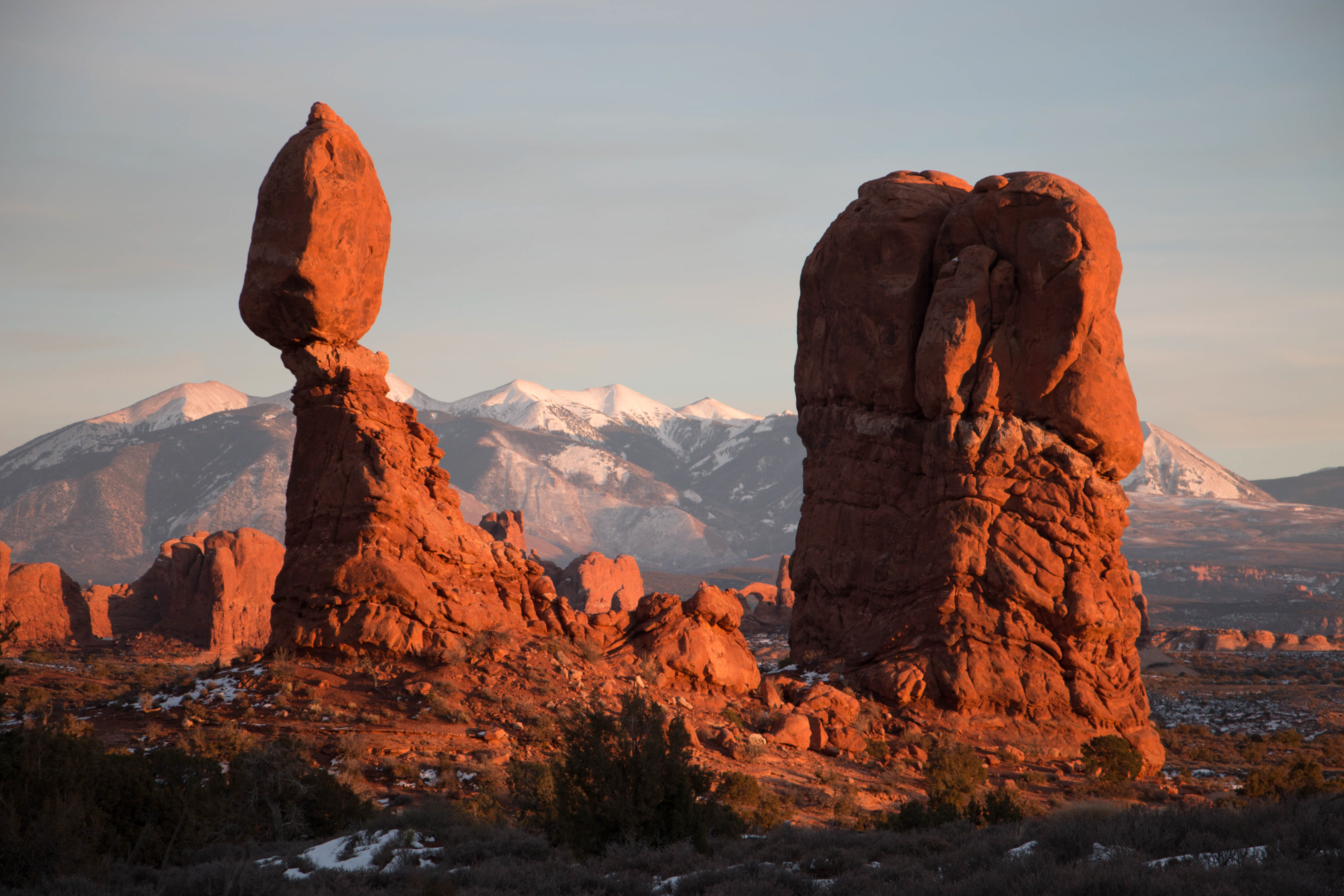 Photo: NPS/Chris Wonderly
No closures listed
The National Park Service lists no closures for Arches National Park.
As of · Source: NPS · Arches National Park. Agencies don't list every closure — check before you go.
Balanced Rock can be seen from the park road 9.2 miles (14.8 km) from Arches Visitor Center. View the feature from a viewpoint or hike the short trail around it. Climbing on Balanced Rock is prohibited. • Roundtrip Distance: 0.3 mi (0.4 km) • Time: 15-30 min • Elevation Change: 35 ft (11 m) • Difficulty: Easy • Hike Description: This is a loop trail at the base of a picturesque rock formation. Part of the trail is paved. • Accessibility: The beginning of the trail is flat and paved. It passes alongside Balanced Rock to a viewpoint of The Windows and the La Sal Mountains in the distance. The trail continuing around Balanced Rock has steps, slopes, and rocky, uneven surfaces. An accessible picnic area and toilet are located up a gravel road across from Balanced Rock. • Dogs are not allowed on this trail. Service animals are allowed in national parks. What is a service animal? One of the most iconic features in the park, Balanced Rock stands a staggering 128 feet (39 m) tall. While this formation may appear to be an epic balancing act, it’s actually not balanced at all. The top boulder of Entrada Sandstone sits attached to its eroding pedestal of Dewey Bridge mudstone. The exposure of these two rock strata layers are ideal for the formation of arches and balanced rocks. Balanced Rock defies gravity but this won’t always be the case. Eventually, the 3,600 ton (over 4 million kg) boulder will come tumbling down as the erosional process continues to shape the landscape. In the winter of 1975-76, Balanced Rock’s smaller sibling “Chip-Off-the-Ol'-Block” collapsed (view Then and Now photos), proving that there is no better time than the present to see this awe-inspiring giant. At sunset, Balanced Rock becomes saturated in a deep red-orange making it a great place to end a fun-filled day in the park. This is also an ideal place for stargazing and night photography. Its location is just far enough from the city lights of Moab, Utah and provides whimsical rocky spires in the foreground. A picnic area is located across from Balanced Rock to the west down a gravel road. The picnic area offers multiple picnic tables, covered canopy, vault toilet, and spectacular views of Salt Valley. We encourage you to leave no trace by using trash/recycling bins in the picnic area. Feeding wildlife can be harmful and is prohibited in the park. A cairn marks the trail. NPS/Christian Wright Find Your Way Cairns are the rock piles that you see along many of the trails in the park. They are carefully placed by rangers to mark the route. Building your own cairns may be tempting but consider the how that may impact other hikers. "Cairn clutter" and "sculpture gardens" can be confusing to others on the trail. They can also damage park resources and impair the natural beauty of the park.
Site 47 - Juniper Basin Group Campsite
Campground
Colorado River Overlook
Viewpoint
Places © OpenStreetMap contributors
More in MoabNot on Roamze yet. Their page has how to reach them.
Best months: March–May and September–October. Best months have typical highs of 55–85 °F, lows of 30 °F or warmer (32 °F where the station doesn't record snow), at most one snowy day and no more than 12 wet days.
Jan
39° / 18°
Feb
46° / 25°
Mar
58° / 33°
Apr
66° / 40°
May
77° / 50°
Jun
89° / 60°
Jul
95° / 68°
Aug
92° / 65°
Sep
83° / 56°
Oct
68° / 42°
Nov
52° / 30°
Dec
39° / 19°
Typical high / low (°F) and days with rain or snow, 1991–2020. Measured at Castle Valley 1se, UT, 10.9 mi away at 4,905 ft. This station doesn't record snowfall. Source: NOAA NCEI U.S. Climate Normals 1991–2020.
HIKE
Double Arch Viewpoint and Trail
~3 min drive
Visible from the parking loop at The Windows, Double Arch is an impressive feature—the tallest (112 ft/34 m) and second-longest (144 ft/44 m) arch in the park. A gently sloping path leads to its base. Roundtrip Distance: 0.6 mi (1 km) Time: 15-30 min Elevation Change: 30 ft…
HIKE
Delicate Arch Trail
~6 min drive
This trail is strenuous and the arch is not visible until the end of the trail. For an easier view, try Delicate Arch Viewpoints. Roundtrip Distance: 3 mi (4.8 km) Time: 2-3 hours Elevation Change: 538 ft (164 m) Difficulty: Strenuous Hike Description: Avoid this hike during…
 Photo: inkknife_2000 (7.5 million views +), CC BY-SA 2.0 (via Wikimedia Commons)
Courthouse Wash Trail
~7 min drive
10.48-mile out-and-back trail in Utah with 2,545 ft elevation gain/loss.
HIKE
Saltwash Trail
~8 min drive
8.6-mile out-and-back hike in Utah with 1,738 ft gain and 4,814 ft max elevation
HIKE
The Windows Viewpoint and Trail
~3 min drive
The Windows Section is located 12 miles (19 km) from the park entrance. Massive North Window is visible from the parking lot. Trails lead to Turret Arch, North Window, South Window, and Double Arch. Limited oversize parking is available at the lower lot near Double Arch.…
HIKE
Sand Dune Arch Trail
~8 min drive
Hike through deep sand to find this hidden arch between tall sandstone walls. You may also choose to continue across a grassland to Broken Arch, returning via the same trail or making a loop through the campground. Sand Dune Arch Trail Roundtrip Distance: 0.4 mi (0.6 km)…
HIKE
Circle O Trail
~10 min drive
6.06-mile out-and-back trail in Utah with 618 ft elevation gain and loss.
 Photo: Greg Willis from Denver, CO, usa, CC BY-SA 2.0 (via Wikimedia Commons)
Fiery Furnace Loop
~5 min drive
Fiery Furnace Loop is a 1.18-mile trail in Utah.
HIKE
Skyline Arch Trail
~9 min drive
A short, out-and-back hike on well defined trail leads to an arch in a high wall. A gentle, rocky uphill slope at the beginning of the trail continues along a relatively flat path to the base of the arch. Roundtrip Distance: 0.4 mi (0.6 km) Time: 10-20 min Elevation Change…
Photo: inkknife_2000 (7.5 million views +), CC BY-SA 2.0 (via Wikimedia Commons)Ring Arch Trail
~7 min drive
2.88-mile out-and-back hike in Utah with 325 ft elevation gain
Also worth it near here
 Photo: Ron Clausen, CC BY-SA 4.0 (via Wikimedia Commons)
Elephant Butte
~2 min drive
 Photo: inkknife_2000 (7.5 million views +), CC BY-SA 2.0 (via Wikimedia Commons)
Arches National Park
~3 min drive
 Photo: W. Bulach, CC BY-SA 4.0 (via Wikimedia Commons)
Turret Arch
~4 min drive
SEE
Take Out Beach
~8 min drive
