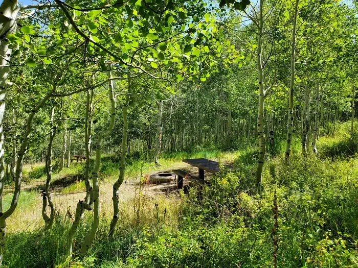
Fish Creek Campground and Trailhead
Campground
Campground · < 0.1 mi from the trail
No closures listed
The Forest Service lists no closures for Manti-La Sal National Forest.
As of · Source: USFS · Manti-La Sal National Forest. Agencies don't list every closure — check before you go.
Anderson Canyon is a hard hike in the Price Ranger District of Manti-La Sal National Forest in Utah, managed by the Forest Service. The trail is about 5.3 miles long, with a one-way climb of about 1,500 feet from a low point of roughly 7,700 feet to a high of about 9,250 feet. It is an out-and-back route, and the trail surface is natural, so plan on a rougher path than a smooth road. Summer is the most comfortable time to go. Typical averages from a nearby weather station at Scofield-Skyline Mine show July highs around 74°F with lows near 48°F, while winter highs stay around 30°F. Fish Creek Campground and Trailhead sits just 0.1 mile away, making it the natural base for the trip. Fish Creek, about 2.8 miles off, offers canoeing. The Trail to Commisionary Springs and Gooseberry Creek are both within about 3.3 miles.
Fish Creek Campground and Trailhead
Campground
KJ's Catch N Snack
Restaurant
Fairview Museum of History and Art
Museum
Places © OpenStreetMap contributors, Places © Overture Maps Foundation
More in Mount PleasantNot on Roamze yet. Their page has how to reach them.
 Gooseberry Creek CampgroundCampingPhoto: Recreation.gov (RIDB) / public domain7.8 mi
Source: Roamze catalog (indexable pages within 10 miles, PostGIS distance)
Best months: June–September. Best months have typical highs of 55–85 °F, lows of 30 °F or warmer (32 °F where the station doesn't record snow), at most one snowy day and no more than 12 wet days.
Jan
30° / 13°
12 wet
Feb
31° / 14°
11 wet
Mar
38° / 20°
11 wet
Apr
44° / 24°
10 wet
May
54° / 33°
9 wet
Jun
66° / 41°
7 wet
Jul
74° / 48°
8 wet
Aug
72° / 46°
10 wet
Sep
63° / 39°
8 wet
Oct
50° / 29°
8 wet
Nov
38° / 19°
9 wet
Dec
30° / 12°
11 wet
Typical high / low (°F) and days with rain or snow, 1991–2020. Measured at Scofield-Skyline Mine, UT, 6.2 mi away at 8,697 ft. The station sits about 600 ft lower than this place, so expect it a little cooler here. This station doesn't record snowfall. Source: NOAA NCEI U.S. Climate Normals 1991–2020.
