Panguitch Lake General Store and RV Park
Campground
Campground · 2.1 mi from the trail
Alert in the area
The Forest Service lists 3 alerts for Dixie National Forest.
Duck Creek OHV Trail Closure
Agency alert covering Dixie National Forest · Order 0407-26-11 · USFS · Dixie National Forest
Pine Valley Ranger District Area and Trail and Road Closure
Agency alert covering Dixie National Forest · Order 0407-26-01 · USFS · Dixie National Forest
Cedar City Temporary Road Closure Webster Flat Road (Order 0407-25-02)
Agency alert covering Dixie National Forest · Order 0407-25-02 · USFS · Dixie National Forest
As of · Source: USFS · Dixie National Forest. Agencies don't list every closure — check before you go.
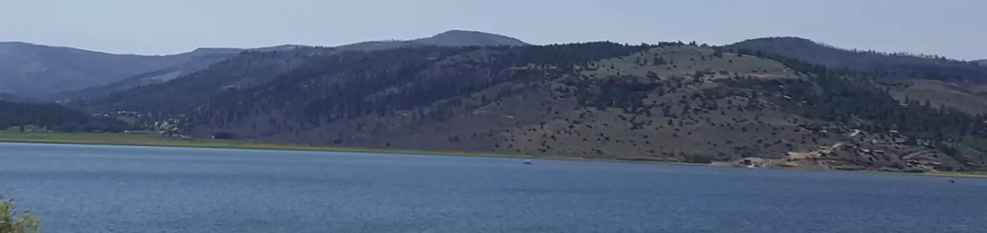
Panguitch Lake is a fishing lake in the Cedar City Ranger District of Dixie National Forest in southern Utah, about 18 miles southwest of the town of Panguitch. The Forest Service manages the land, and the lake sits at 8,212 feet. It is the source of Panguitch Creek, fed by Blue Springs Creek, Clear Creek and Ipson Creek. The lake is a popular trout destination, with rainbow, brook, cutthroat and brown trout in its cool waters. Two public boat ramps and a fish cleaning station are on site. Anglers can fish from shore, motorized boat, float tube, fly, spin or bait, and the lake is also open to ice fishing. Summer is the most comfortable time to visit. Typical averages from a nearby weather station in Hatch, Utah, run to highs around 79°F in June and 85°F in July, with July and August also bringing the most wet days. That station sits roughly 1,350 feet lower than the lake, so temperatures at the lake run cooler. The closest neighbors are Haycock Mountain, a hike about a mile away, and Cooper Loop, about 1.8 miles off. Panguitch Lake North and Panguitch Lake South campgrounds are each about 2.3 miles away.
Panguitch Lake General Store and RV Park
Campground
Panguitch Lake Resort
Restaurant
State park and museum in the United States
Places © OpenStreetMap contributors
More in EnochNot on Roamze yet. Their page has how to reach them.
Best months: May–September. Best months have typical highs of 55–85 °F, lows of 30 °F or warmer (32 °F where the station doesn't record snow), at most one snowy day and no more than 12 wet days.
Jan
40° / 9°
6 wet · 4 snow
Feb
43° / 15°
6 wet · 4 snow
Mar
53° / 19°
6 wet · 3 snow
Apr
59° / 25°
6 wet · 2 snow
May
68° / 31°
6 wet
Jun
79° / 37°
4 wet
Jul
85° / 46°
8 wet
Aug
82° / 44°
9 wet
Sep
75° / 35°
6 wet
Oct
65° / 26°
5 wet · 1 snow
Nov
51° / 16°
5 wet · 2 snow
Dec
41° / 10°
5 wet · 4 snow
Typical high / low (°F) and days with rain or snow, 1991–2020. Measured at Hatch, UT, 11.5 mi away at 6,893 ft. The station sits about 1,400 ft lower than this place, so expect it a little cooler here. Source: NOAA NCEI U.S. Climate Normals 1991–2020.
SEE
Panguitch Lake
~4 min drive
SEE
Navajo Lake
~29 min drive
SEE
Powell Ranger District
~31 min drive
SEE
Little Salt Lake
~33 min drive
Little Salt Lake is a 18-acre lake near Parowan, Utah, at about 5,683 feet.
SEE
Aspen Lake
~35 min drive
Aspen Lake is a 9-acre lake near Cedar City, Utah, at about 8,079 feet.
SEE
Coyote Lake
~49 min drive
Coyote Lake is a 16-acre lake near Panguitch, Utah, at about 8,317 feet.
SEE
Meadow Hollow Reservoir
~51 min drive
Meadow Hollow Reservoir is a 18-acre reservoir near Kanarraville, Utah, at about 8,348 feet.
SEE
Nipple Lake
~1h 13m drive
Nipple Lake is a 92-acre lake near Kanab, Utah, at about 5,570 feet. It is managed by the Bureau of Land Management.
SEE
Long Willow Bottom
~1h 16m drive
SEE
Round Willow Bottom
~1h 16m drive